I’ve never surfed. The last time I skateboarded was when I was 7. I only tried snowboarding once and quickly figured it was a bad idea, when little kids at the bunny slope started complaining about me holding up the lift line by constantly falling down.
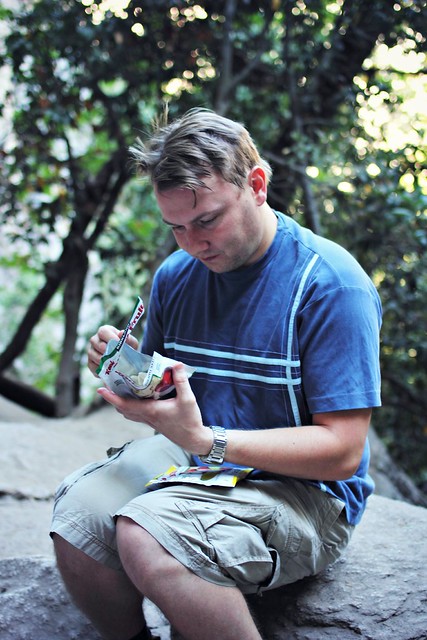
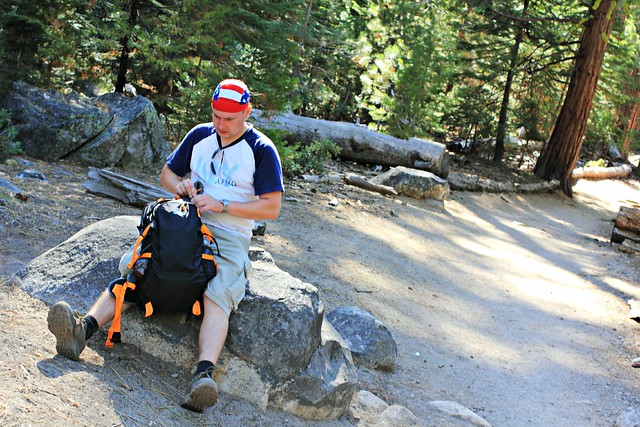
Still when Margaritaville Hollywood Beach Resort offered me a chance to try out their new Flowrider, I jumped at it. in my mind, this was such a Florida thing to do!
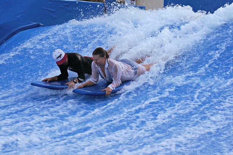
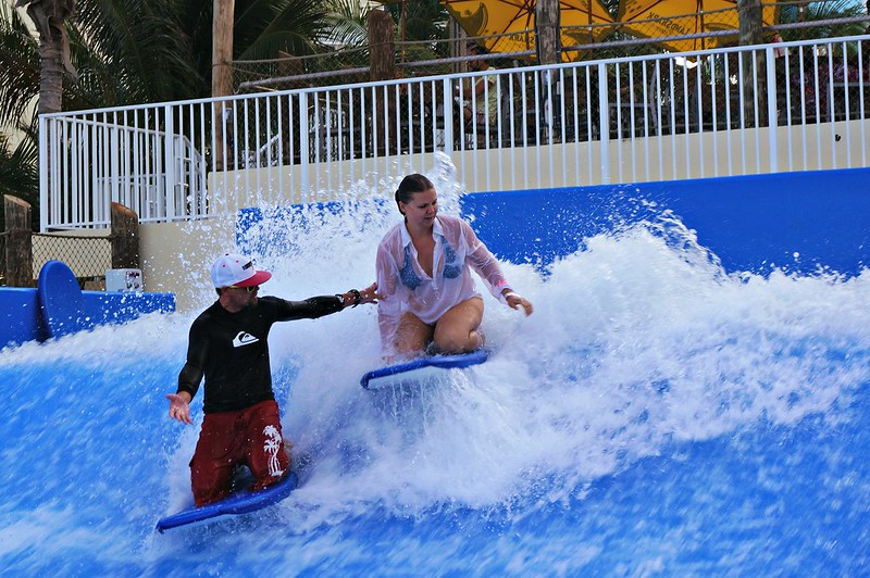
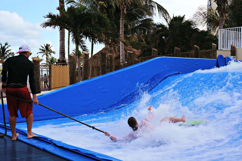
The way Flowrider works is that a thin sheet of water flows up a slope at 20 to 30 MPH and creates an artificial wave that you can surf. Or can try. If you’ve never done it before, it’s best to start from bodyboarding and get used to the sensation of water flowing at you, losing your balance and crashing towards the back wall. I’d say it doesn’t hurt, but the bruises I found the next morning tell a different story.
This is probably seconds before I go crashing over the waveThe instructor recommended I keep a shirt over my bikinis, and so do I. There’s always at least 10 spectators with their cameras ready to snap a photo if your top comes off, so better not to take chances.Can’t smile while concentrating…
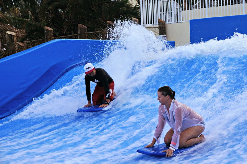
After a while sitting on top of the board started to feel like a piece of cake, so with a sudden boost of confidence I figured that sure, I can try standing up! Flowrider boards aren’t the huge surf boards you’d be used to but more like skateboards without wheels, and I should have known how it would go. There’s a rope you can hold on to to help you stay put, but you’re still all responsible for finding your own balance.
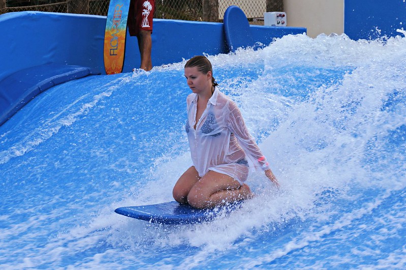
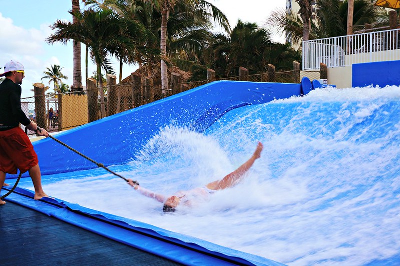
What I looked like around two seconds after I stepped on the board.Third time’s a charm?
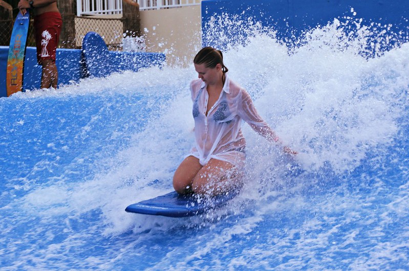
Finally on my fourth try, I found something that resembled a balance, and boy was I excited when I could let go of the rope and stay upright for at least three seconds!!! Of course I don’t have photos to prove, because my friend with the camera was probably too busy laughing at my last fall down. A couple tries more and I was ready to move over to the inviting pool. Flowrider is definitely fun, but also definitely hard!
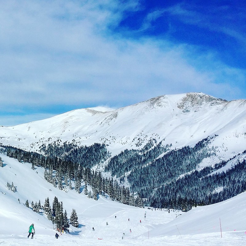
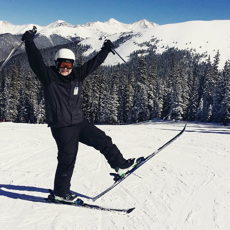
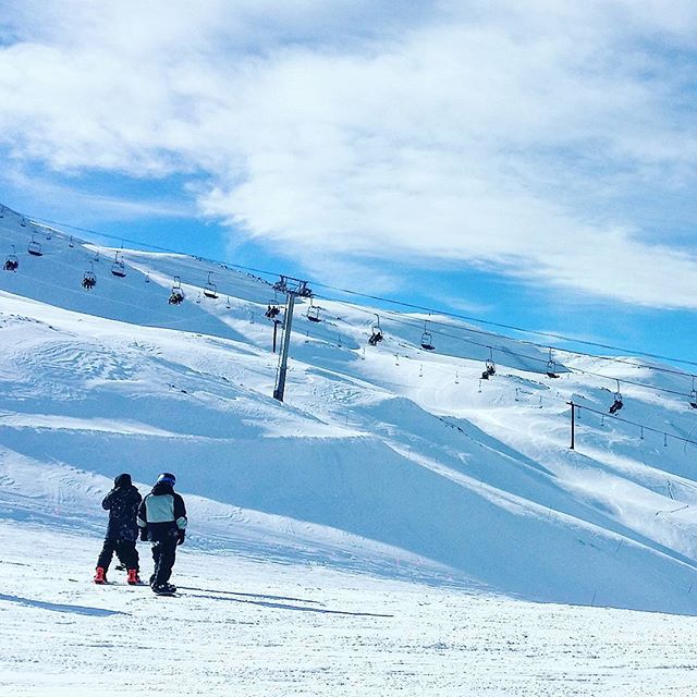
There wasn’t a weekend in November that we didn’t pack our skis in the car and drive up to the mountains to enjoy snow and sun. It’s a blessing to live just a couple hours away from world class ski resorts, but these resorts are worth the trip even if you’re coming from furthere off! Here’s five reasons why you should plan your ski holidays in Colorado right now:
1. Colorado’s Powder Snow
Forget those clumpy slopes with dreadful wet snow. Colorado’s dry climate gives you amazing fluffy powder where riding the hills is pure bliss. Although Utah is trying to claim on their license plates to have the best snow on Earth, the Rocky Mountains are clearly a contender in this category.
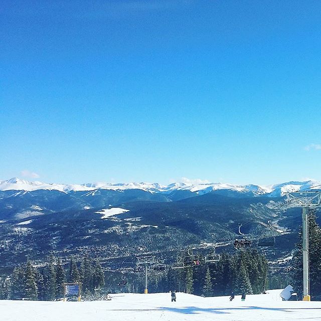
2. More than 20 Ski Resorts
Wanna ride the slopes like they did in the alpine world ski championships? Check out Beaver Creek. Wanna get lost in a resort where skiing every slope would take more than a weekend? Vail’s calling. Wanna spot Hollywood stars in the lift line? Everybody knows Aspen. Whether you’re a family, ski bum or snowboarder, everybody’s got their mecca in Colorado.
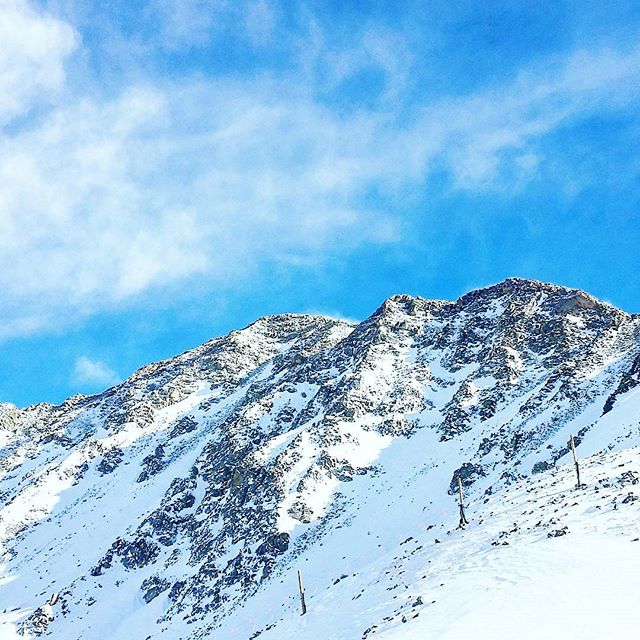
3. Ski Season from October to June
Arapahoe Basin is the most high altitude resort in the US, where the highest lifts take you well above 13 000 feet. High altitudes bring with them the “Got Oxygen?”-slogans and may force you to head to lower slopes – like I did after starting to feel ill – but one thing they never lack is snow. A-Basin always opens before Halloween and usually closes around June, but closing dates as late as 4th of July are not unheard of.
4. Not Just Slopes
Breckenridge Ski Resort is right next to a century-old mining town with a charming and lively main street. In Steamboat Springs, you can rest your sore muscles in one of the town’s several hot springs – although in my several visits there, I never got further than the condo hot tub, also lovely on a starry night. Many ski towns offer horse-drawn sled rides and guided snowmobile tours, and several boast to be the state’s best resort for shopping. I think the jury’s still out on that.
5. Despite the Price, Still Worth It
Of course, the lift tickets are far from cheap. If you make the mistake of marching up to Vail’s ticket booth some random morning, be ready to pay around $170 per day. American ski resorts tend to be more expensive than their European cousins, and the most expensive resorts in the US are in – you guessed it – Colorado. Still, planning your trip early can save you a penny, and you can rest at ease knowing you’re paying for the best resorts in the US, possibly in the world.
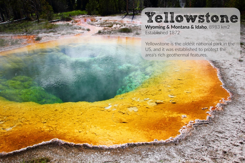
Hands up who loves US national parks! So do I. Having toured them for a couple of years now, I can agree that they are really America’s best idea.
The beauty of national parks is as unbelievable as is their variety. From hot springs to swamps and mountains to volcanoes, every park is special in its own way and no two are really alike.
For the last couple of years I’ve made wall calendars for the upcoming year for friends and family, but this year, I’m making them for the public who loves national parks as much as I do. I’m making them for you: 12 months worth of my best photos combined with facts and stats on the parks for you to enjoy all year long.
The calendar is all ready to be hanged on your wall and is of a quality I’m happy with, as I’ve been using the same publisher in previous years. It’s got the most common holidays in it and has space for you to write your own notes.
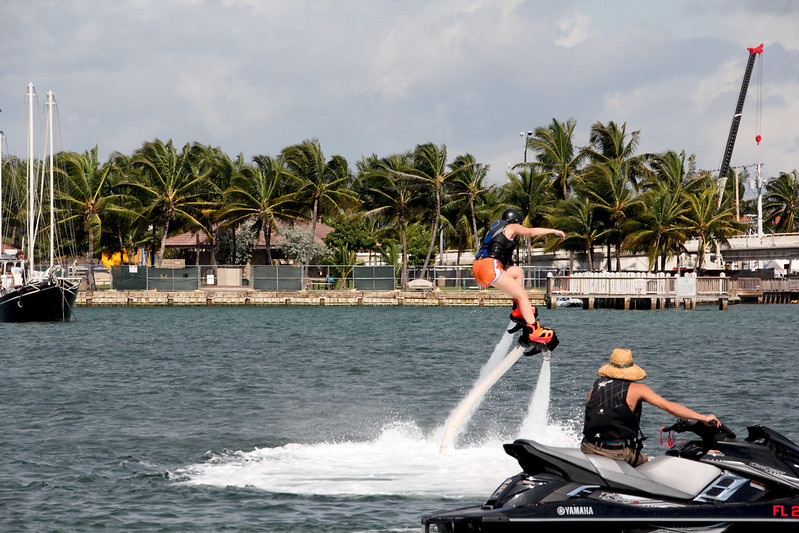
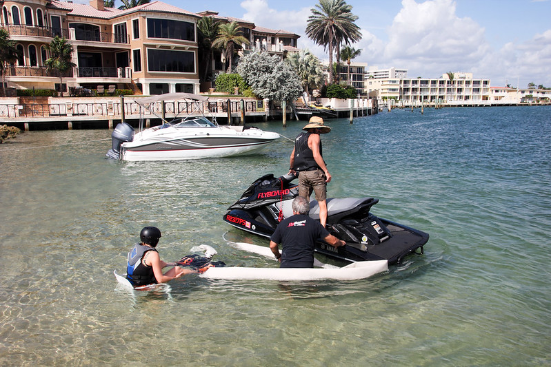
I plummet into the warm ocean, splash and gasp for air, salt water filling my nose, splashing some more. When I make it back to surface, I try desperately to blow the water out of my nose and rub the salt out of my eyes. “You ready?” the jet ski pilot shouts and I shake my head. Wait, a moment, I need a moment to get myself back together! And then it’s on again.
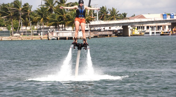
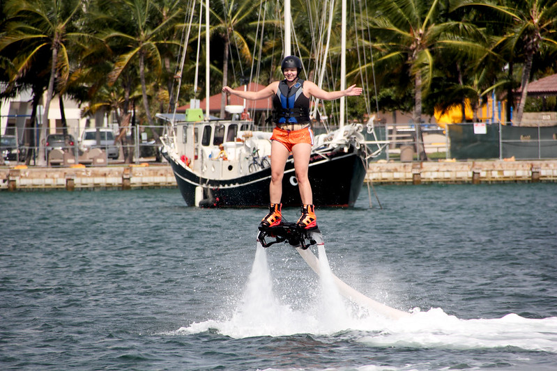
Flyboarding is not the easisest sport, but all worth the practice.
“Always keep your legs straight” is the rule. “Keep your hips forward” is another one. You can see how well this is going.Good thing the Atlantic’s warm in South Florida. This is an activity you want to reserve for warm waters.
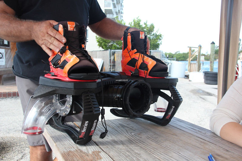
There are several different types of flyboards, and the one I tried out was one of the easier ones. Harder boards have more buoyancy which means it’s “easier” to do flips and turns, but the board I tried was more stable and easier to stand on, which is perfect for a total beginner. That still didn’t make it easy. I’ve always thought I have fairly strong legs, but it was still hard standing when the board was forcefully pushing me up to the sky.
The more stable flyboard that South Florida Flyboarding tied me to so I could reach the skies.This is me sitting in a plastic chair, getting my shoelaces tied.
The jet ski pilot handled the force of water flowing from the board, which was great: one less thing for me to think about. I had enough on my plate trying to balance and keep the board horizontal. The only way I could rise up on top of the board was aiming the flow of water straight down, and a smallest movement to any direction plummeted me back in the sea. Good thing water is my favorite element, because there was little time to prepare for being whisked under the waves.
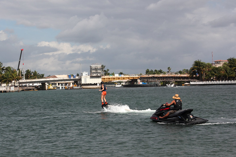
After five minutes, the thought of giving up passed through my mind – but only passed. In ten minutes I was already flying up in the air for minutes at a time. I’d found my balance, and I have no clue how. It just happened!
The training session lasted for 15 minutes, after which I retreated back to dry land to breathe and relax, and to follow others’ attempts at flying. Later in the day, I got another chance at flyboarding, and finally I felt like I was “soaring like a bird”, like they had promised I would. Dolphin jumps I gladly left for another time.
Flyboarding was part of a press trip arranged by Greater Fort Lauderdalen. I thank South Florida Flyboarding for giving me the opportunity to try out this great sport. If you’re interested, check them out for your own flyboarding experience.
I asked my readers to reveal me their favorite beaches. Here they are:
7. Australia
Whitehaven Beach on Queensland’s Whitsunday Island. These white sand beaches have been chosen the most ecological in the world – and Queensland’s cleanest! [photo: Birger Kühnel]
Cape Tribulation in Daintree National Park, Queensland. Far from any civilization, the only ways to get here are by a guided tour from Cairns or by car. Stay in an eco-lodge in the midst of the rainforest. [photo: Ian Mackenzie]
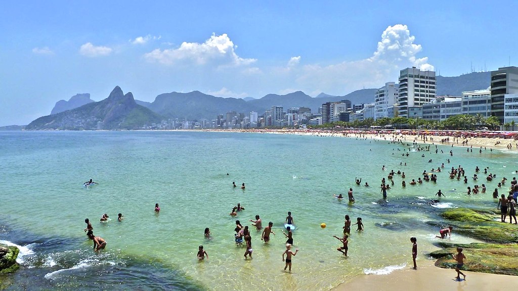
6. Brazil
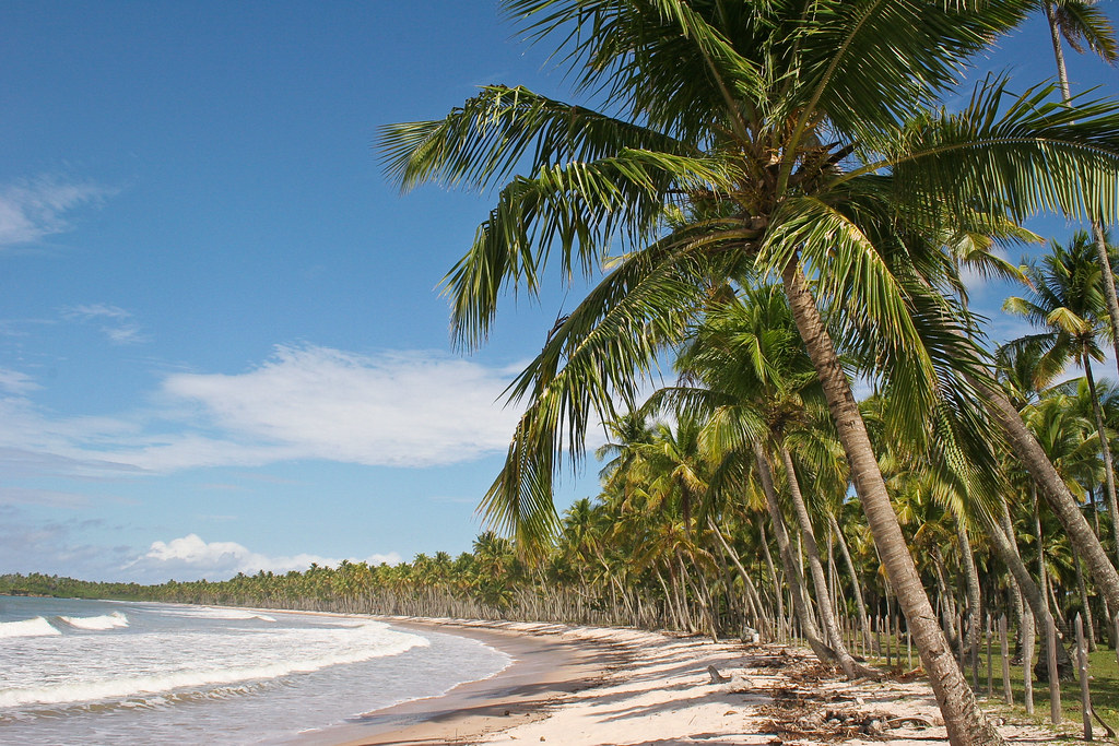
Rio de Janeiro’s Ipanema is famous for a lot more than just the song. The word “ipanema” comes from Tupi language and means a “stinky lake”, which couldn’t be further from the truth. [photo: alobos Life]Boipeba Island, around 50 miles South of Salvador, is a dream destination for those seeking a secluded beach. Most of its 15 miles of coastline is pristine beaches. [photo: Danielle Pereira / Miradas]
5. Maldives
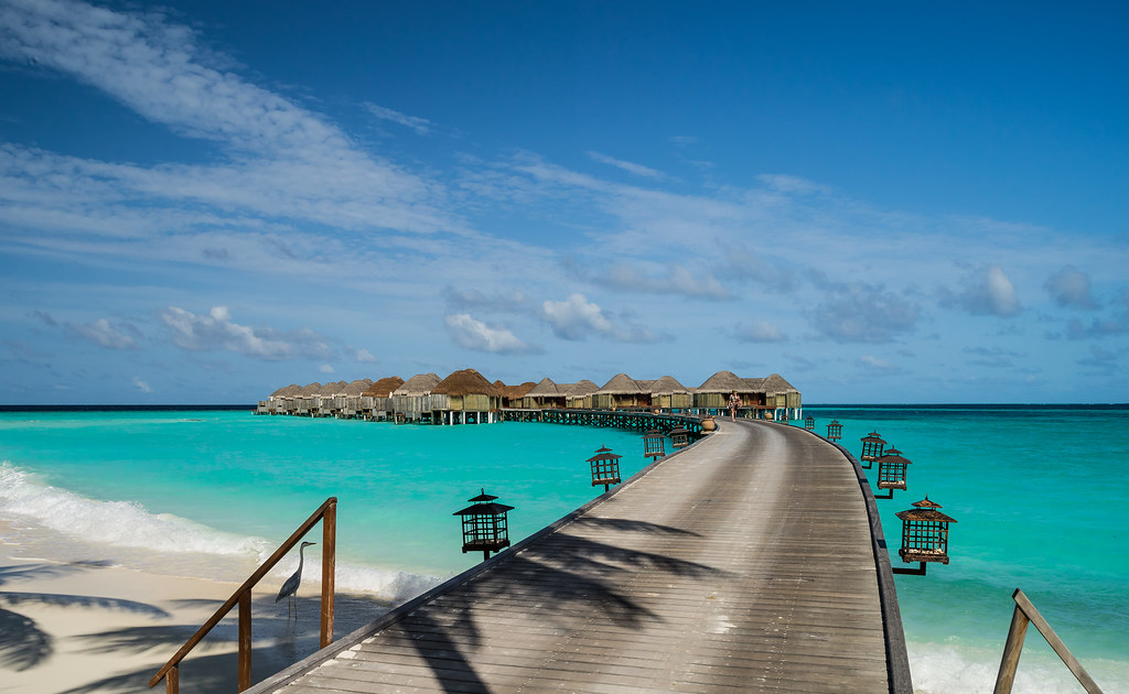
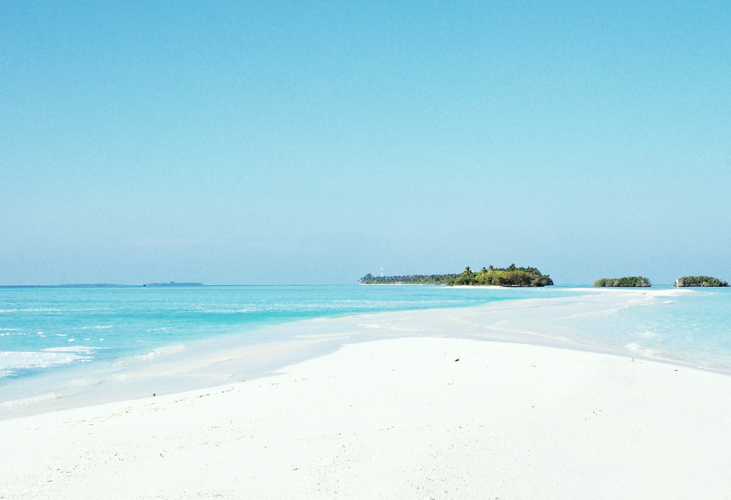
Maldives are some 1200 islands in the middle of the Indian Ocean. Every resort has its own island, and it’s said to be a divers’ paradise. [photo: Mac Qin][photo: Nattu]
4. India
Anjuna is a village on Goa that has been a hippie paradise from the 60s. South of the village is a busy beach accessible by a short scooter ride. [photo: Olivier]Goa is India’s very own beach holiday destination that is set apart from the rest of India with its Portuguese-influenced food and architecture. It was a Portuguese colony for five centuries. [photo: Dennis Yang]
3. Philippines
Small island of Boracay is an hour’s flight away from Manila. It’s been lately hit by a tourist tsunami as Asian travelers have found its beaches. Parties are held on the beaches in the evenings. [photo: Duncan Rawlinson / Duncan.co]
Tiny Malcapuya Island is a little North of the much more famous Palawan. It’s mostly a day trip destination from Coron, but there are several huts on the beach that you can rent for overnight stays. [photo: Roslyn]
2. Greece
Halkidiki Peninsula close to Thessaloniki is full of beaches. This is Kavourotripes, in the area of Sithonia, where the beaches are more secluded and nightlife not as vivid as in the nearby Kassandra. [photo: gichristof]Zakynthos Island in Western Greek archipelago is a relaxed vacation destination with some nightlife and plenty of peace for families. Bouka Beach is 5 miles North of the town of Zakynthos and one of the island’s more quiet beaches. [photo: Robert Wallace]
1. Finland
Finland, why Finland? This was voted on the list by my Finnish readers who all love their cottages on islands and by the lakes, but you gotta admit that the land of 300 000 lakes and several archipelagos has lots to choose from.
What do you think is the best beach destination in the world?Share it on Facebook and you could win a bag from Globe Hope, made of old sails! The giveaway is still open for a week.
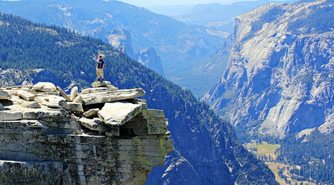
I don’t remember exactly how we got the idea to hike Yosemite’s Half Dome. I think I spotted the hike in some magazine, and although I’d never heard of it before – hey, I’m from Europe! – we were already planning an adventure to California and it sounded like it would fit right in. While researching, I ran across an article in Backpacker, calling it one of the most dangerous hiking routes in the US, and that sounds kinda cool, doesn’t it?
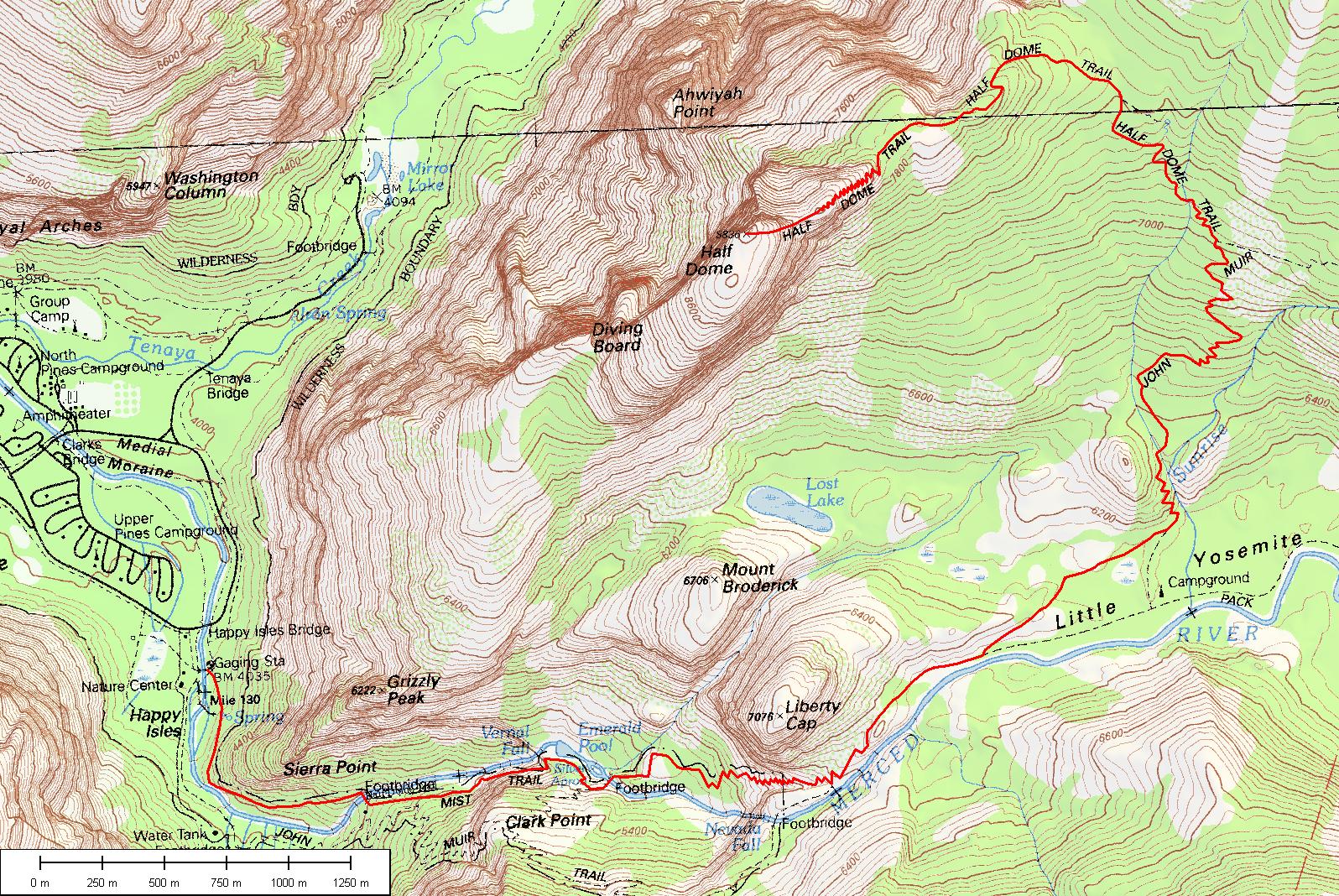
In order to do the hike, you need to take part in the Half Dome Permit Lottery, arranged around March each year, and if you’re lucky, you’ll win a permit to hike up those cables. There’s a limit of one ticket per person, so we put in two, and one of our tickets won a permit that covers a maximum 6 hikers. I recommend putting in more than one ticket if you really want to do this!
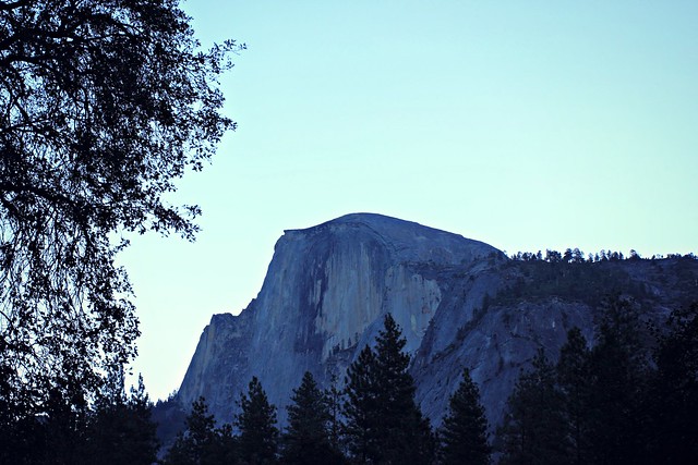
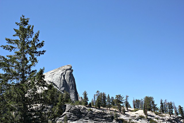
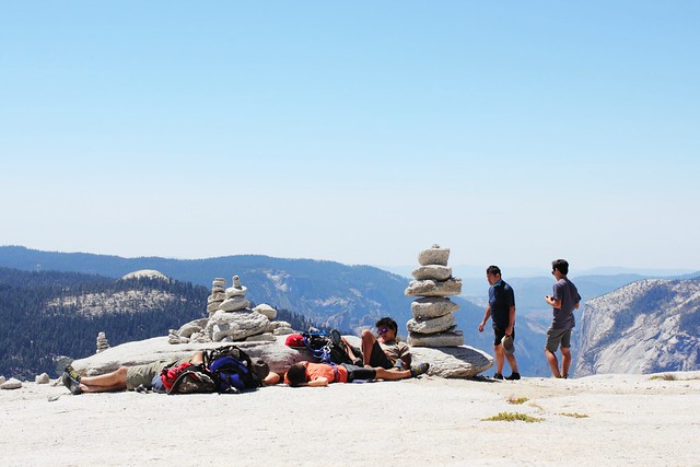
Half Dome (2695 m / 8844 ft) as seen from our campground
We stayed the night before our climb at Curry Village tent cabins, a very short way from beginning of the trail. We were aiming to start off before sunrise, but we made the mistake of not preparing with our own breakfast and had to wait until 7am to get some from Curry Village’s Coffee Corner. (They have pretty good lunch bagels you can pack as take-away on your hike!) If you’re coming from sea level, sleeping in Yosemite Valley is a good idea to get yourself at least a bit accommodated to the thinner air.
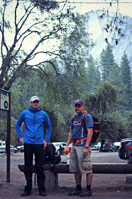
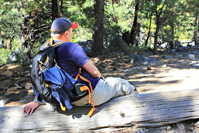
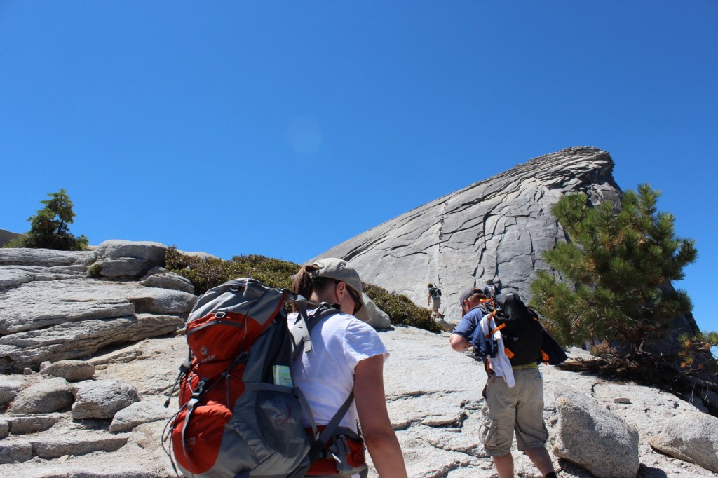
Waiting for the shuttle bus from Curry Village to the trailhead at 7.30am
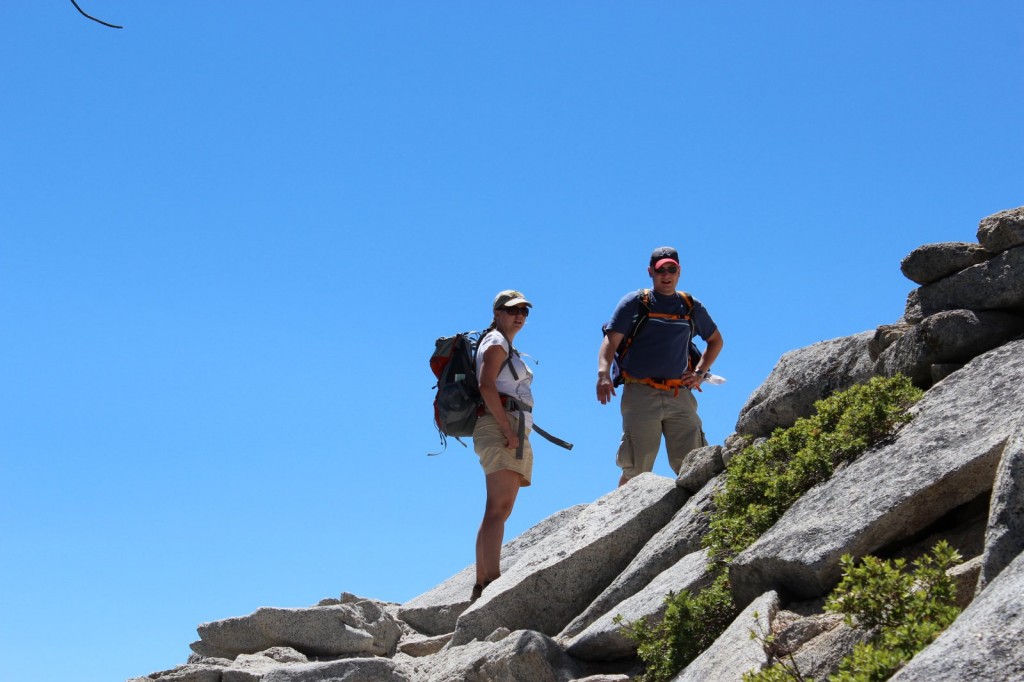
We were three of us on the trail: Iiro, Aki and I. Only Iiro had the courage to leave in shorts, but he made the right choice. In less than an hour, Aki and I were changing our long pants into shorts and packing away our sleeves. It was a great mid-August day with sunshine and warm temperatures predicted for the day, so we were really in luck.
The very beginning of the trail was fairly easy, but it quickly turned into stairs and our calves and quads were feeling it. Unless you’re in really good shape (like Aki was), this is a hike you should train for. I had been a regular at Step classes, hiked along the Ardennes and followed a 6-week program that I can fully recommend. Iiro, living in Georgia at the time, had climbed up Kennesaw Mountain at least once a week. Maybe thanks to our efforts, we passed a group of Asian girls at Vernal Falls – but at the same time, one woman passed us running up the stairs, so we definitely could have been more in shape, too.
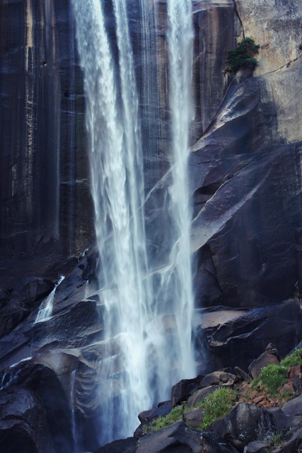
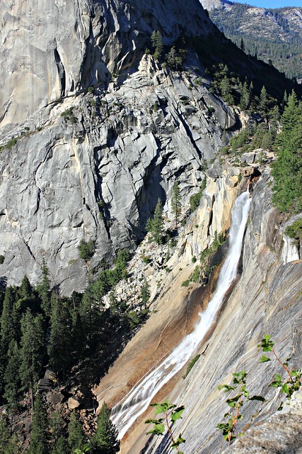
Stairs at Vernal FallsIf you don’t want to hike all the way to Half Dome, hike to Vernal Falls. The trail up there is beautiful!
I had trained for the hike with a backpack full of water, and my backpack on the hike ended being around 9kg (20lb). We’d taken with us 6 liters of water per person, and all of us had around two thousand calories worth of nuts, energy bars and trail snack that we stopped to eat around every 45 minutes. This was a pretty good pace for us, because it kept our energy levels high despite the intensive climb, and it also gave us a chance to catch our breath at regular intervals.
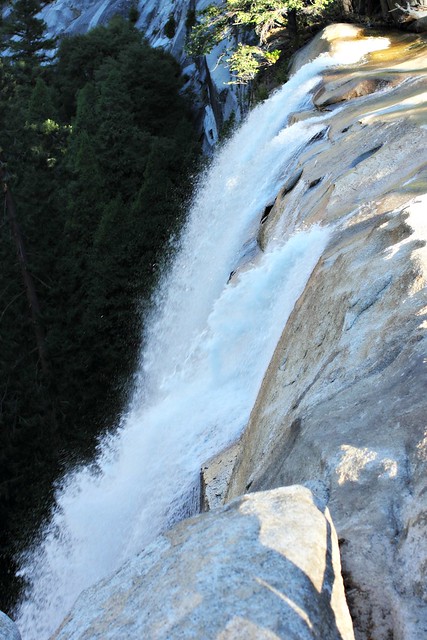
We got all our snacks from Costco, which had a great variety of stuff at bulk.Vernal Falls from above. 1524 m.You don’t especially need a topo map on the trail, but it was great to be able to check how long we still had left to the top.
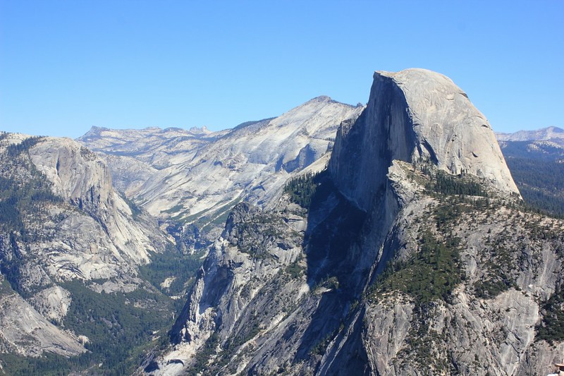
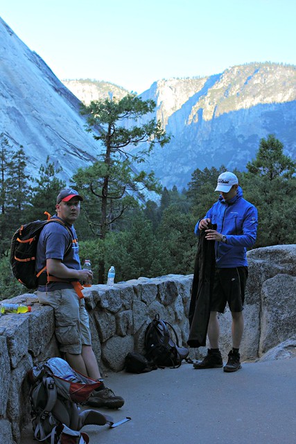
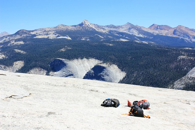
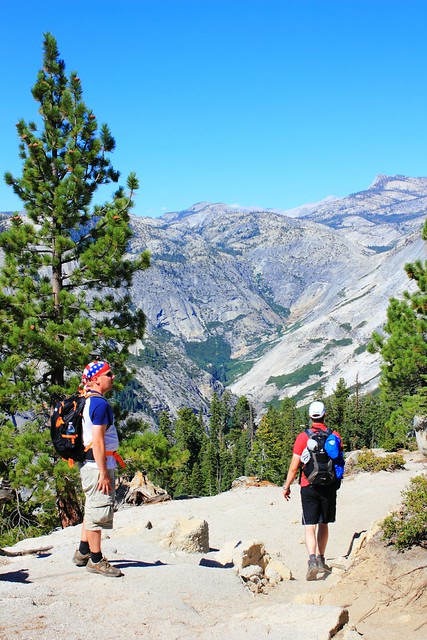
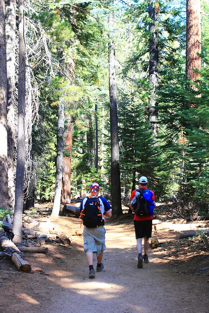
After Vernal Falls, it was a similar effort to make it up to Nevada Falls along some tight switchbacks, but then it got easier. At an altitude of around 1800m, after climbing up 600 meters (around 2000ft) and hiking for 4,2km (around 2.5 miles), all of which took us several hours, we reached Little Yosemite Valley, a flat portion of the trail in a forest which felt like dancing on clouds compared to the climb we had just done. At this point, we finally saw Half Dome for the first time after leaving the trailhead.
There it is!
After a couple kilometers in the valley, the trail continued climbing up. All the while we’d seen other hikers on the trail, but now we really started reaching slower hikers who had left already before dawn. Considering how tough the trail was, it was surprising that the hikers ranged from kids to retirees and everyone in between. All the better to them!
The last official toilets we’d seen were at Nevada Falls, so potty breaks in the bushes were a thing at this point (and if you don’t need them, you haven’t drunk enough water). And here’s a word of warning to you: while I was doing my business in the woods, I heard a buzzing noise, and then a horrible pain in my bicep. I didn’t stay to figure out what kind of insect had bit me, but instead I got back to the trail as fast as I could and for a while could just lay in the ground trying to wish the pain away. We had some ibuprofen with us, which took a while to settle in, but antihistamine would have been an even better addition to our first aid kit.
Mount Broderick. Half Dome is not the only halfish-dome-shaped mountain around here.
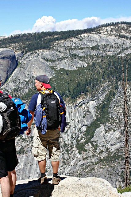
When we finally reached 2300m, the views really opened up. We were a bit worried to see dark clouds in the horizon, because the rule is that you should never climb Half Dome if there’s any sign of thunder on the horizon: the mountain attracts lighting to it like honey attracts bees, and several hikers have died in lightning strikes. This is also why you should reach Half Dome before noon, because afternoon thunderstorms are common in the area. We only reached the check point at half past noon, and I’d say that’s around as late as you should get there without turning back.
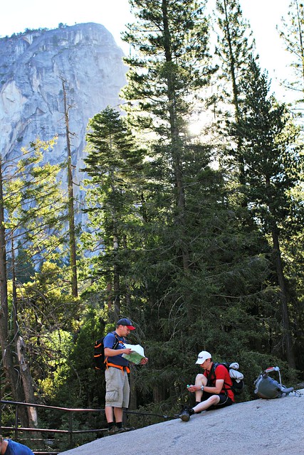
Later we realized that the “clouds” were actually smoke from wildfires in the area.Park Ranger checking permits just below tree line. The ranger had a list of people who’d won the permit, but we had our own print of it with us just to be sure.
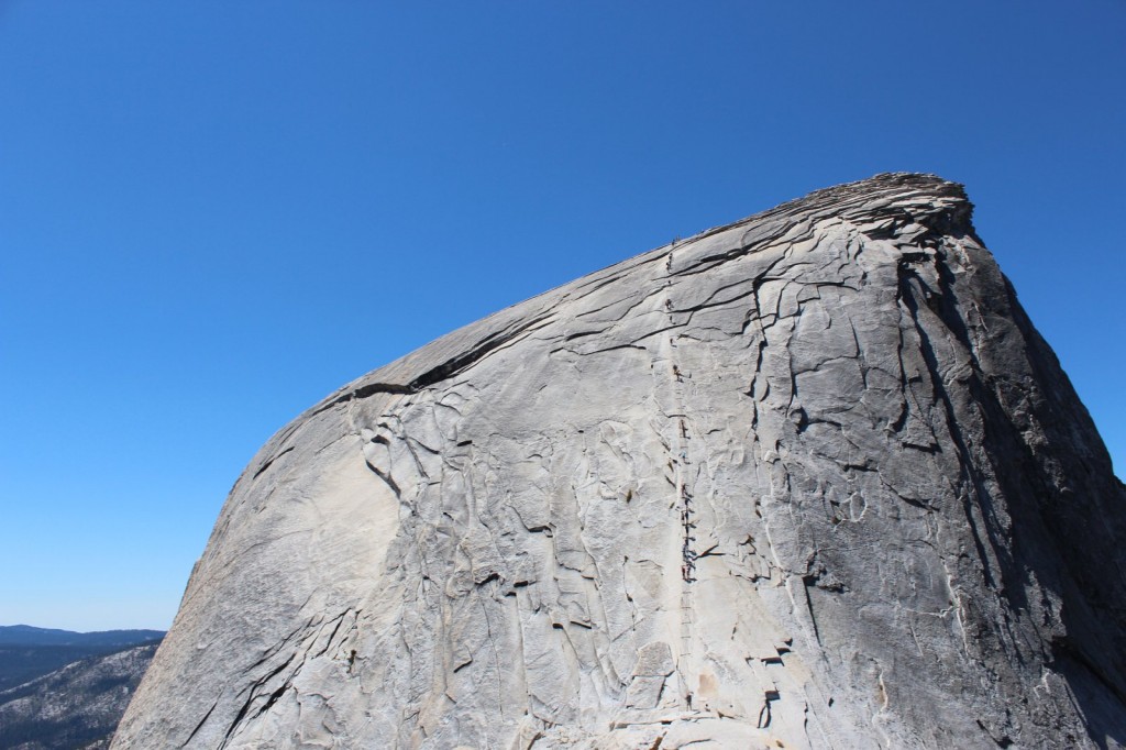
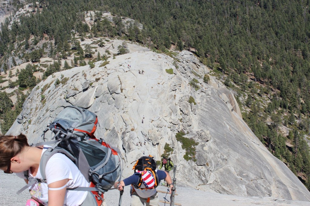
At the ranger check point, we rested for a while and prepared for the final ascent: summiting Half Dome. First 150m (500ft) were a tougher-than-tough climb, the latter 150m were pure crazyness.
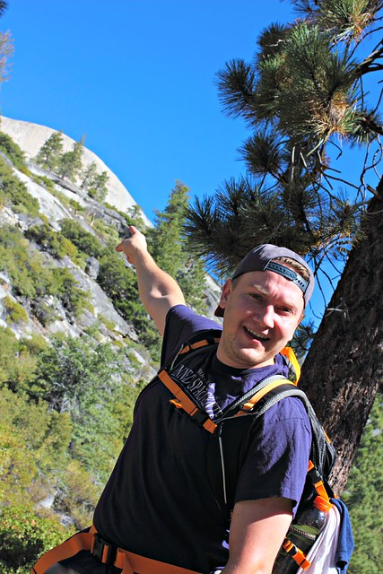
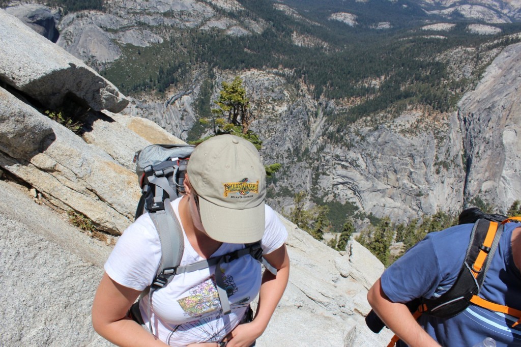
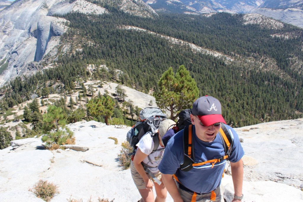
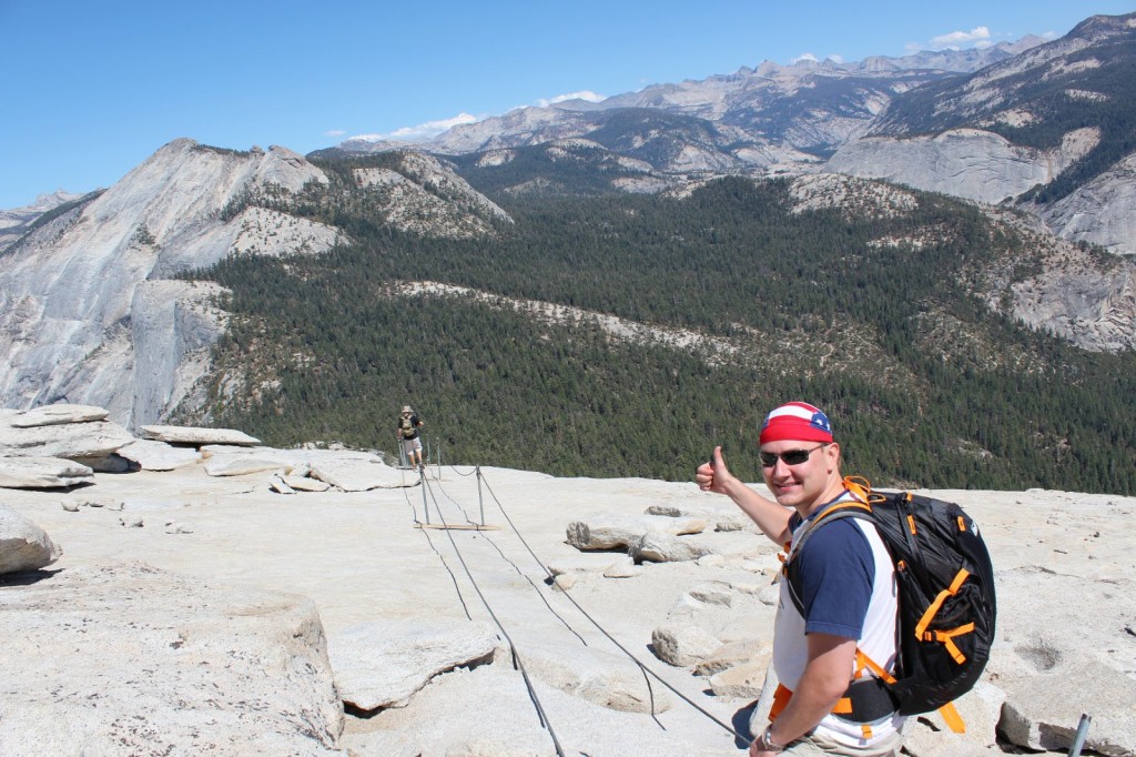
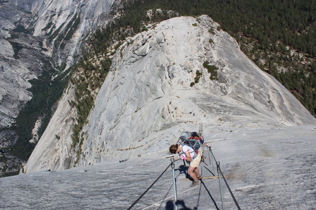
On the way up the switchbacksI have a fear of hights that isn’t very strong but started to get the better of me when we got above treeline. This is why all of the photos above treeline have been taken by Aki, because i couldn’t stop anymore to take photos.The other reason was that i was in too bad of a shape to do anything but put one foot ahead another and try to catch my breath.Almost done with the switchbacks, and the 150m-of-pure-craziness is already visible ahead of us.
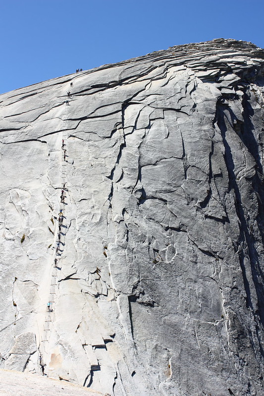
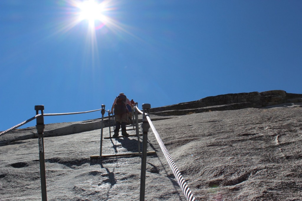
The reason why Half Dome is one of the most dangerous hiking routes in the US is the last 150m meters of it: The Cables. Sure, you could sprain your ankle, fall and hit your knee or suffer from dehydration on other portions of it, but if you fall at the Cables, you fall down. Like really down. Like almost a mile down. Basically, it’s a “make a mistake and die”-portion: you hold on to two cables that ascend up the rock at a 70 degree angle at its best. Every couple meters, there’s a wooden plank where you can stay for a moment and catch your breath, but not for long because there’s people behind you who want to get up – and other people descending the same route.
When we looked at photos of the Cables before the hike, we thought they were taken from an especially dramatic angle or something, and they’re probably not as dramatic in real life. Well, they are. Every bit as dramatic. This is a completely realistic photo of what it’s going to be like.
The wind at the Cables was so strong it was hard to stay upright, and all around me the rock plunged into sure death. From the switchbacks, I crawled on all fours towards the Cables, until I got behind a large boulder and broke down: I can’t! This is horrible! There’s no way I’ll get up there, I’ll just slip and fall and die! This is it, I’m done!
“No you’re not, you can do it,” Iiro told me and after a moment of coaching got me to continue. “Just keep your wits about you, hold on, and if you slip, I’ll catch you.”
So up i went. Maybe one climber out of a hundred had any safety gear with them.
Climbing up was tough but in the end, not as nerve-wrecking as I had thought. I had bought some garden gloves from the internet which had perfect grip and slowly but surely a foot at a time I ascended. At the Cables, you really don’t have time to fear, because all your concentration will go into the climb itself: always one hand at the cables, passing by people coming the other way, going from plank to plank. I tried at first to hold on to both cables, but soon I let go of the other one and just hung on to one with both hands, holding it under my arm and pulling myself up.
You can do it, almost there, coming down is easier, the hikers descending kept telling me, and before I knew it, the rock started leveling out, and the planks and the cables ended. A couple more meters of crawling on all fours, and then I was there.
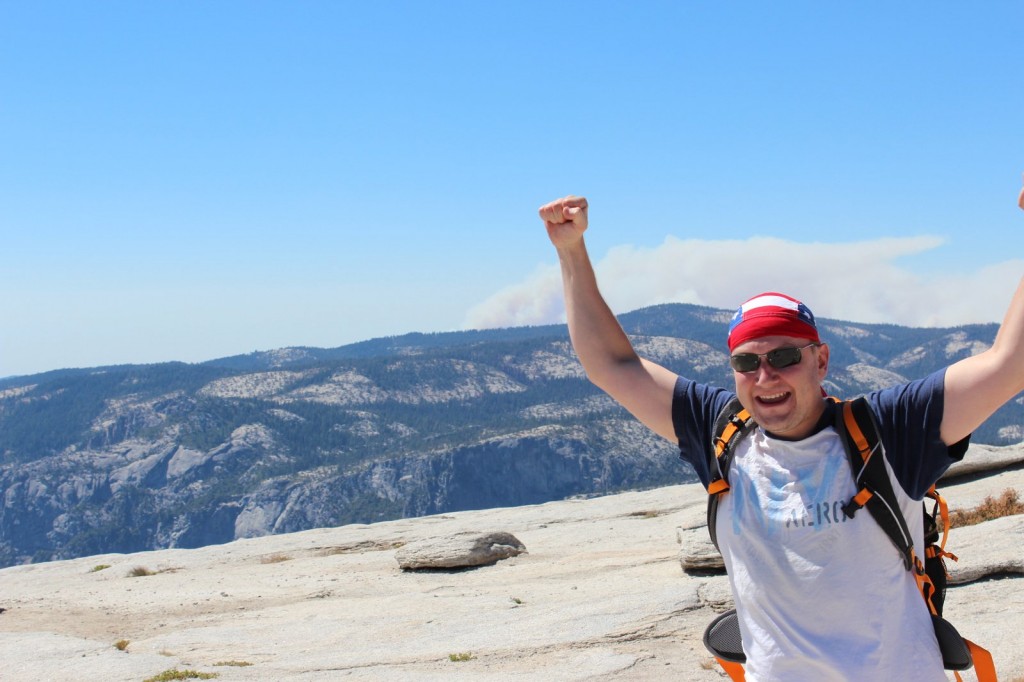
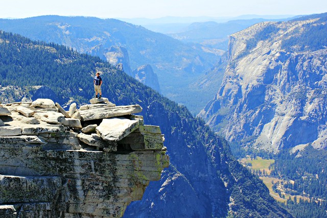
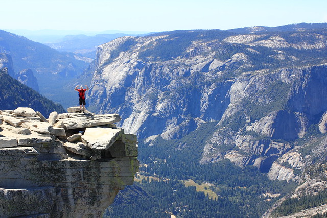
Woooohooo!Half Dome summit!Our packs and a breathtaking view.Chillin’ at Half Dome
All of the celebrational photos here feature just Aki and Iiro, running around the summit, taking photos and eating a relaxed lunch with the best feeling ever: we did it! I, on the other hand…
I feel like throwing up don’t talk to me
After all that stress and exhaustion, I was feeling dizzy and felt like throwing up. My head hurt, stomach hurt, I could eat less than half of my lunch and most of the time at the summit I spent laying down as still as possible and trying to calm my raising heart. Every once in a while I peeked under the scarf on my head to take a look at the views, and yeah, despite my feeling, this was still worth it.
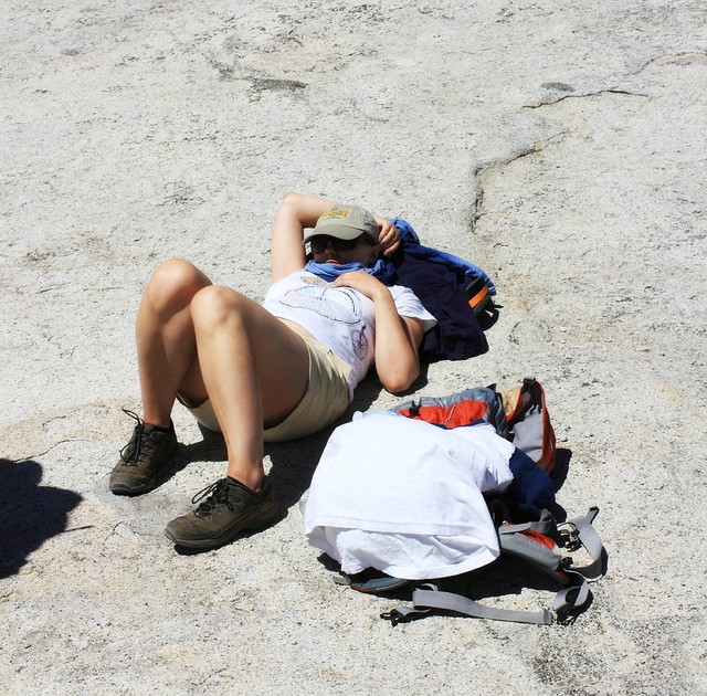
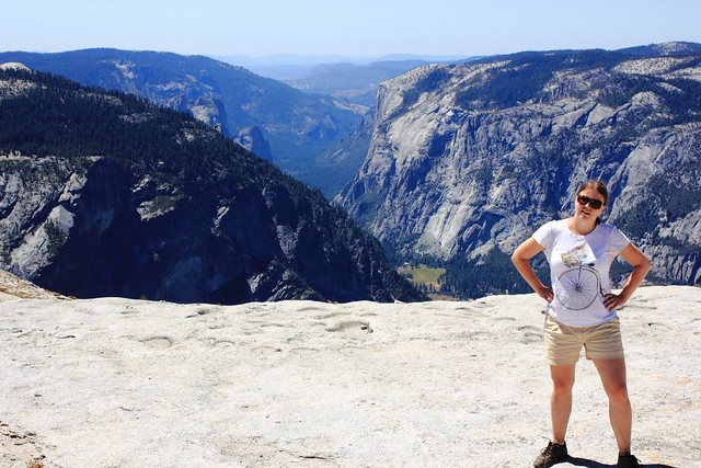
Finally i got up and posed. “Safely” on top of the summit and not on the ledge.
The descent really was easier than the ascent. Aki even got some photos of it, which was nice, because I would never have taken my hand off the cables.
Don’t look down.Don’t let go.The cables were actually pretty wobbly, which didn’t ease my mind at all.
When we finally got down, it was like a weight coming off my shoulders. That was the hard part, now it was just a 7 mile hike to the bus stop.
When we got down the cables, we met the ranger on his way up to check nobody had been left behind.
There’s not much to tell from the way down. Climax of the trip was over, and now we just wanted to get to camp as soon as possible to rest our feet and enjoy a couple victory beers. I think I was the most energetic of us, having gotten over my fit of nausea. Aki had a blister on his foot and Iiro had spent his last drops of energy getting down the cables.
We had all felt the day in our knees, so instead of taking the stairs down, we took the longer John Muir Trail that wasn’t as steep. Now I wouldn’t make the same choice again, because those two extra kilometers with the setting sun and running out of drinking water (yes, we all did – take more than 6 liters on a hot day) felt reeeeaally loooong, and to top it off, we got a bit lost. We finally made it back to camp around 7.30pm, exactly 12 hours after we’d left. Pizza had never tasted as good.
Nevada Fallsffrom John Muir TrailNevada Falls a bit further off
25 kilometers back and forth, 1500 meters of ascent, and 12 hours on the trail. This is probably the craziest and most dangerous thing I’ve ever done, and I’ve also jumped from an airplane. It’s also one of the most beautiful hikes I’ve done
Would I go again? I doubt it. I think this will be a once-in-a-lifetime experience for me, and that was really what it was. But you should go! Start planning your next summer’s adventure and, come March, take part in the lottery. And then train, prepare, train, and hike. You won’t regret it. Good luck!
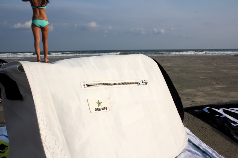
I’d gotten my previous laptop bag from some chain store, Made in China, and of course the zipper broke just when I was traveling. I always bring my laptop with me, and it takes me around two connections to cross the Atlantic, with numerous safety screenings on the way. So there I was, with my broken bag, my stuff flowing out of my bag when I least wanted it. I swore that the next bag I’d get would be more durable.
Can you imagine anything more durable than safety belts and sails?
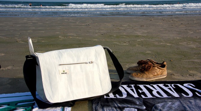
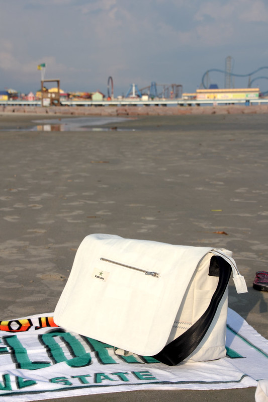
Globe Hope’s Saalinki messenger bag at Galvestone Beach, Texas
Last two months I’ve traveled with Globe Hope’s Saalinki messenger laptop bag, stitched out of old sails with a strap of safety belts. I’ve thrown it over my shoulder and rode my bike downtown to a cafe as well as flown to Finland, Florida and Texas through numerous airports. It’s big enough to fit long sleeves, noise-cancelling headphones, a couple books and cosmetics on the airplane, but small enough that it’s classified as a laptop bag that you can take in addition to your normal carry-on. When I flew Frontier and didn’t want to pay $35 for carry-on, it was small enough to classify as a free “personal item” that fits under the seat in front of you, and still left room for my feet.
The bag comes with both a zipper and a clip, which makes it well protected against pickpockets, but also means when I’m ina hurry or in a constant need to open it, I can just clip it without fear of losing anything. A small minus is that it’s got only three pockets besides the laptop compartment and large compartment in the bag: one inside, one outside, and one tiny one on the side. This means there’s no separate space to store my keys, tickets, passport and cell phone, but it’s more of a personal preference, and I think I’ll get used to it.
Besides being durable and handy, it’s also nice to know that my bag is ecological. Globe Hope’s production is Made in Finland and Estonia from beginning to end in small-scale seamstress shops, all of which are inspected for workplace safety and some of which are third sector organizations. The materials – seatbelts and sails – are something that would otherwise be thrown to the landfill and have now instead found a new usage, saving natural resources.
The ecological and socially responsible side of Globe Hope was why I contacted them to ask for the bag to test – and I’m very happy with the quality. Now as a reader of my blog, you also have a chance to win one of these bags. Just head over to Facebook to like my blog’s page and read how to take part!
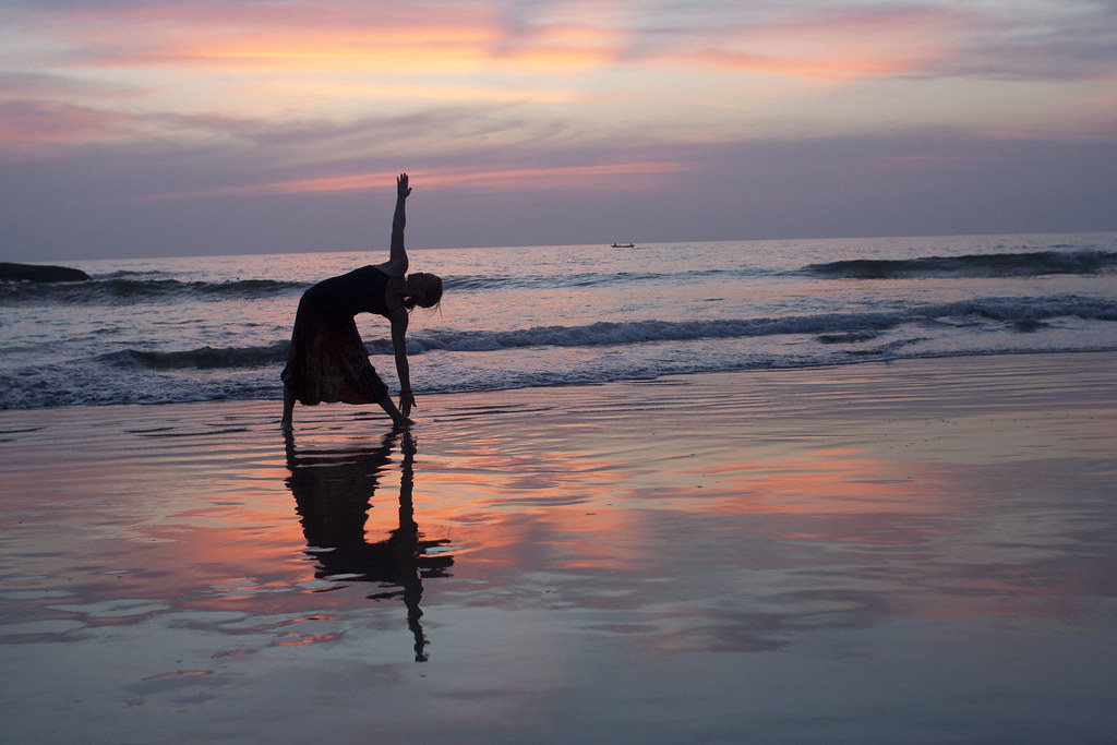
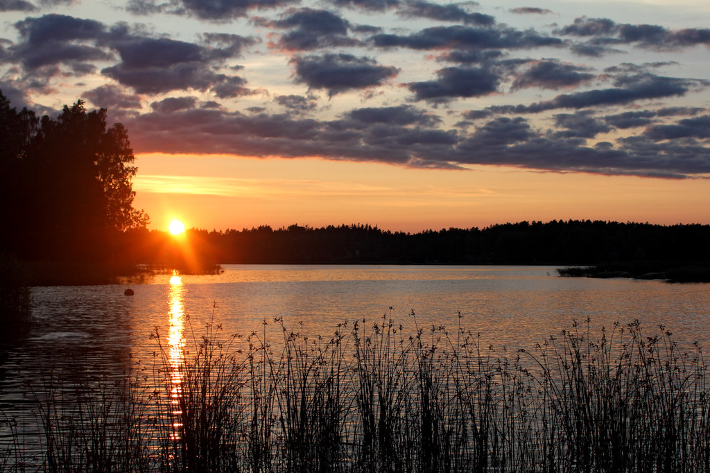
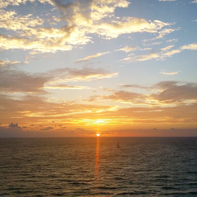
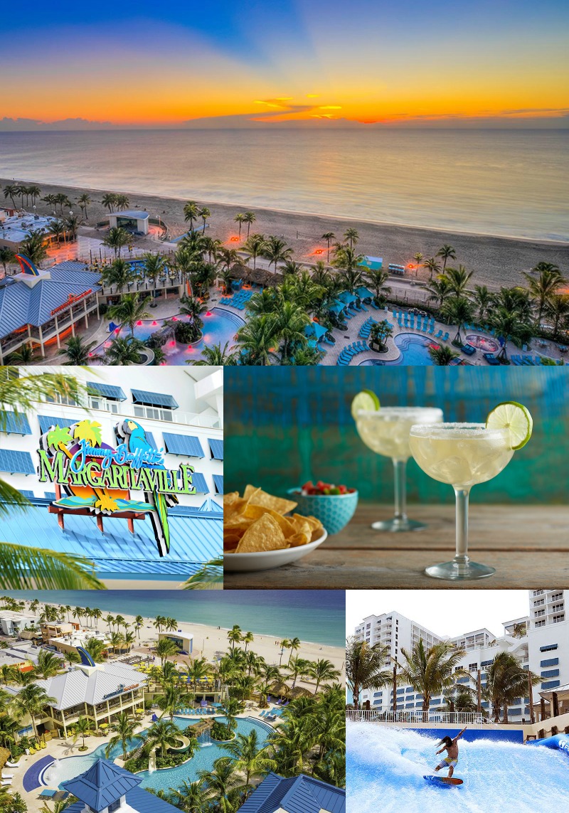
A week ago I already felt like I had landed in the middle of paradise – and then the bell boy led me to my room where the balcony opened to an amazing view of the Atlantic, straight to East. Sunsets are beautiful, but sunrises are even more so, and what could be better than viewing them straight from your bed?
My kind of view to start the day! Thanks to Margaritaville Resort for the amazing view – and at this resort, every room comes with a view.Do you think it was worth it to wake up at seven? Especially when I could go back to sleep at 7.30…
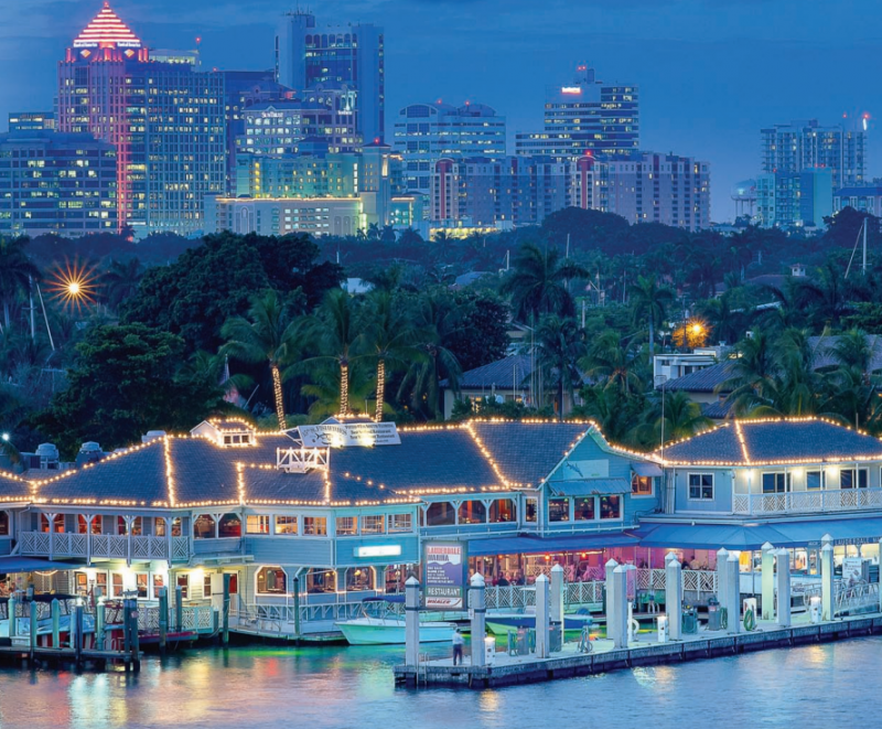
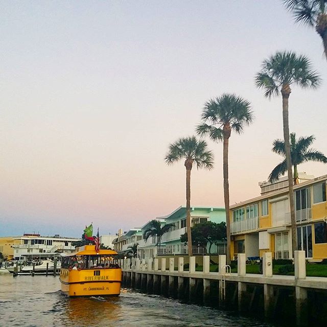
Colorado weather was good enough when it was time to head to Florida, but still the warm wet air of Southern Florida caught me off guard when I exited Miami airport in search of a taxi to my final destination, Fort Lauderdale. I spent nine days in South Florida, and this is what I loved:
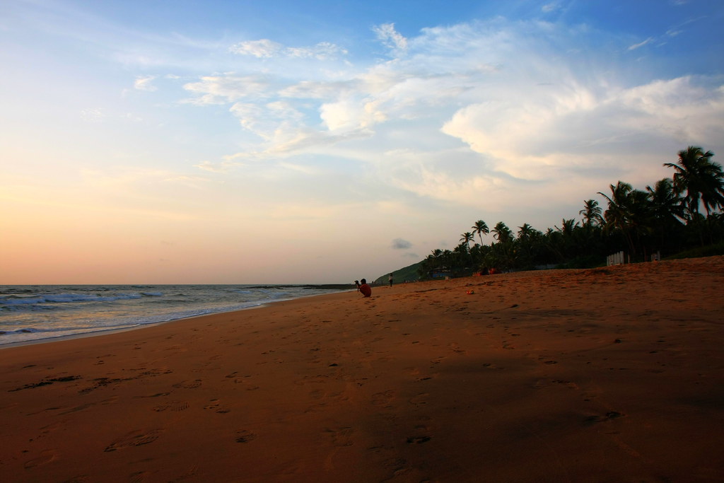
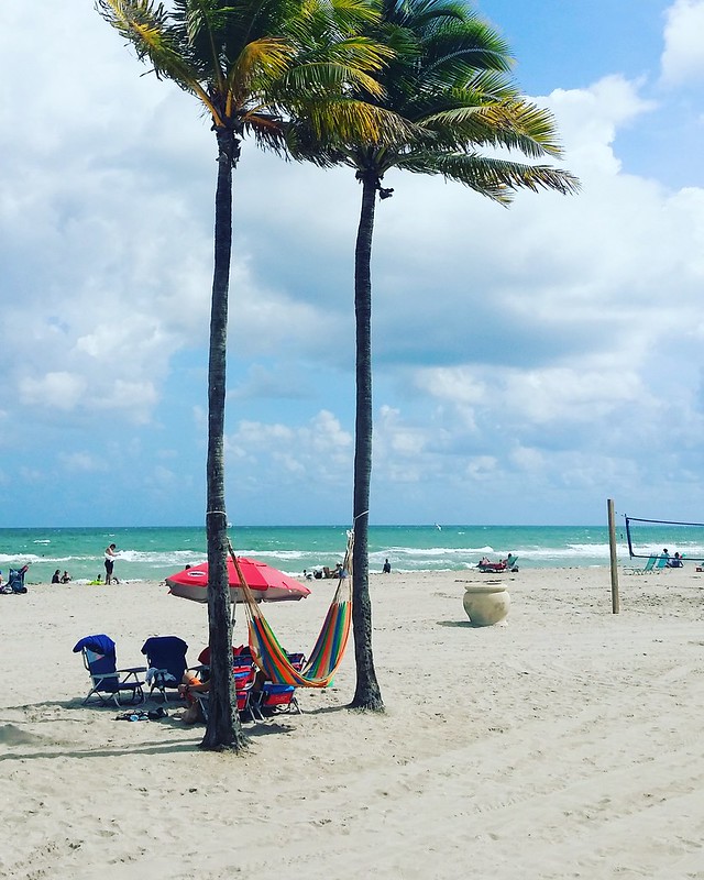
Hollywood Beach Boardwalk. Bands playing almost every night at the band stand, and the feeling of warm sand between my toes right off the airplane.
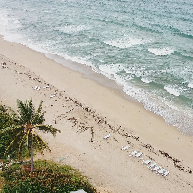
Fort Lauderdale Beach and an ocean that was still warm in November. The lights around here are turned down in the night to not confuse sea turtles nesting on the beach.
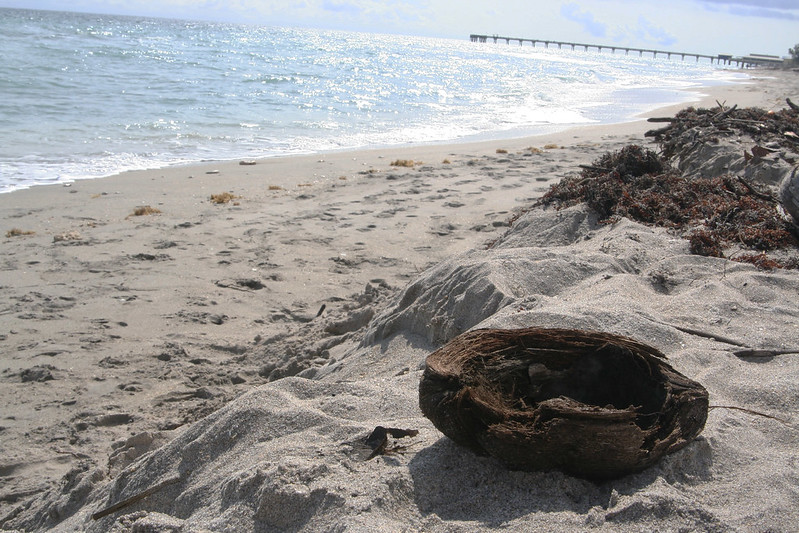
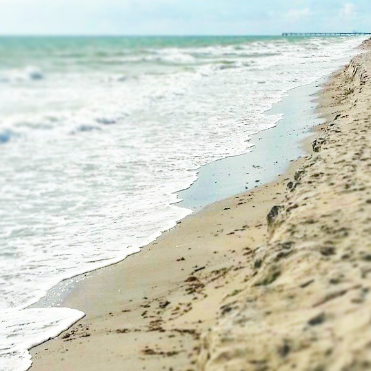
John U Lloyd State Park with a beach completely untouched by development. If you think Florida’s beaches are too touristy, this is for you.
Hollywood Beach right next to MargaritavilleJohn U Lloyd State Park – this view could be from a hundred years ago, when barefoot postmen walked days on end to deliver mail to different beach communities.
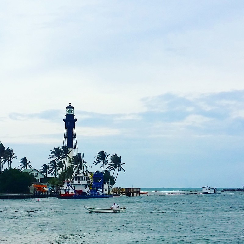
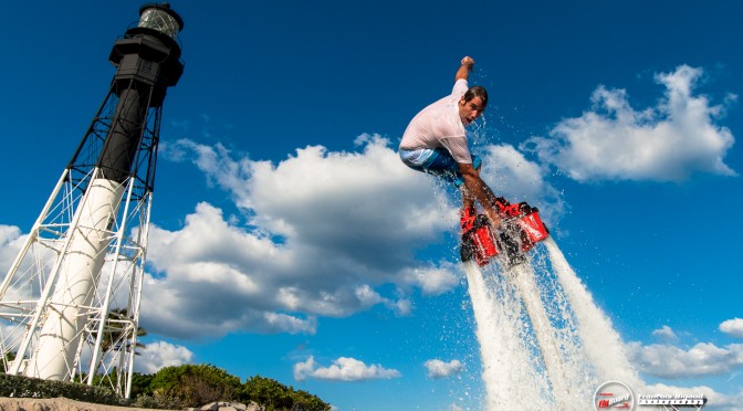
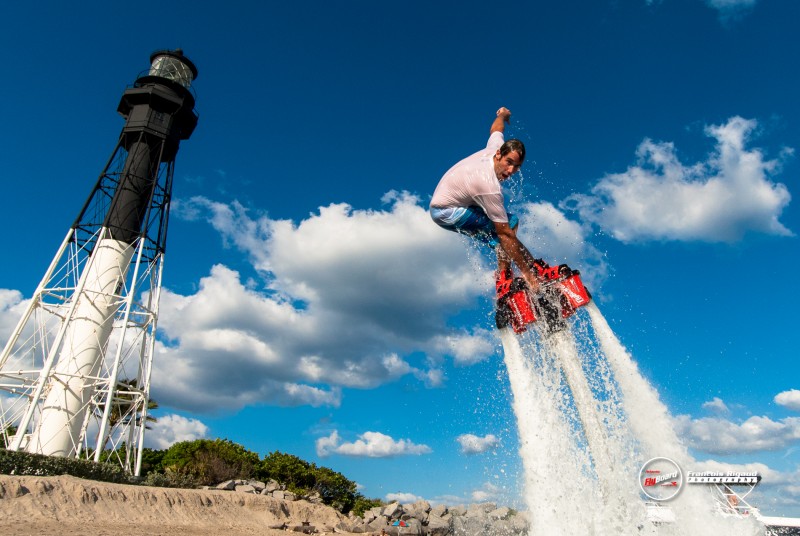
The 175 steps leading up to Hillsboro Inlet Lighthouse. The museum is small and you won’t be able to get a close-up with the lense, but check out the views!
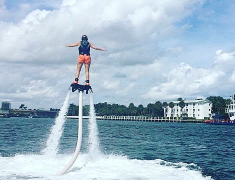
Those couple magic minutes, when I figured out how to flyboard. Totally worth the ten or so minutes spent splashing into the water at awkward angles.
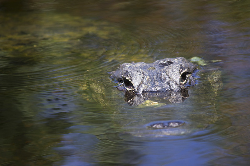
Four alligators spotted while airboating around night-time Everglades. Wroooom!
One alligator that we spotted with Iiro while driving along an “alternative” toll-free route to Big Cypress Swamp. The route was a dirt road in bad shape, and our rental car was a Toyota Prius, but hey, we made it – with a wild alligator sighting to boot!
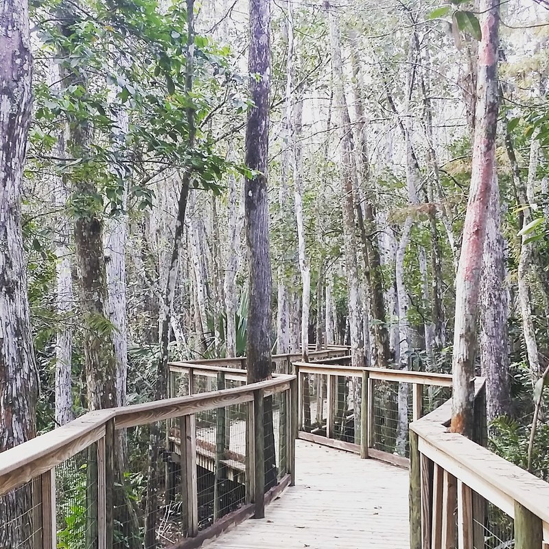
A mile of boardwalks around a swamp next to the Ah-Tah-Thi-Ki Seminole Indian Museum. Don’t step off the boardwalk, a sign told us, and looking at the impenetrable wetlands, this seemed like one of those “don’t microwave your cat”-signs of pure obviousness. Hard to believe people actually lived in these swamps!
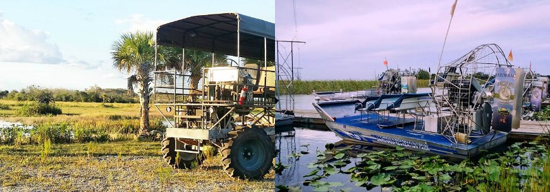
One big bad swamp buggy, whose sole passengers Iiro and I were. The ride might be a little more bumpy than usual, the driver said and charged straight into the swamp. Fun!
No way we could have hiked around a swamp without the boardwalk.Swamp buggy at left, swamp airboat on the right. Thanks to Billie Swamp Safari and Sawgrass Recreation Park for the rides!
150 miles to Key West, which we didn’t drive but FLEW! The small Piper airplane took us low enough for me to grasp the sheer size of the Everglades.
The 100,000 or so party people who had come to Key West’s Fantasy Fest with us. “Crazier than New Orleans on Mardi Gras” said one local and I don’t find it hard to believe…
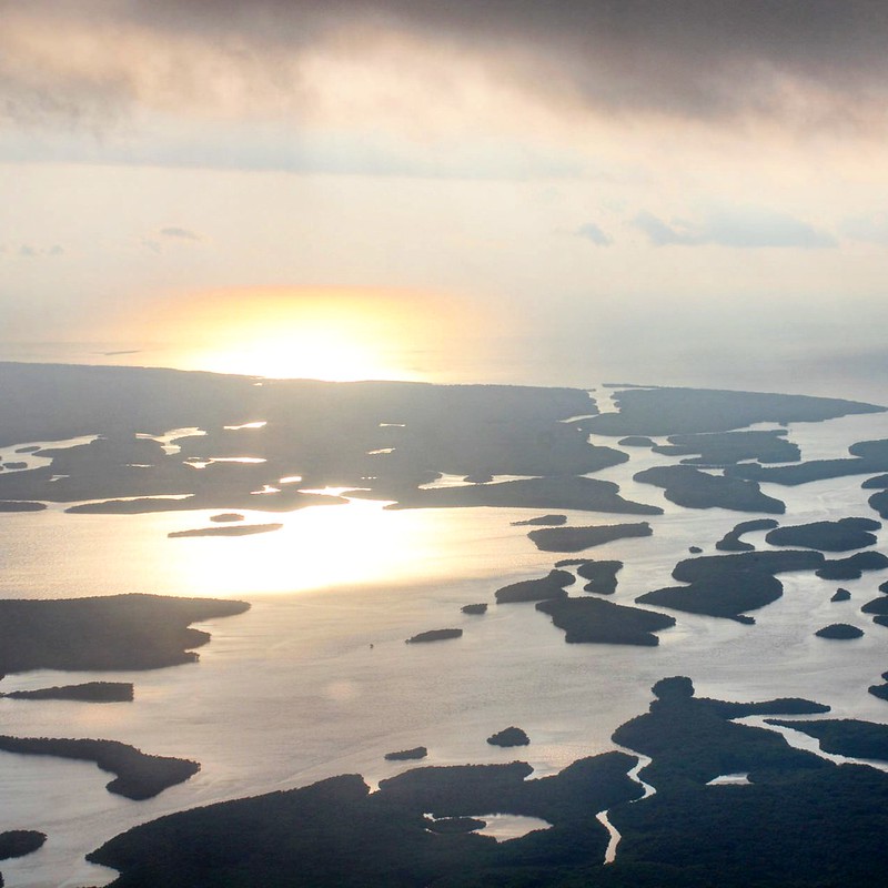
Everglades right off the coast
Dozens of new tavel bloggers I met at TBEX travel blogger conference.
Two “old” travel blogging pals from Finland, who I finally got to know face-to-face. Moikka, Sanna and Ulla!
The top-rated award-winning queen size air mattress that our friend in Fort Lauderdale had gotten to host us for the last couple days of our stay. And this is completely without irony here.
Some of the photos and events featured in this post are from a press trip organized by Greater Fort Lauderdale CVB.
This post is part of Instagram Travel Thursday, a celebration of travel photos on Instagram and the stories behind them. You can find me on Instagram as @globecalledhome. The rest of the participants are below.
Coming up next week is something I wasn’t really expecting much from in the beginning, but that I’m completely utterly head-over-heels excited about right now. I’m heading off to my first travel blogger conference ever, and on Sunday morning, I’ll jump on a plane towards South Florida and TBEX North America. It’s going to be two days worth of talks on blogging, content creation and traveling, and of course enjoying the beautiful South Florida. The latter is thanks to an invitation that I got for a hosted pre-conference trip with an adventure theme – and when someone says adventure, I’m always in!
During the trip I’ll enjoy life at the Margaritaville Resort at Hollywood Beach. Did you think the only Hollywood in the US was in California? Well think again, because Florida’s also got its own Hollywod, and unlike its Californian namesake, this one’s also got a beach! Hollywood Beach is situated midway between Fort Lauderdale and Miami, and it’s one long beach boardwalk lined with restaurants, shops, and of course the beach. Next week it’s going to be around +30C, so I’ll make full use of the resort’s pool as well as the Atlantic’s waves. But this trip won’t be just beach life…
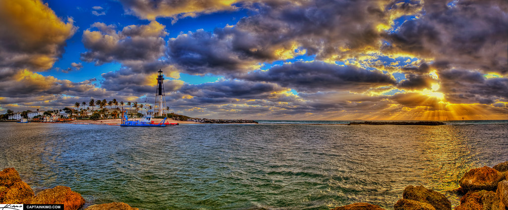
Flyboarding looks absolutely crazy. [photo: Flyboard South Florida]On Monday, I’ll get to try flyboarding at Pompano Beach, a bit north of Fort Lauderdale. According to the info I got, I’m supposed to “soar like a bird and swim like a dolphin”, but let’s see what kind of a flying fish my performance will resemble the most. If it turns out to be harder than you’d think, I’ll switch over to doing a little stand-up paddling in the lagoon. As a hard-core lighthouse fan, I’ll also get my dose with a tour of Hillsboro Lighthouse.
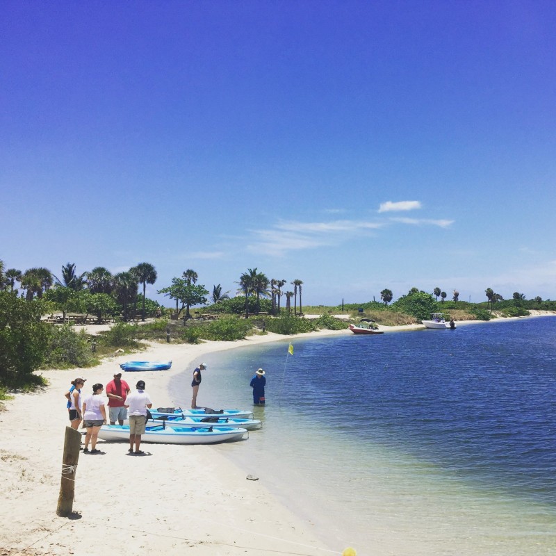
Hillsboro lighthouse and Pompano Beach [photo: Kimo]Everglades is a region of tropical wetlands that extends to a much wider area in South Florida than you’d think just looking at Everglades National Park. The plan is to spot some gators just a rock’s throw from Fort Lauderdale at Sawgrass Park. The best way to get around the marshes is by an air boat, which I’ve only seen before in movies. The next day, I’ll get to tour John U Lloyd Beach State Park‘s mangrove mazes and reefs with a kayak!
Air boat ready to go. [photo: Sawgrass Recreation Park]Kayaks setting off from John U Lloyd Beach State Park. [photo: Whiskey Creek Hideout]John U. Lloyd State Park is a national park with everything from beaches to reefs to mangroves, right next to Fort Lauderdale. [photo: Alysha Khan]All this adventuring is going to make me hungry, and luckily the program’s got some great sounding restaurants on it. The part I’m mostly looking forward to is fresh seafood, as that’s kind of hard to come around to in my present land-locked home.
In the conference, I’ll meet up with a couple Finnish travel bloggers – Sanna from Siveltimellä and Ulla from 50 State Puzzle – and together with Iiro and a couple of other Finnish guys we’ll head off to the always-fabulous Key West. October 31st, also known as Halloween, is on Saturday, and Key West is going to have a parade with floats and everything that we just can’t miss. It would be a long drive to Key West by car, so we’re saving some time by hopping on a private airplane – which I’m looking forward to just as much as Key West!
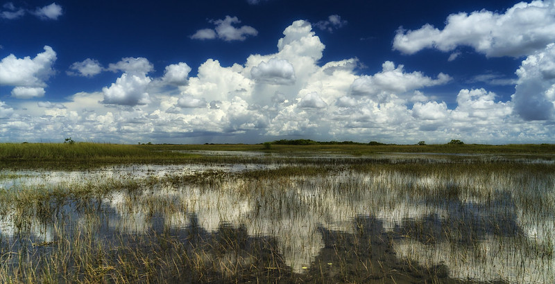
American Halloween costumes aren’t just limited to those with a horror theme. In fact, it doesn’t seem like the costumes have to fit any theme, just as long as they’re fun! [photo: Brian Lin]We’re still planning on heading deep into the Everglades National Park before we head home. The park’s a UNESCO world heritage site, and it spans more than 6000 square kilometers – more than twice the size of the country of Luxembourg! We’d better not get lost there…
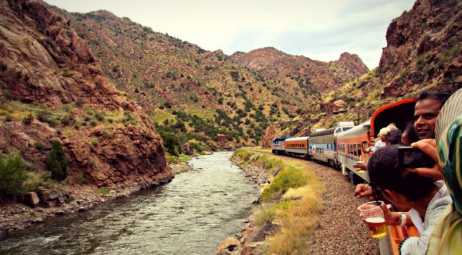
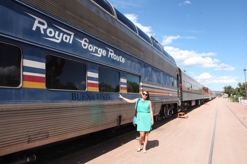
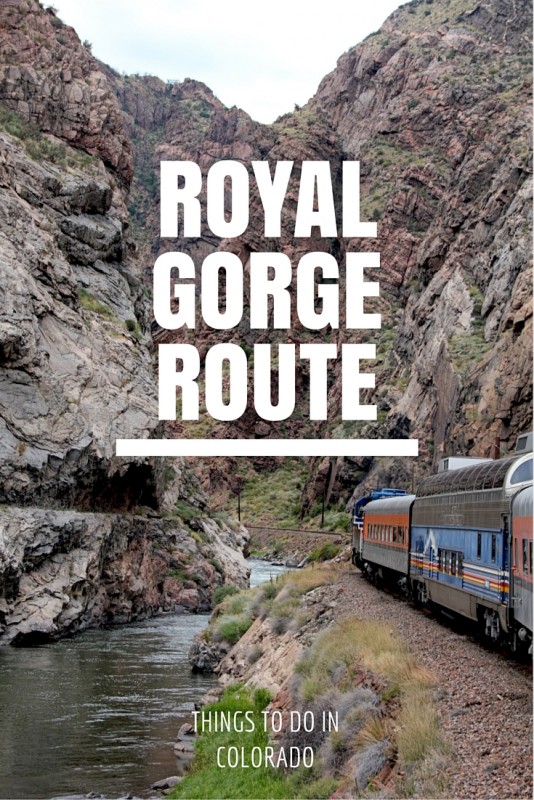
Do you know what’s the difference between a gorge and a canyon? A canyon is wider than it’s deep, like the Grand Canyon, which is almost two kilometers deep but still at least six kilometers wide. Compare this to Royal Gorge in Colorado, which despite it’s nickname Grand Canyon of the Arkansas is actually a gorge: up to 400 meters deep and only 15 meters across! One thing’s sure, though. No matter the name, Royal Gorge is breathtaking.
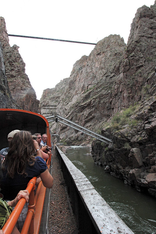
Train approaching the narrowest section of Royal Gorge
What makes this gorge close to Cañon City really special are the railway tracks that run through it. Nowadays scenic passenger trains run through it, but more than a century ago when it was being built, it wasn’t tourists that the railroad companies were after but something more precious: silver. The Rocky Mountains were gripped by a silver rush, and Royal Gorge was one of the few viable routes for train tracks, which meant that not only were tracks built in the gorge, but two railroad companies were fighting over them – literally. In June 1879, the men from Denver & Rio Grande railroad company attacked the men of Santa Fe railroad company with rifles, and Santa Fe’s men responded with the help of a cannon “borrowed” from the army. It’s not sure whether anybody died, but this forced the federal courts to step in, and the tracks were finally completed the next year.
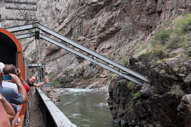
That guy leaning out of the train is my hubby waving to me
Besides silver, the trains also carried passengers of the past century through the gorge, but midway through the century, travel habits started changing thanks to air traffic. When finally in 1967 US Post Office withdrew its contract to transport mail via the Royal Gorge Route, passenger traffic finally came to an end. Not that this kept tourists out of the gorge, because 1929 had seen another wonder built in its vicinity…
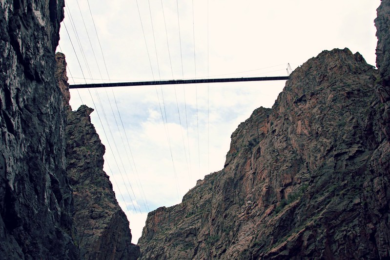
Royal Gorge Bridge, almost 300 meters above the gorge
Royal Gorge Bridge was not just any bridge but the highest bridge in the world! It kept its record from 1929 all the way to 2001, when it was surpassed by a Chinese bridge, but that didn’t diminish its grandeur – nor its pointlessness. The thing with this bridge is that it doesn’t lead anywhere, never has, and it was only built to lure in tourists, with which it was doing a very good job. Even now, it’s one of Colorado’s most popular attractions, and it’s surrounded by a theme park bearing its name.
The bridge isn’t the only thing that crosses the gorge. Tourists can also use a gondola or zip lines to take in the views.
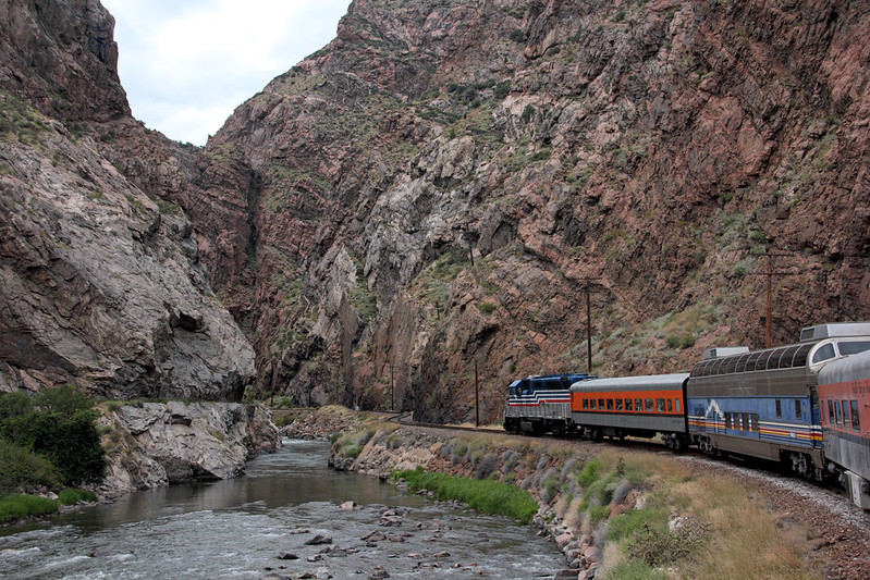
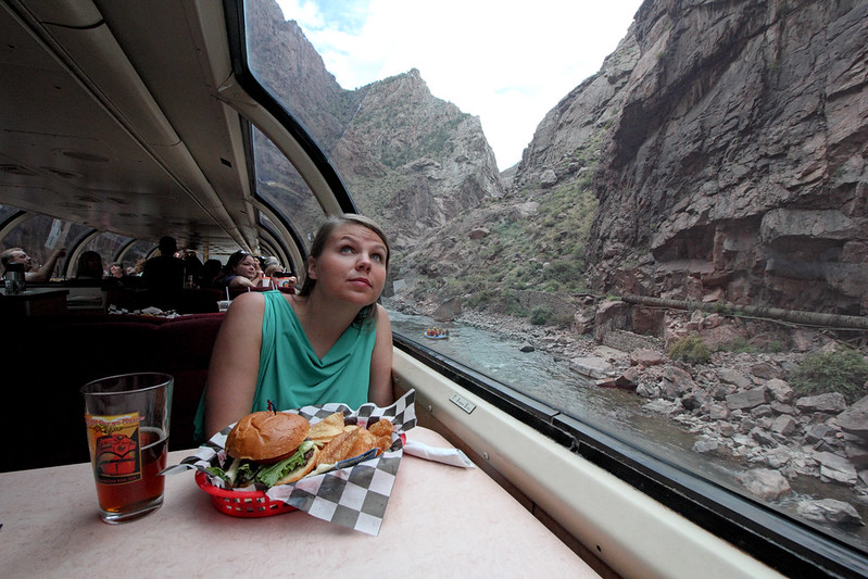
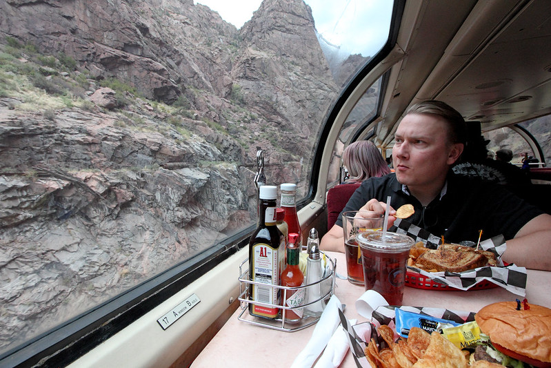
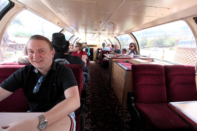
Beginning of September was pleasantly warm, but we still kept mostly indoors through our train ride. That was because we’d gotten seats in the Vista Dome cars, which had fantastic views of the gorge thanks to its rounded windows – a big step up from how it was in 1999 when passenger service was first restarted.
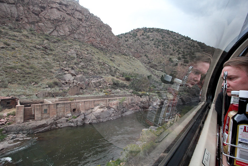
There were several historic buildings in the gorge, including this former water pumping facility, which provide downstream cities with fresh water.
First passengers on the newly opened Royal Gorge Route were transported with old vintage cars, just a couple of them per ride, and service was limited to what drinks were found in the conductor’s cooler. As the route got more popular, more cars were added (most of them still with a vintage vibe), and the owners focused their investment efforts on dining on the train.
Not bad views at all! And the food wasn’t too shabby either.
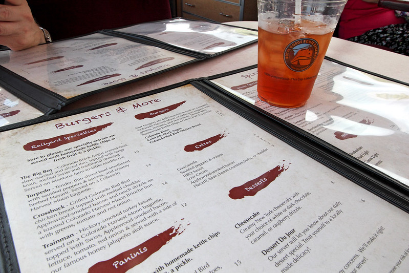
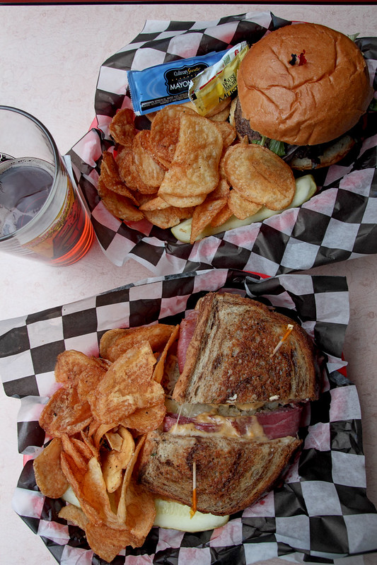
We took the 3.30pm train – late lunch, early dinner – so Iiro ordered The Big Boy sandwich, and I got a bison burger. Besides a train enthusiast, the owner of the Route is also a big foodie, and the menu had a local emphasis. The bison in my burger had roamed the prairie near Henderson, Colorado – just a couple hours North, near Denver – and Iiro’s Black Angus had grown up in North-East Colorado’s Sterling. The vegetables, too, were mostly local, and overall the lunch was the best food I’ve ever had on a train!
Two very American things here: lunch served not on a plate but from a basket,with a side of potato chips.
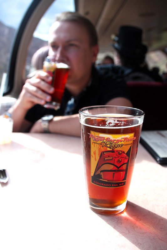
The Royal Gorge Route amber ale was just as good as you’d expect a Colorado amber to be.Each party had its own table in the Vista Dome car.
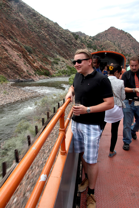
Royal Gorge Route takes around two hours and it’s a there-and-back through the gorge. If you don’t want to spend the whole time inside, you certainly don’t have to. We got out in the beginning to breath some fresh air at the open air carriages. And here’s a sign of excellent service: when our lunch was ready, the waiter found us and informed about it.
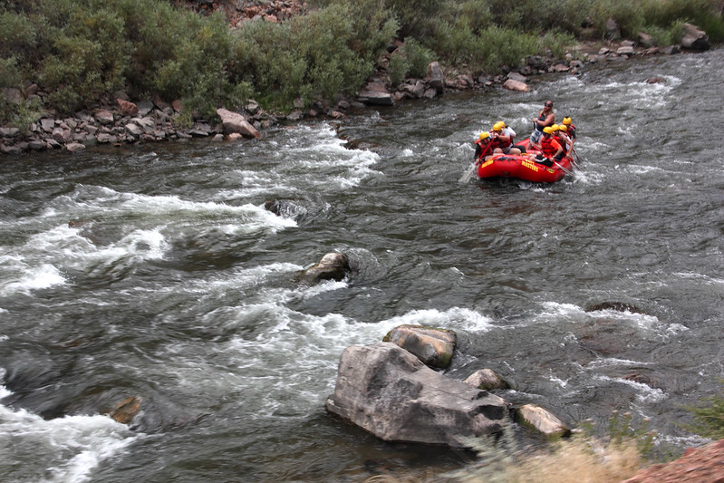
Rafting’s a popular sport at Royal Gorge
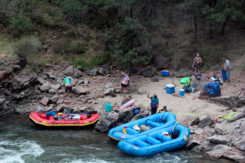
We were told to keep our eyes peeled for wildlife during the trip: big horn sheep, black bears, even mountain lions… but this time, we didn’t see any. Instead, we spent the time following efforts of white water rafters coming down the river. All of them seemed to make it though the rapids alright, and we also saw a group that was camping for the night…
What to do if you’re rafting and see a tourist train coming? Moon them, of course…
This was definitely the most relaxing part of our long weekend, and I can fully recommend it to just about anybody! Just book early, if you’re going between Memorial and Labor Day, because the trains can be sold out during high season.


![ilmatyynyalus valmiina lähtöön. [kuva: Sawgrass Recreation Park]](http://globecalledhome.fi/wp-content/uploads/2015/10/12038677_764655650310911_3466657757045180341_o-800x533.jpg)