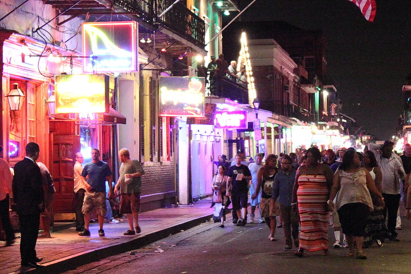
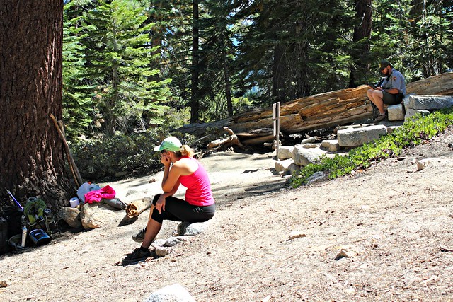
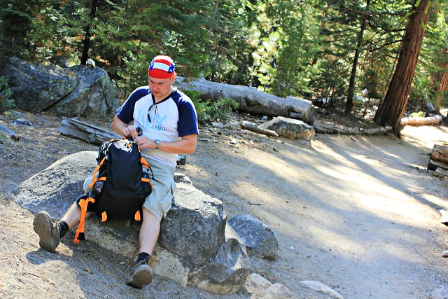
While we were approaching Nederland on a Saturday afternoon in mid-March, the shoulders were parked full of cars already a mile from town. We were in luck and found a spot at some auto repair shop’s yard, which was just a short walk from lakeside, where we could see people gathering.
On the way there, we were passed by a pale posse carrying a metal coffin.
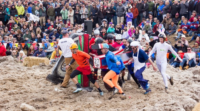
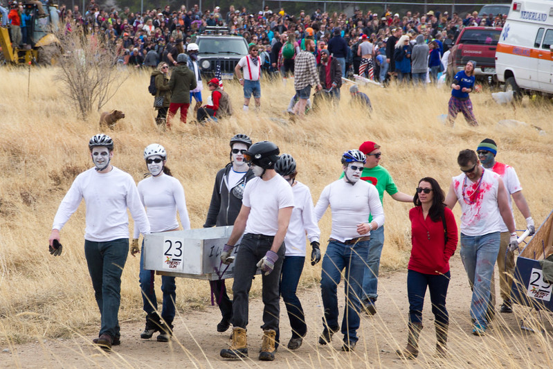
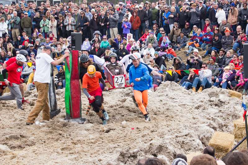
A little further along we noticed spectators following a sport, where a colorful team was carrying a similar metal coffin, this time with someone in it.
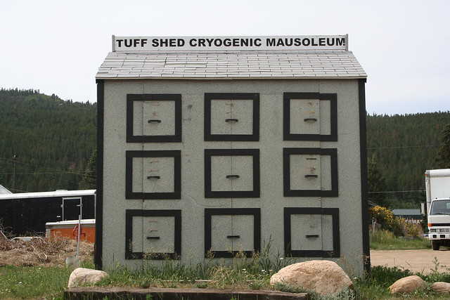
We knew what was going on, but it was still hard to believe a festival like this was real. It’s a long story, and it begins when Norwegian Bredo Morstøl died from a heart condition while cross-country skiing in his native country. His grandson Trygve Bauge did not want to give up his grandfather and instead transported him to California, where the body was deep-freezed in a local cryonics facility.
[photo: Kent Kanouse][photo: Kent Kanouse]After a couple years in California, Trygve together with his mother (and Bredo’s daughter) Aud transported grandpa to Nederland, where they were planning to build an earthquake-, bomb-, fire-, wind- and flood-proof home. Unfortunately Trygve’s visa expired and he was deported, so the home was never finished, and grandpa’s body was left laying in a shed behind the construction. When Aud was evicted – apparently it’s illegal in Nederland to live in a house without electricity or plumbing – grandpa’s future seemed more and more uncertain.
Aud contacted the press, and suddenly grandpa was an international news story. City council quickly prohibited keeping dead bodies on private property, but grandpa Bredo was “grandfathered” in and allowed to stay. A local radio station together with a Tuff Shed distributor decided to sponsor a new and better shed for grandpa, and Trygve hired a caretaker – “Ice Man” – to bring in dry ice.
Seven years later, in 2002, the town had gotten over its shock and was ready to see the humor in it. Someone got an idea to celebrate the town’s most known inhabitant, and Frozen Dead Guy Days was born.
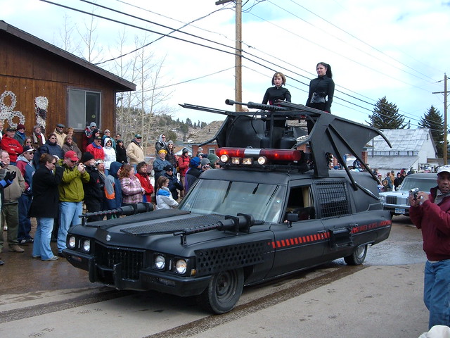
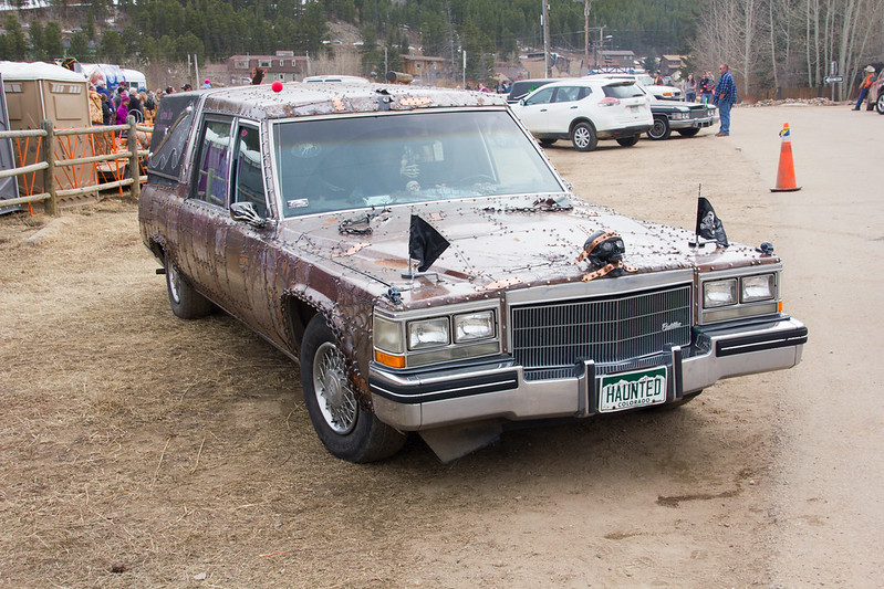
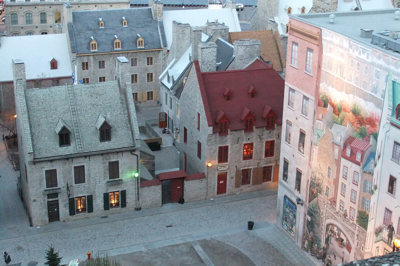
The shed were grandpa is kept. [photo: Towle N]One of the festival events, the Polar Plunge, which apparently is not as normal in the US as it is in the Nordics. [photo: CL.Baker]Every festival must have a parade, right? This one has a parade of hearses. [photo: Matt Beldyk]
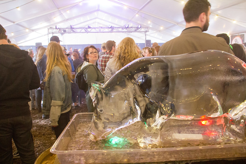
At first, it looks like any other festival: tents, music, beer, lots of people in good spirits. Except other festivals don’t have frozen salmon tossing, frozen T-shirt or slushie drinking (Freeze Your Brain) competitions. I almost brought with me the left-over turkey from Thanksgiving that had been sitting in our freezer, so I could participate in frozen turkey bowling. Theme of the program seemed to be “anything dead or frozen, preferably both”.
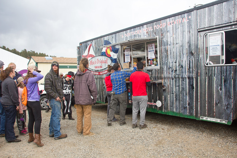
Moe’s Original BBQ, pulled pork sandwiches worth the queue.
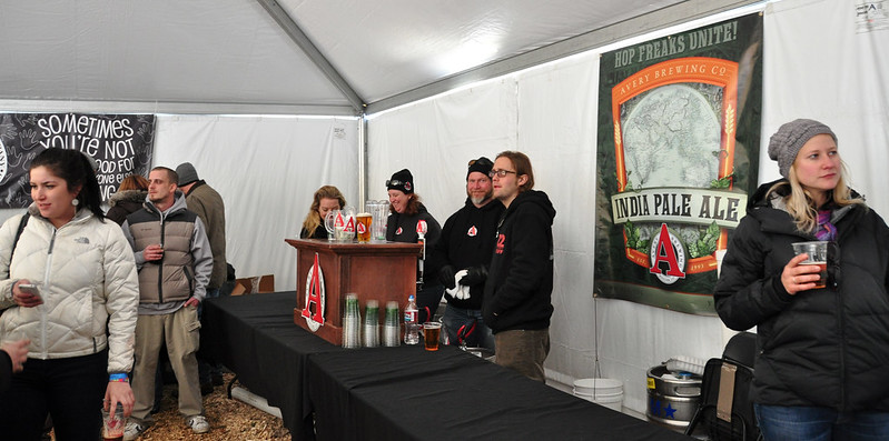
Inside the tents, local craft breweries were selling beer, each at their own table. I thought I knew the local beer scene pretty well, but these breweries were so small I hadn’t even heard of half of them.
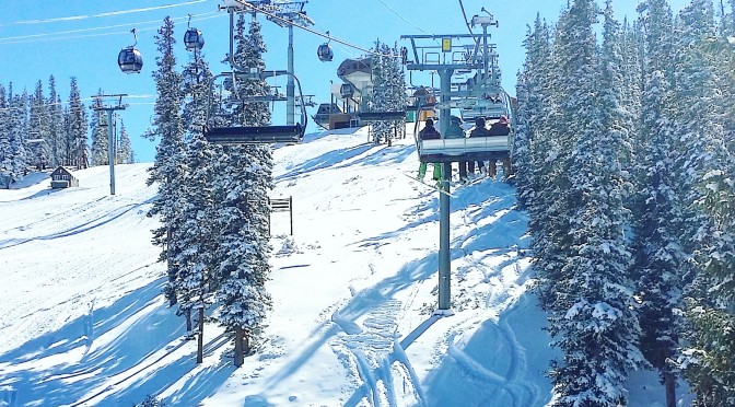
[photo: Kent Kanouse]The festival goes on in every weather, and in March in Colorado, that can be anything from freezing cold and snowstorm to balmy almost-summer. Dress accordingly.
Frozen Dead Guy Days in March. There’s a festival bus from Boulder to Nederland, and it’s around an hour’s drive from Denver.
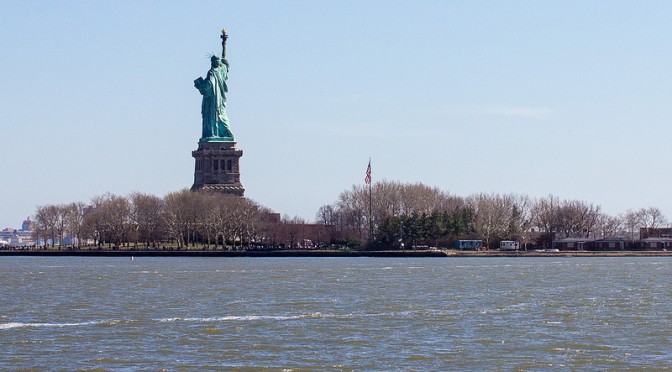
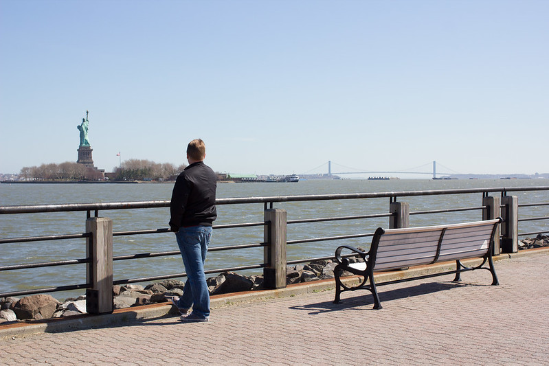
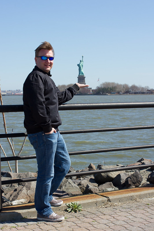
There’s a lot of things in New York that you don’t need to plan for days, weeks or even months beforehand. Statue of Liberty is not one of them.
Two years ago on our visit to New York, we would have wanted to climb up to the crown of the Statue of Liberty. Unfortunately, while I was asking my husband which time he considered the best for the trip, the tickets were sold out. Then we thought we’d visit just the pedestal, but we thought about it for so long that those tickets were also sold out. The frustration!
That experience taught me a lesson, so now for our September trip to New York, I started checking the Statue of Liberty tickets online already months before the trip. It’s now six months to our trip, and I noticed today that tickets for those dates had some on sale – and I didn’t hesitate clicking them to my shopping cart! If you’re going to New York in June, it’s already too late for the crown tickets, but you’ll still have time for a trip to the pedestal, which is half as high as the statue itself.
Tickets are sold online at Statue Cruises, and they always include a visit to Ellis Island, the place so many immigrants passed through in the first half of the 20th century on their way to New World. Both the Statue of Liberty and Ellis Island are on different islands and the cruise that is included in the ticket will take you to both of them from either New York’s Battery Park or New Jersey’s Liberty State Park.
If you’re too late to the game, you can still go check out the Statue of Liberty from nearby Liberty State Park, where the photos in this post are taken from. Another option is to jump on the Staten Island ferry from Whitehall terminal, South Manhattan. The ferry is a part of New York’s public transportation system, and it passes the Statue of Liberty close enough for photos.
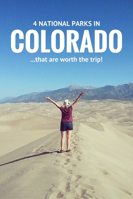
National Park Service is by far the best government agency in the US – and possibly the whole world – and national parks are its crown jewels, the pride and joy of the system. Colorado is proud to have four of these gems, which are all worth a visit:
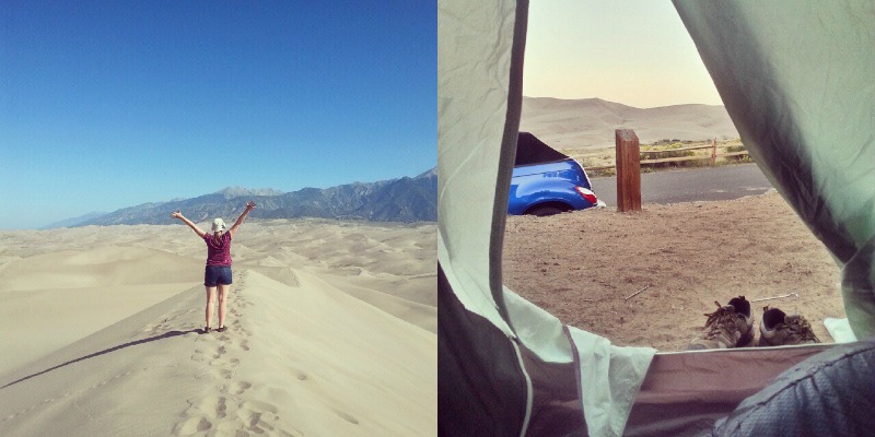
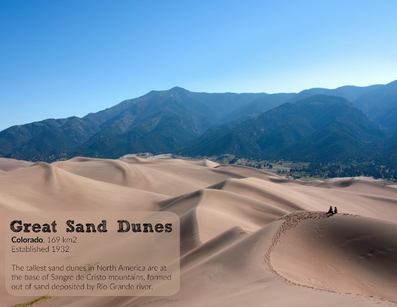
Great Sand Dunes National Park
When my family roadtripped around Colorado in the 90s, this place had yet to gain its park status, but that didn’t keep us from hiking up those hills, sledding down the sandy slopes and feeling the enormous heat of the warm dunes through our sneakers. A couple years ago, my husband and I camped next to the dunes, waking up together with the sun to hike to the highest point of the dunes before they were too hot to handle. One of the most amazing views I’ve ever seen.
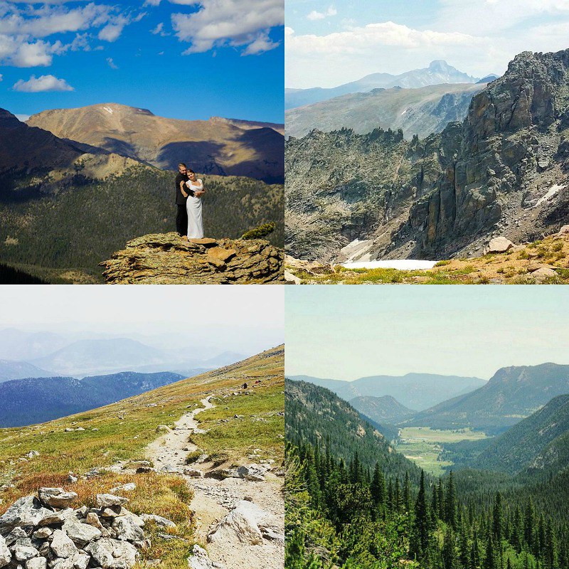
Rocky Mountain National Park
Our closest national park will always hold a special spot in my heart, and not just because I got married there. This park is a dream come true for any hiker, full of wonderful trails where anyone can find their favorite, be it wildflowers, mountain vistas, alpine lakes or secluded groves. And even if you’re not into hiking, there’s always Trail Ridge Road, the highest altitude paved highway in the US with amazing views of the Rockies.
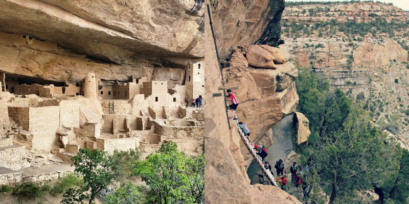
Mesa Verde National Park
There’s only one national park in the US that was founded mainly to protect human heritage, and that is Mesa Verde. Here you can ponder what forced the ancestral Pueblo people to abandon their homes more than 700 years ago after they had built a civilization on the sides of canyons. You need at least a couple hours for a visit, but we spent a whole day there to explore the cliff dwellings.
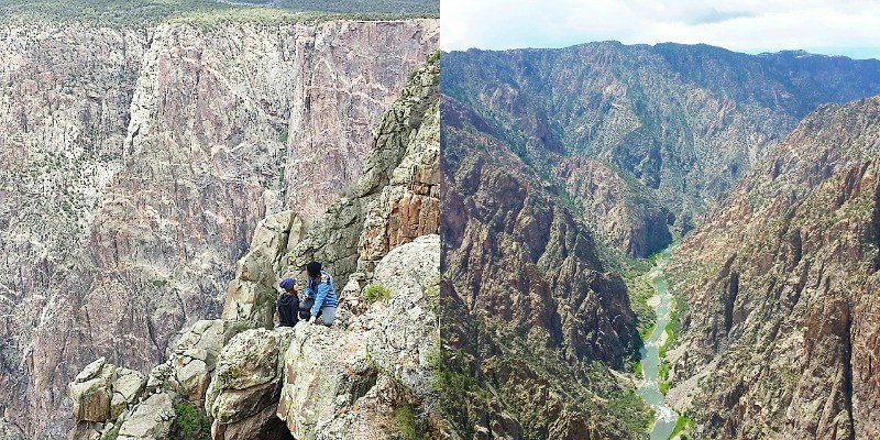
Black Canyon of the Gunnison National Park
Black Canyon is actually not a canyon but a gorge, one of the steepest and deepest in the US. More than 800 meters deep at most and only around 350 meters wide at its narrowest, it’s probably the darkest gorge around, and that’s where it got its name: at parts of it, sunlight reaches the bottom only 30 minutes a day. We contemplated hiking to the bottom but thought it best to leave it for some other time, as you can always roll down a mountain if you get tired, but a gorge is a whole lot tougher business to hike up.
Travel+Leisure published a while back their readers’ list of ten best domestic (incl. Canada) cities to travel to. I was delighted to notice I’ve visited six of them, and even more delighted when I realized the top destinations weren’t mega popular internationally well known cities but instead the smaller gems that I’ve only found out about after moving to the US.
So if you’re planning on a North American roadtrip this coming year, take heed of this list:
10. Asheville, North Carolina
Asheville is one of the two cities in this list I’ve missed even though I’ve meant to visit. When we lived in Georgia, we were planning to go here, but only got as far as Cherokee before we had to head for Tennessee and the Great Smoky Mountains.
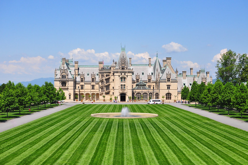
I had heard a lot of good things about Asheville’s whitewater rafting opportunities, and I was also aware of the city’s brand as a home of new age hippies in the middle of mountains. The city’s also known as Paris of the South, which title it has claimed surely thanks to Gilmmore Estate: this French renaissance style mansion is over 16 000 square meters and is the largest privately owned home in the US.
Biltmore Estate is nowadays also open to the public. [photo: Blake Lewis]
9. Victoria, British Columbia, Canada
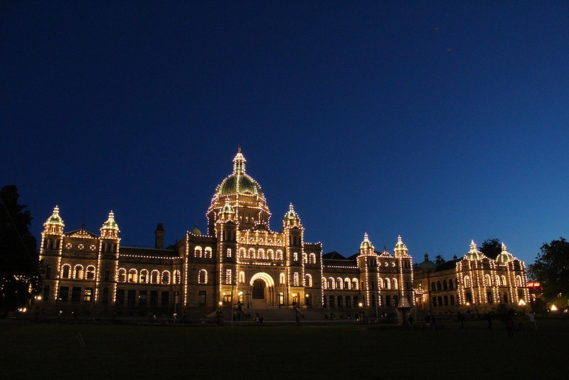
Victoria is a smaller city than the nearby Vancouver, but it still beats its big brother in a lot of aspects, like the weather: it rains only a third in Victoria of what it does in Vancouver. Victoria’s population is only around 80 000, and its downtown has a British vibe. I haven’t been to the Northwest corner of the US yet, but when I head there, Victoria’s going to be on my list.
Victoria is the capital of British Columbia, and here’s its parliament. [photo: Annika / Live, laugh, explore]
8. New York City, New York
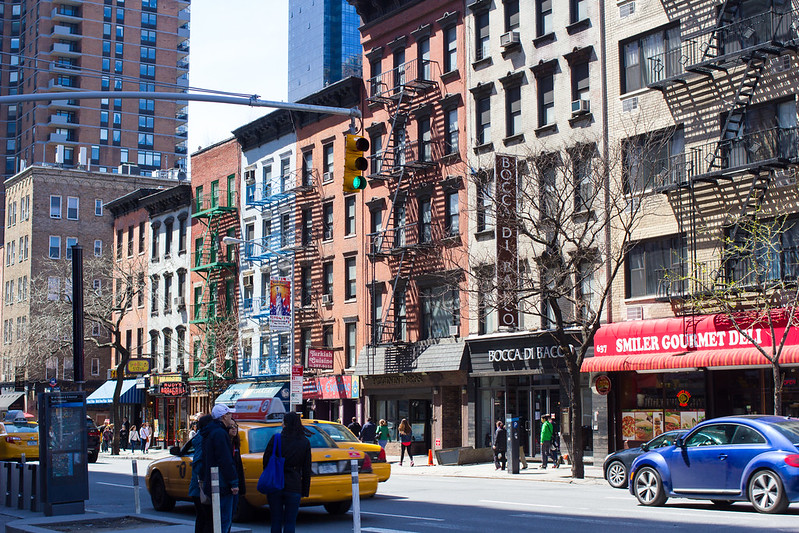
It’s a surprise to noone that good ol’ New York City is on the list. A surprise to me was its placement: only eighth! NYC is iconic, special, in its own division altogether, one of my favorite cities, but I gotta give it to you, it’s not the easiest for a tourist. Hotel prices are seriously crazy here!
If you do manage to find accommodation, New York City will have activities for every day of the year, and the restaurants are some of the best in the world. It’s in fact such a great place that this will be my third year in a row that I’m visiting: I just booked airfare for our first anniversary in September!
7. Chicago, Illinois
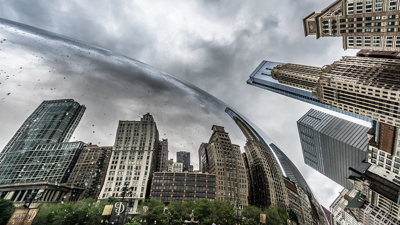
I’ve spent just one day in Chicago, back in 2007, and then the city really lived up to its nickname, the Windy City. Walking along the banks of Lake Michigan, I was freezing, and it was “only” October!
I was impressed in Chicago by the city itself. To start, I climbed Willis Tower (back then, Sears Tower) and stared at the city, amazed at skyscrapers pushing up from the grass of low-rises. Architecture and urban culture are reasons why Chicago has such a good rep these days, and reasons why I’m heading back some day, hopefully soon.
The most European city in Canada? That would be Quebec. The city and its namesake province must be one of the only places in US and Canada where you’d be better off speaking something else than just English. French is the lingua franca around here!
I haven’t visited Quebec myself, but I’ve wanted to since I realized the city’s a world heritage site. Old cute town centers just take my heart away.
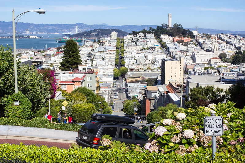
San Francisco might not be the warmest part of California – we visited two years ago in August and had to don our jackets for the first time on our roadtrip – but this doesn’t slow the city down.
What I loved the most of about San Fran were the neighborhoods, each with a distinctively different vibes, and the numerous hills with trams speeding up and down. We only spent two days in the city, and that was clearly not enough. Another city we must visit again!
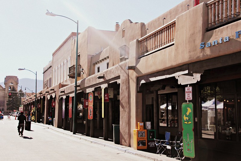
4. Santa Fe, New Mexico
When I mentioned smaller gems in the introduction, this was exactly what I was thinking about. Santa Fe is far from everywhere, but this is a city you should make a bigger detour for.
Downtown of Santa Fe is built from adobe, and it feels like time lost its course some two centuries ago, never finding its way again. The city has numerous excellent museums, and after they close down, there’s simply nothing better than spending the evening way on one of the rooftop terraces, enjoying summer heat that lasts well into fall.
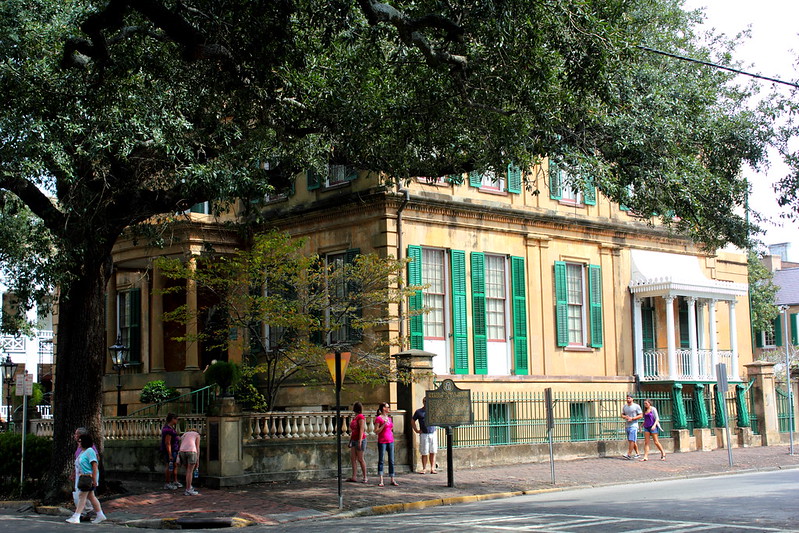
3. Savannah, Georgia
I’d never heard of Savannah before our move to Georgia, and I fell deeply madly in love on my first visit. Every time we had visitors from Europe, we’d tell them go see Savannah!, and they all would, and they all loved it too. So what’s up with that?
Savannah is built of old antebellum mansions from centuries ago, gardens inbetween them, carriage houses behind them and all of downtown tied together by squares where moss grows on trees and makes the town look alive with ghosts of the past. The local art school, which happens to be one of world’s best, must have had a positive effect on the city, because the streets are filled with small galleries, design shops, cute cafes and good restaurants.
I’d go back anytime, darling, anytime.
2. New Orleans, Louisiana
New Orleans’s French Quarter, the official party town of USA, is alive 24/7 and especially during Mardi Gras. Who cares if sewages smell in the summer and rats having a party of their own? This is the Amsterdam of USA.
But don’t just stay in the French Quarter. Garden District has a lot of magnificent large mansions, and Saint Louis Cemetary is one of the more interesting ones to visit.
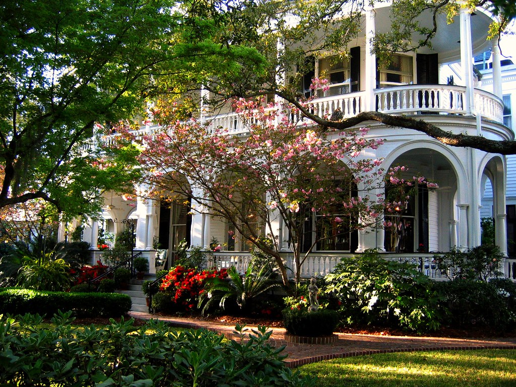
1. Charleston, South Carolina
Charleston seems to hang around the top of almost every list: best places to travel, most romantic American towns, cutest Southern charm, best places to live… and now it’s even trying to get on the list of UNESCO world heritage sites!
…so of course I’m super bummed that we didn’t have time to visit when we lived in Georgia. One acquaintance said of Charleston: it’s a bit like Savannah, only nicer – which means I absolutely have to go and visit even if I don’t live around anymore.
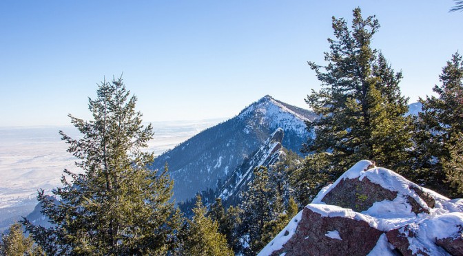
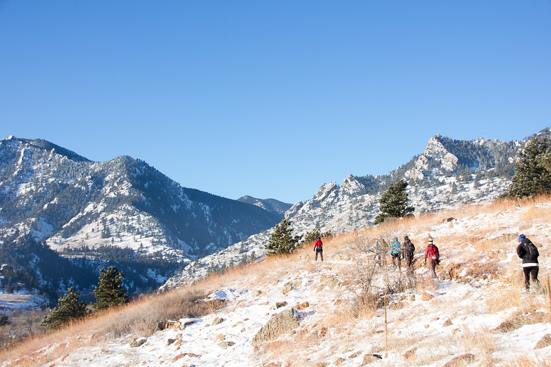
Hiking used to be a summer activity for me, but in the four seasons of Boulder, Colorado, with hiking clubs active year-round, I’ve slowly started to change my mind and gotten accustomed to winter hiking. Last Sunday I put my winter hiking skills to the ultimate test by attending the Boulder Hiker Chicks‘ Winter Trifecta, a tour of Boulder’s three local peaks.
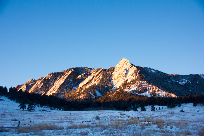
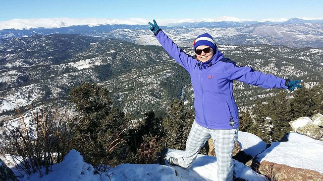
Flatirons at sunrise. This was the end point for our hike, so we met up with a smaller group here at sunrise to carpool to Mesa Trailhead.
Rather opt for more clothes than less.
It was around -12C when we started the hike, but the forecast said the temperature would rise above 0 in the afternoon. On the other hand, we’d be walking along peaks and ridges with a chance of high winds. And then again, you’ll get warm when you walk. So what to wear on a winter hike?
I wore a technical T-shirt underneath, because earlier I’d hiked in wintertime with a cotton shirt, sweated it while climbing, and then shivered coming down. Not an experience I’d like to repeat! On top of that, I wore a NorthSky microfleece and a softshell jacket. Because I always take something extra with me in case I get cold, I also packed a Patagonia vest because of its light weight. I ended up putting the vest at the first summit and wearing it for the remainder of the hike, instead removing my jacket when needed.
On my legs I wore Patagonia leggings for warmth and waterproof pants on top of them, plus good quality hiking socks. For my hands, I only had a pair of knit gloves, which proved to be sub optimal when I had to use my hands to support my climbing efforts. Waterproof gloves would have been a better choice in the snow.
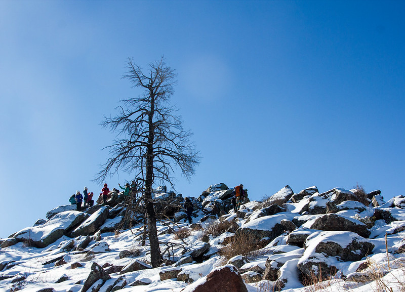
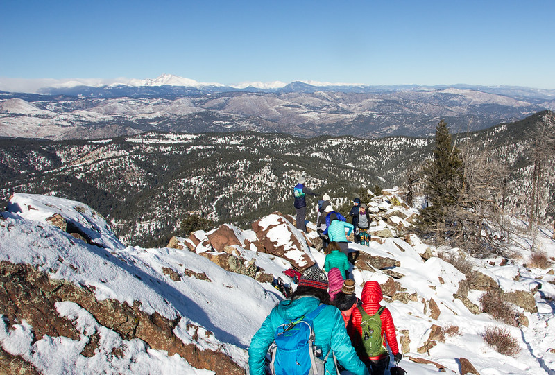
We met up with our hiking group at Mesa Trailhead at 8am in the morning, and after a short regrouping we started off to our first goal, South Boulder Peak (2606m). In Boulder’s hiking terminology, “trifecta” means the route that passes through Boulder’s three big local peaks. After South Boulder Peak, we’d continue on to Bear Peak (2579m) and from there on traverse to Green Mountain (2482m).
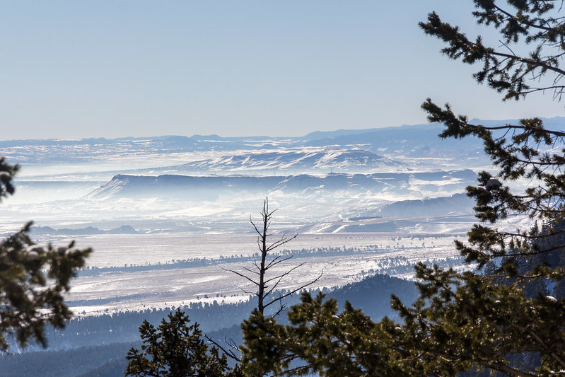
Completing this route from South to North meant that we’d be climbing to the highest peak right in the beginning. The route through Shadow Canyon felt like it took forever, but finally we started seeing remnants of a past forest fire around us, which meant the peak wasn’t far. The horizon also opened up for a view of surrounding Front Range.
What food and drink to pack for a day’s winter hike
On day hikes, my nutrition is based on a cheese sandwich packed in a ziplock. Since this would be much more demanding than your average day hike, I needed additional sources of energy. I ended up packing:
Half a bag of trail mix, which I snacked on whenever I felt low on energy on the long climbs up.
Mini bag of chips. Chips seem to be a big thing with American hikers, as everybody instructed me to pack them before the hike, and bags were passed around at every peak by fellow hikers. I ended up not eating mine, but it’s a nice backup to have.
As a backup, one Clif Bar. In case I get lost or sprain my ankle, or something, it’s good to have more food than you plan on eating.
In addition, somebody passed around some Clif BLOKS before the last climb. It was either the caffeine-infused snack or the great company, but the last climb wasn’t half as bad as I thought it would be.
“Take snacks of every kind, so you’ll always have something you feel like eating on the trail.”
During summer hikes, I drink around half a liter of water per hour, but the winter’s a completely different thing. I packed 1,5 liters with me and ended up drinking less than a liter during the whole hike. One pro-tip for winter hikes: Don’t fill your water bottles with cold water straight from the fridge. It’s not fun to drink water that’s turned into ice slush.
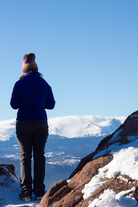
At the summit of South Boulder Peak
The Ten Essentials
This should be nothing new to anyone who hikes, but there’s a list of 10 essentials you should always pack with you for longer hikes in the backcountry. Normally for a hike on Boulder’s local mountains, I wouldn’t bother with all of these, but this hike was a full day, longer than usual, and sometimes a little far from civilization, so it’s better to be safe than sorry. What I packed for my winter hike was:
Topographical map. I prefer National Geographic maps for hiking in the US. In addition, I had a compass, which I ended up not using on the well marked trails, but which could have come in handy if I had lost my way.
Sunglasses and sunscreen. Colorado sun and the snow pretty much make these mandatory. I still managed to forget both but luckily another hiker had an extra pair of glasses and people passed sunscreen around on the way.
Extra clothing. That vest, which ended up not being extra at all.
Headlamp. Our intention was to get back before dark, and while I managed to do that, part of the group got lost and would have had to hike back in the dark if one person hadn’t gone to pick them up with a car from an earlier trailhead. Delays are always possible, so never trust the sun.
First aid kit. I’ve filled a small beauty box with bandaids, desinfection liquid and other first aid essentials. My husband added in some M&Ms for good measure.
Extra food...
…and extra water.
Space blanket, in case you break a leg and need to wait for hours for help.
Yep, there’s only eight things there. I left out two, another by accident and the other on purpose. I forgot to pack my Swiss army knife – I’ve needed it every now and then, so it’s good to have – and I left out matches on purpose, because Boulder’s Open Space & Mountain Parks prohibits fires.
Don’t slip!
Everybody has their own taste in hiking boots. High hiking boots are recommended, but since I’ve never sprained my ankle, I prefer the more light-weight low boots from SCARPA. When hiking up mountains, I always use approach shoes that have a sole with better traction. They’re not as comfortable to walk in as normal hiking shoes, which is why I don’t wear them on flat hikes.
On winter, you need traction on your shoes if you’re going to hike any kind of grades. I wore ICETrekkers Diamond Grips, which I’ve found work well on ice, but in slippery snow they were no match for Kahtoola Microspikes that many others were using. In the snow, gaitors would have also come in handy, and while the trails were trampled enough, I got some snow up my shoes a couple times while stepping on the side of the trail to give way to fellow hikers.
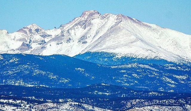
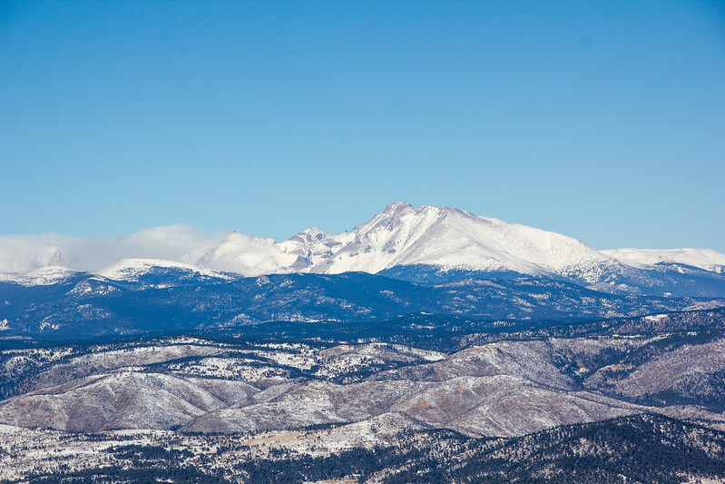
Longs Peak at Rocky Mountain National Park was clearly visible from the peaks.
The weather gods favored us on our trip, and even though wind on Bear Peak was brutal, I’d say overall the weather was excellent, with blue skies holding on for the whole day. Perfect day for a hike, that is!
We saw other hikers on the way, but even more so we passed (or were passed by) trail runners who hopped around the peaks in shorts. I would never be able to run up or down those mountains in winter – up because of my fitness level, and down because I’d be too scared of slipping.
On top of Green I already felt my feet hurting, and the next day I had trouble moving, but my spirits were high the whole time. Fastest hikers in our group did the route in around seven hours, while I took around eight for the whole trip. 11 miles, over 4000 feet of elevation gain. I had really earned that burger at Chautauqua Dining Hall!
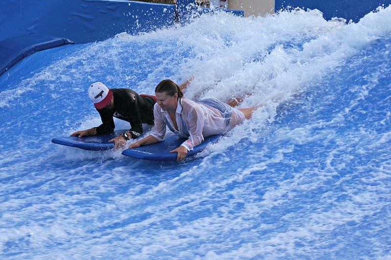
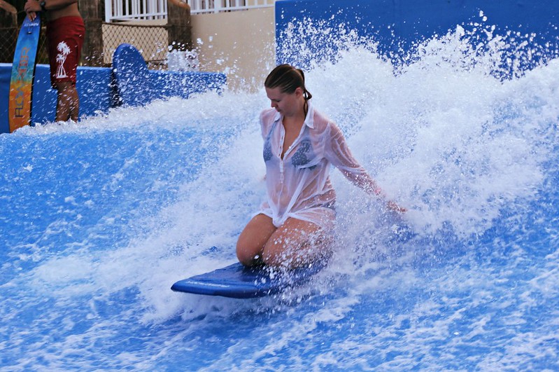
I’ve never surfed. The last time I skateboarded was when I was 7. I only tried snowboarding once and quickly figured it was a bad idea, when little kids at the bunny slope started complaining about me holding up the lift line by constantly falling down.
Still when Margaritaville Hollywood Beach Resort offered me a chance to try out their new Flowrider, I jumped at it. in my mind, this was such a Florida thing to do!
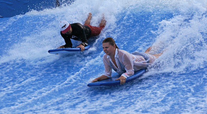
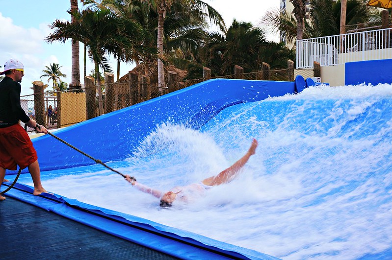
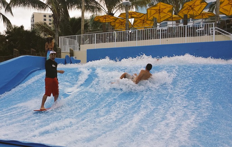
The way Flowrider works is that a thin sheet of water flows up a slope at 20 to 30 MPH and creates an artificial wave that you can surf. Or can try. If you’ve never done it before, it’s best to start from bodyboarding and get used to the sensation of water flowing at you, losing your balance and crashing towards the back wall. I’d say it doesn’t hurt, but the bruises I found the next morning tell a different story.
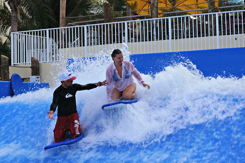
This is probably seconds before I go crashing over the waveThe instructor recommended I keep a shirt over my bikinis, and so do I. There’s always at least 10 spectators with their cameras ready to snap a photo if your top comes off, so better not to take chances.Can’t smile while concentrating…
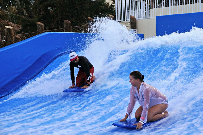
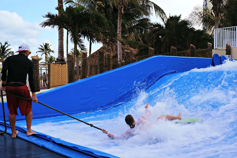
After a while sitting on top of the board started to feel like a piece of cake, so with a sudden boost of confidence I figured that sure, I can try standing up! Flowrider boards aren’t the huge surf boards you’d be used to but more like skateboards without wheels, and I should have known how it would go. There’s a rope you can hold on to to help you stay put, but you’re still all responsible for finding your own balance.
What I looked like around two seconds after I stepped on the board.Third time’s a charm?
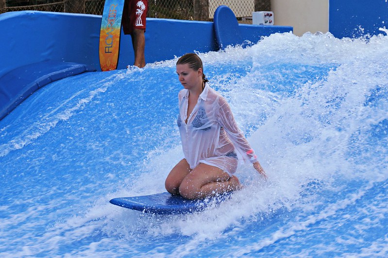
Finally on my fourth try, I found something that resembled a balance, and boy was I excited when I could let go of the rope and stay upright for at least three seconds!!! Of course I don’t have photos to prove, because my friend with the camera was probably too busy laughing at my last fall down. A couple tries more and I was ready to move over to the inviting pool. Flowrider is definitely fun, but also definitely hard!
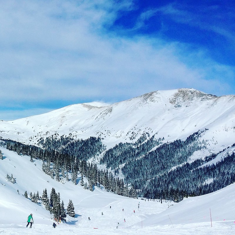
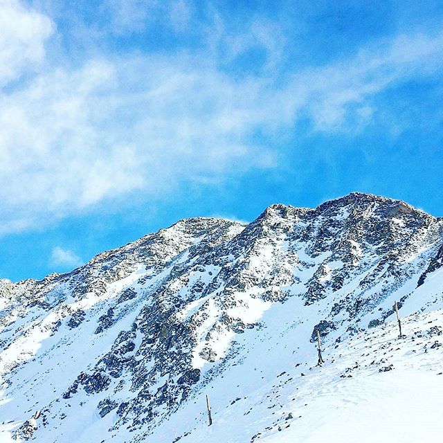
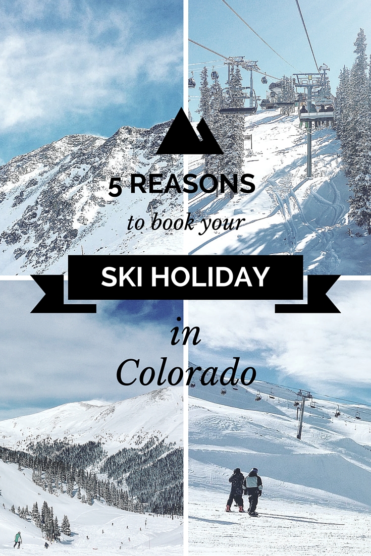
There wasn’t a weekend in November that we didn’t pack our skis in the car and drive up to the mountains to enjoy snow and sun. It’s a blessing to live just a couple hours away from world class ski resorts, but these resorts are worth the trip even if you’re coming from furthere off! Here’s five reasons why you should plan your ski holidays in Colorado right now:
1. Colorado’s Powder Snow
Forget those clumpy slopes with dreadful wet snow. Colorado’s dry climate gives you amazing fluffy powder where riding the hills is pure bliss. Although Utah is trying to claim on their license plates to have the best snow on Earth, the Rocky Mountains are clearly a contender in this category.
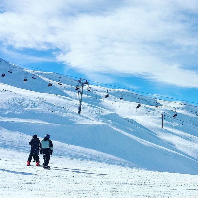
2. More than 20 Ski Resorts
Wanna ride the slopes like they did in the alpine world ski championships? Check out Beaver Creek. Wanna get lost in a resort where skiing every slope would take more than a weekend? Vail’s calling. Wanna spot Hollywood stars in the lift line? Everybody knows Aspen. Whether you’re a family, ski bum or snowboarder, everybody’s got their mecca in Colorado.
3. Ski Season from October to June
Arapahoe Basin is the most high altitude resort in the US, where the highest lifts take you well above 13 000 feet. High altitudes bring with them the “Got Oxygen?”-slogans and may force you to head to lower slopes – like I did after starting to feel ill – but one thing they never lack is snow. A-Basin always opens before Halloween and usually closes around June, but closing dates as late as 4th of July are not unheard of.
4. Not Just Slopes
Breckenridge Ski Resort is right next to a century-old mining town with a charming and lively main street. In Steamboat Springs, you can rest your sore muscles in one of the town’s several hot springs – although in my several visits there, I never got further than the condo hot tub, also lovely on a starry night. Many ski towns offer horse-drawn sled rides and guided snowmobile tours, and several boast to be the state’s best resort for shopping. I think the jury’s still out on that.
5. Despite the Price, Still Worth It
Of course, the lift tickets are far from cheap. If you make the mistake of marching up to Vail’s ticket booth some random morning, be ready to pay around $170 per day. American ski resorts tend to be more expensive than their European cousins, and the most expensive resorts in the US are in – you guessed it – Colorado. Still, planning your trip early can save you a penny, and you can rest at ease knowing you’re paying for the best resorts in the US, possibly in the world.
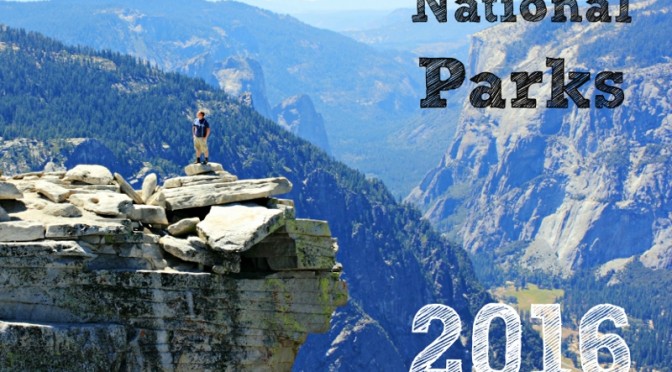
Hands up who loves US national parks! So do I. Having toured them for a couple of years now, I can agree that they are really America’s best idea.
The beauty of national parks is as unbelievable as is their variety. From hot springs to swamps and mountains to volcanoes, every park is special in its own way and no two are really alike.
For the last couple of years I’ve made wall calendars for the upcoming year for friends and family, but this year, I’m making them for the public who loves national parks as much as I do. I’m making them for you: 12 months worth of my best photos combined with facts and stats on the parks for you to enjoy all year long.
The calendar is all ready to be hanged on your wall and is of a quality I’m happy with, as I’ve been using the same publisher in previous years. It’s got the most common holidays in it and has space for you to write your own notes.
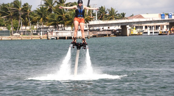
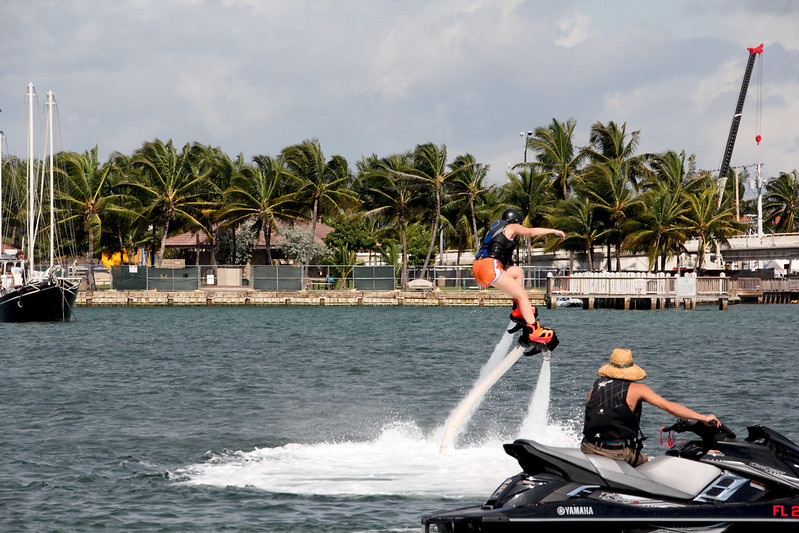
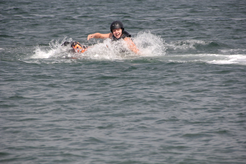
I plummet into the warm ocean, splash and gasp for air, salt water filling my nose, splashing some more. When I make it back to surface, I try desperately to blow the water out of my nose and rub the salt out of my eyes. “You ready?” the jet ski pilot shouts and I shake my head. Wait, a moment, I need a moment to get myself back together! And then it’s on again.
Flyboarding is not the easisest sport, but all worth the practice.
“Always keep your legs straight” is the rule. “Keep your hips forward” is another one. You can see how well this is going.Good thing the Atlantic’s warm in South Florida. This is an activity you want to reserve for warm waters.
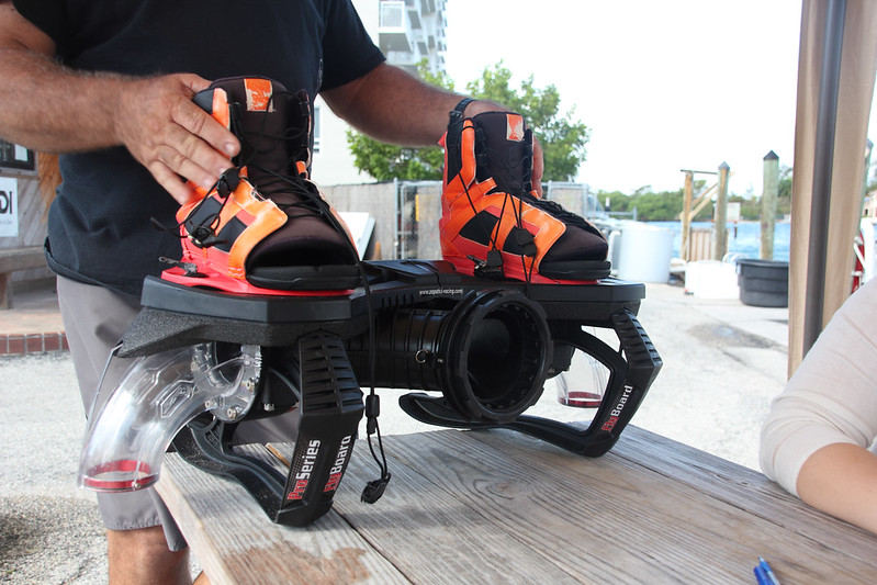
There are several different types of flyboards, and the one I tried out was one of the easier ones. Harder boards have more buoyancy which means it’s “easier” to do flips and turns, but the board I tried was more stable and easier to stand on, which is perfect for a total beginner. That still didn’t make it easy. I’ve always thought I have fairly strong legs, but it was still hard standing when the board was forcefully pushing me up to the sky.
The more stable flyboard that South Florida Flyboarding tied me to so I could reach the skies.This is me sitting in a plastic chair, getting my shoelaces tied.
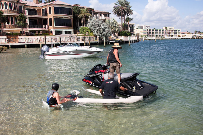
The jet ski pilot handled the force of water flowing from the board, which was great: one less thing for me to think about. I had enough on my plate trying to balance and keep the board horizontal. The only way I could rise up on top of the board was aiming the flow of water straight down, and a smallest movement to any direction plummeted me back in the sea. Good thing water is my favorite element, because there was little time to prepare for being whisked under the waves.
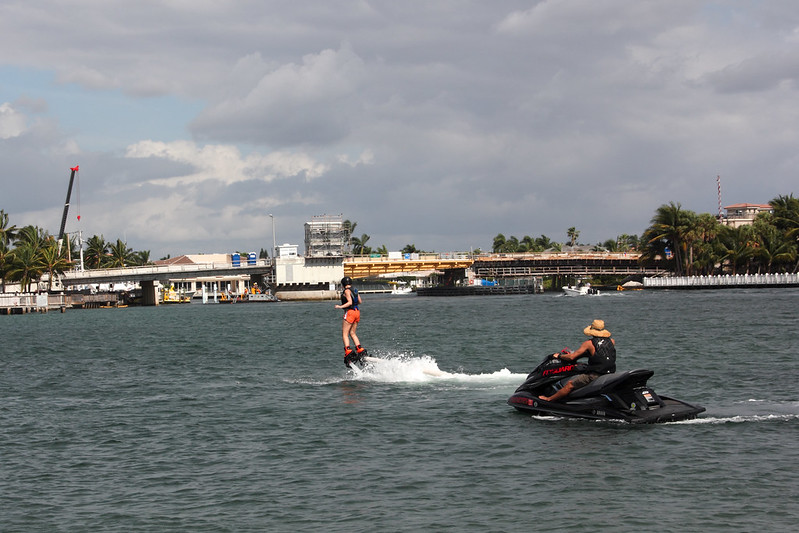
After five minutes, the thought of giving up passed through my mind – but only passed. In ten minutes I was already flying up in the air for minutes at a time. I’d found my balance, and I have no clue how. It just happened!
The training session lasted for 15 minutes, after which I retreated back to dry land to breathe and relax, and to follow others’ attempts at flying. Later in the day, I got another chance at flyboarding, and finally I felt like I was “soaring like a bird”, like they had promised I would. Dolphin jumps I gladly left for another time.
Flyboarding was part of a press trip arranged by Greater Fort Lauderdalen. I thank South Florida Flyboarding for giving me the opportunity to try out this great sport. If you’re interested, check them out for your own flyboarding experience.
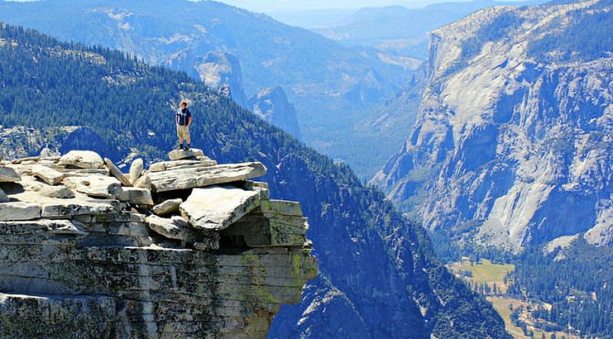
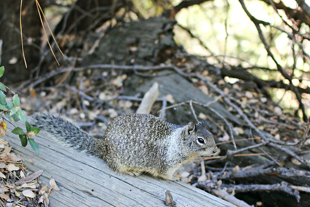
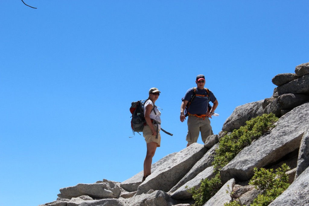
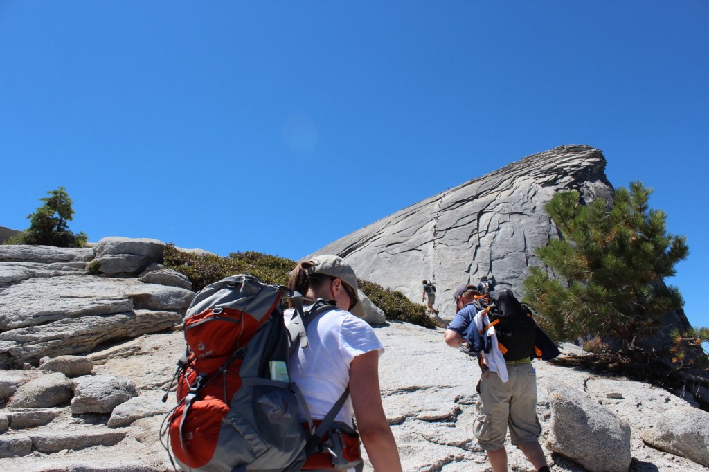
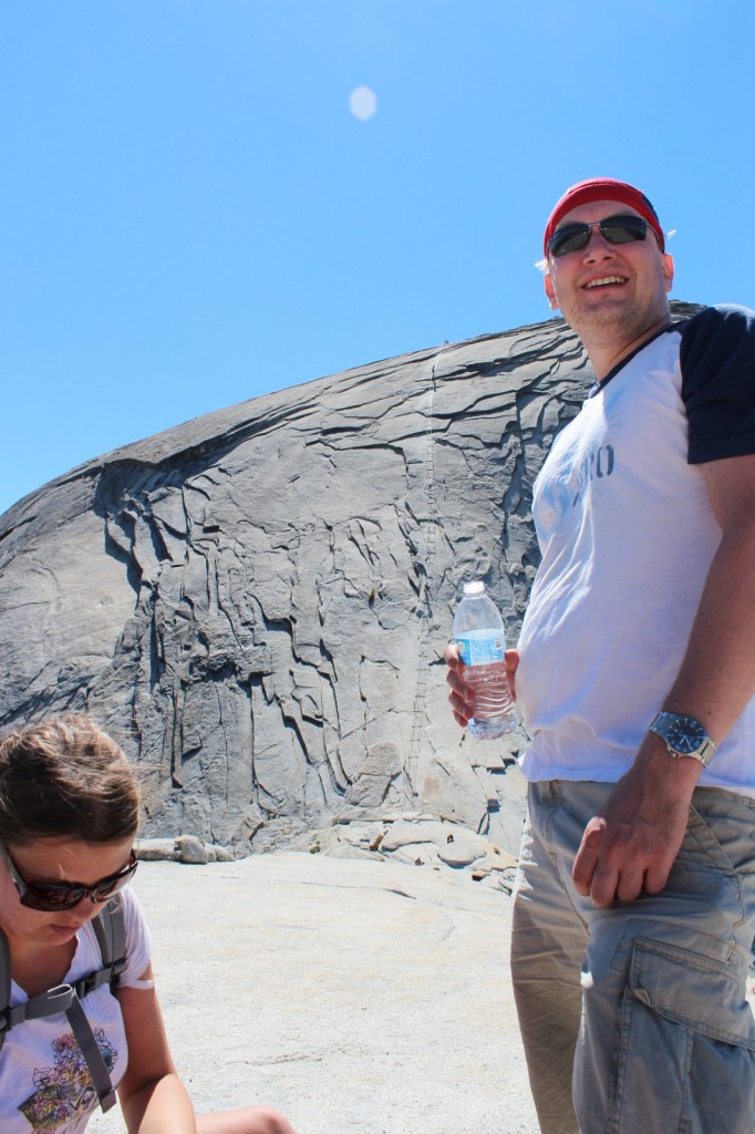
I don’t remember exactly how we got the idea to hike Yosemite’s Half Dome. I think I spotted the hike in some magazine, and although I’d never heard of it before – hey, I’m from Europe! – we were already planning an adventure to California and it sounded like it would fit right in. While researching, I ran across an article in Backpacker, calling it one of the most dangerous hiking routes in the US, and that sounds kinda cool, doesn’t it?
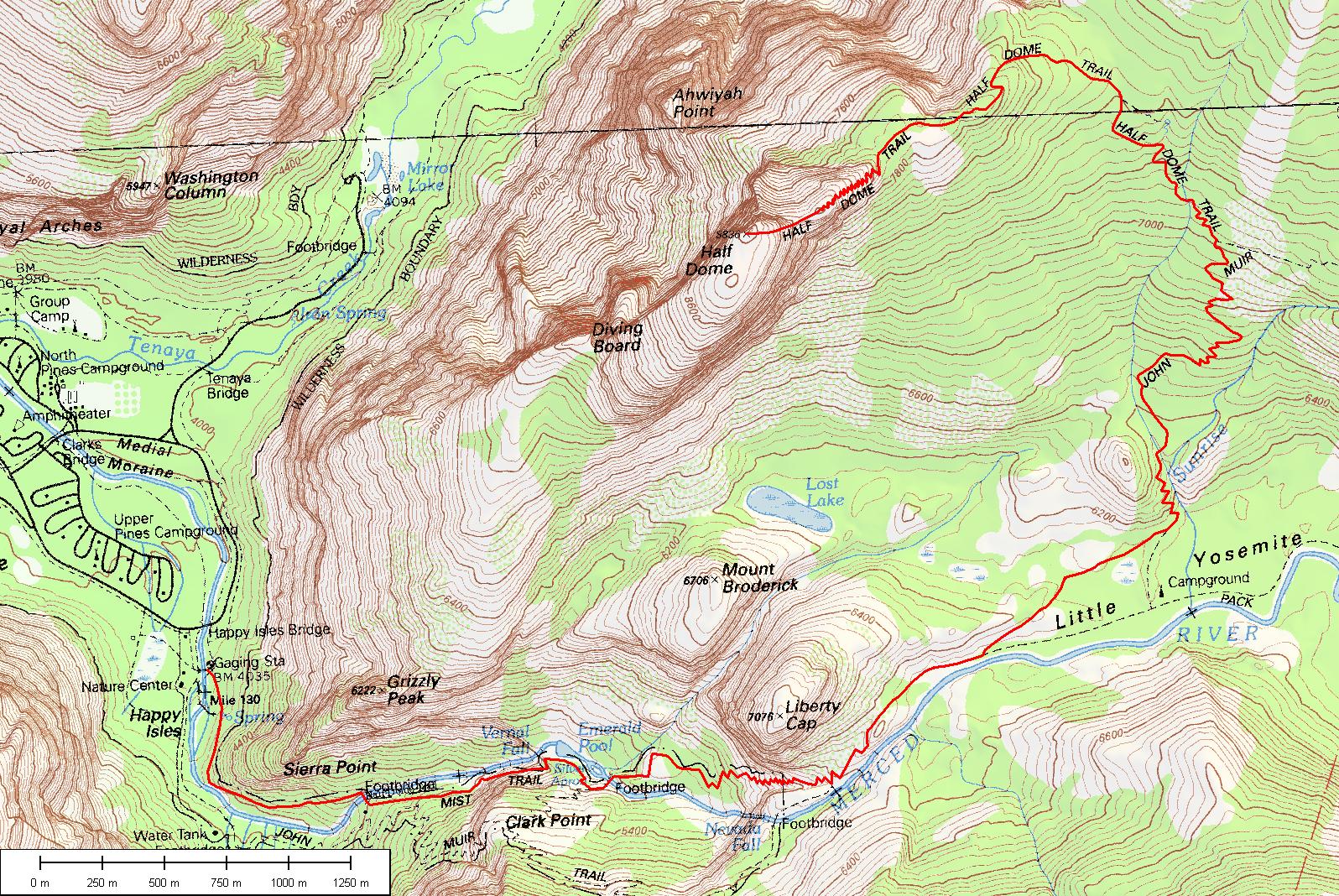
In order to do the hike, you need to take part in the Half Dome Permit Lottery, arranged around March each year, and if you’re lucky, you’ll win a permit to hike up those cables. There’s a limit of one ticket per person, so we put in two, and one of our tickets won a permit that covers a maximum 6 hikers. I recommend putting in more than one ticket if you really want to do this!
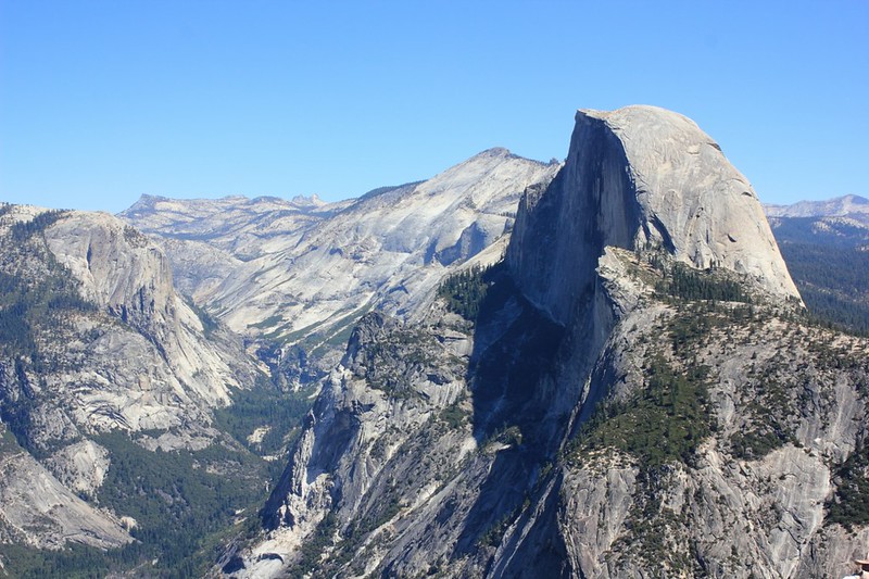
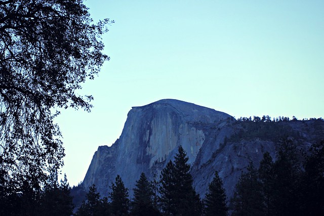
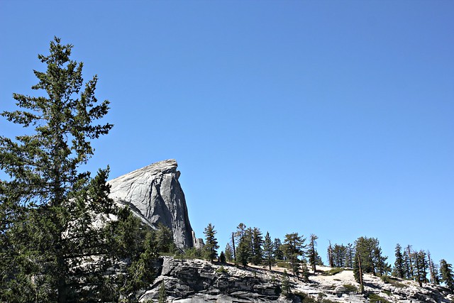
Half Dome (2695 m / 8844 ft) as seen from our campground
We stayed the night before our climb at Curry Village tent cabins, a very short way from beginning of the trail. We were aiming to start off before sunrise, but we made the mistake of not preparing with our own breakfast and had to wait until 7am to get some from Curry Village’s Coffee Corner. (They have pretty good lunch bagels you can pack as take-away on your hike!) If you’re coming from sea level, sleeping in Yosemite Valley is a good idea to get yourself at least a bit accommodated to the thinner air.
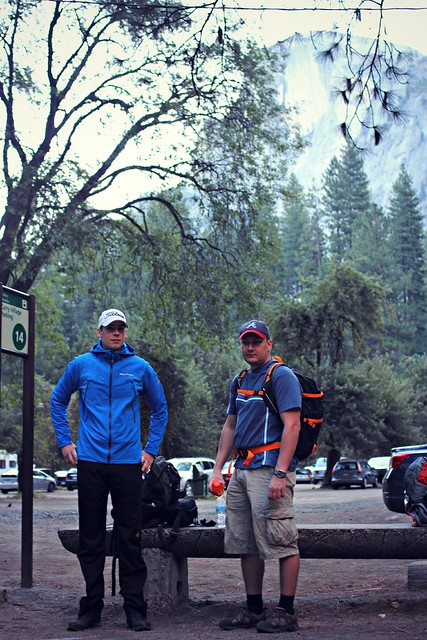
Waiting for the shuttle bus from Curry Village to the trailhead at 7.30am
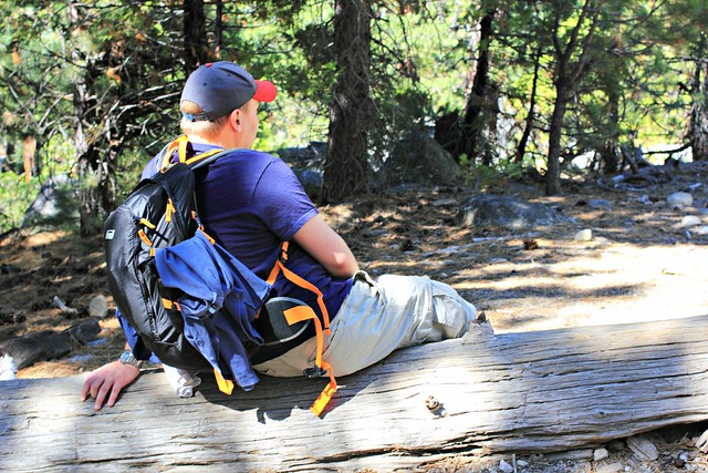
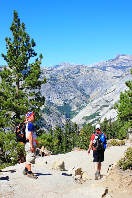
We were three of us on the trail: Iiro, Aki and I. Only Iiro had the courage to leave in shorts, but he made the right choice. In less than an hour, Aki and I were changing our long pants into shorts and packing away our sleeves. It was a great mid-August day with sunshine and warm temperatures predicted for the day, so we were really in luck.
The very beginning of the trail was fairly easy, but it quickly turned into stairs and our calves and quads were feeling it. Unless you’re in really good shape (like Aki was), this is a hike you should train for. I had been a regular at Step classes, hiked along the Ardennes and followed a 6-week program that I can fully recommend. Iiro, living in Georgia at the time, had climbed up Kennesaw Mountain at least once a week. Maybe thanks to our efforts, we passed a group of Asian girls at Vernal Falls – but at the same time, one woman passed us running up the stairs, so we definitely could have been more in shape, too.
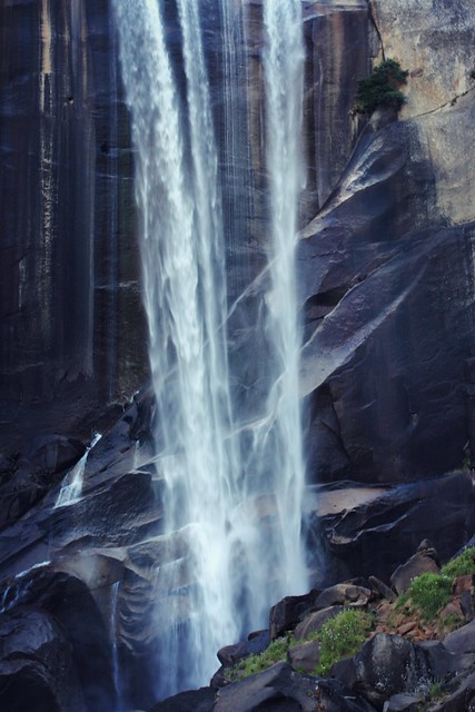
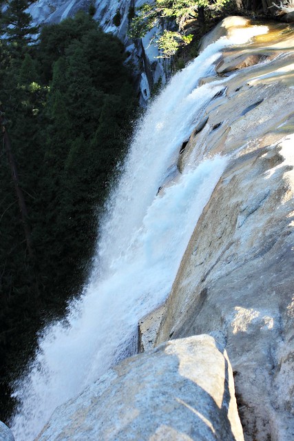
Stairs at Vernal FallsIf you don’t want to hike all the way to Half Dome, hike to Vernal Falls. The trail up there is beautiful!
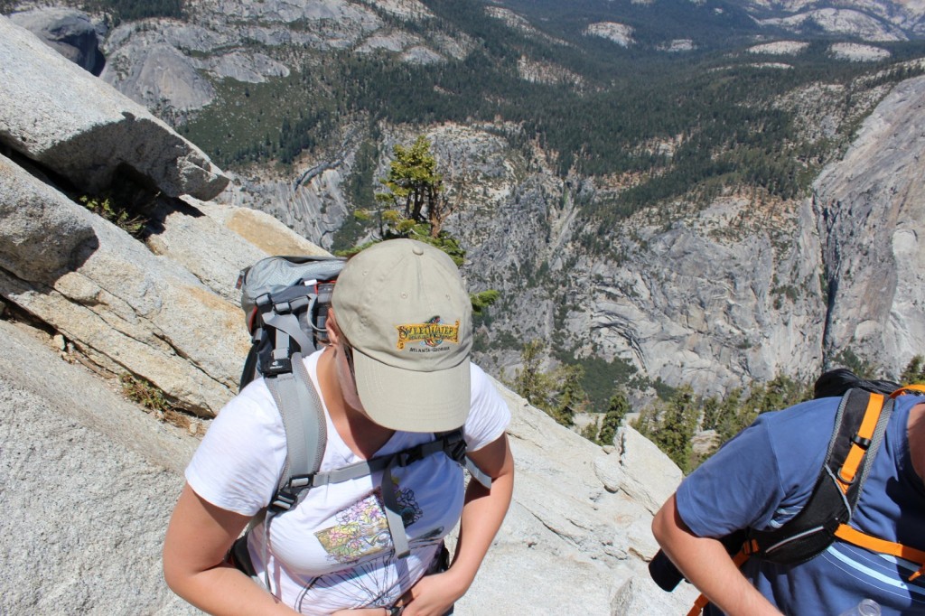
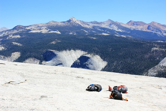
I had trained for the hike with a backpack full of water, and my backpack on the hike ended being around 9kg (20lb). We’d taken with us 6 liters of water per person, and all of us had around two thousand calories worth of nuts, energy bars and trail snack that we stopped to eat around every 45 minutes. This was a pretty good pace for us, because it kept our energy levels high despite the intensive climb, and it also gave us a chance to catch our breath at regular intervals.
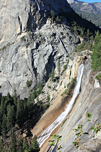
We got all our snacks from Costco, which had a great variety of stuff at bulk.Vernal Falls from above. 1524 m.You don’t especially need a topo map on the trail, but it was great to be able to check how long we still had left to the top.
After Vernal Falls, it was a similar effort to make it up to Nevada Falls along some tight switchbacks, but then it got easier. At an altitude of around 1800m, after climbing up 600 meters (around 2000ft) and hiking for 4,2km (around 2.5 miles), all of which took us several hours, we reached Little Yosemite Valley, a flat portion of the trail in a forest which felt like dancing on clouds compared to the climb we had just done. At this point, we finally saw Half Dome for the first time after leaving the trailhead.
There it is!
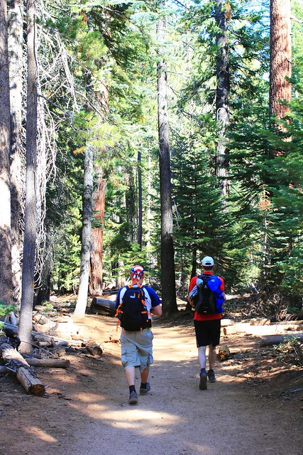
After a couple kilometers in the valley, the trail continued climbing up. All the while we’d seen other hikers on the trail, but now we really started reaching slower hikers who had left already before dawn. Considering how tough the trail was, it was surprising that the hikers ranged from kids to retirees and everyone in between. All the better to them!
The last official toilets we’d seen were at Nevada Falls, so potty breaks in the bushes were a thing at this point (and if you don’t need them, you haven’t drunk enough water). And here’s a word of warning to you: while I was doing my business in the woods, I heard a buzzing noise, and then a horrible pain in my bicep. I didn’t stay to figure out what kind of insect had bit me, but instead I got back to the trail as fast as I could and for a while could just lay in the ground trying to wish the pain away. We had some ibuprofen with us, which took a while to settle in, but antihistamine would have been an even better addition to our first aid kit.
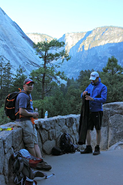
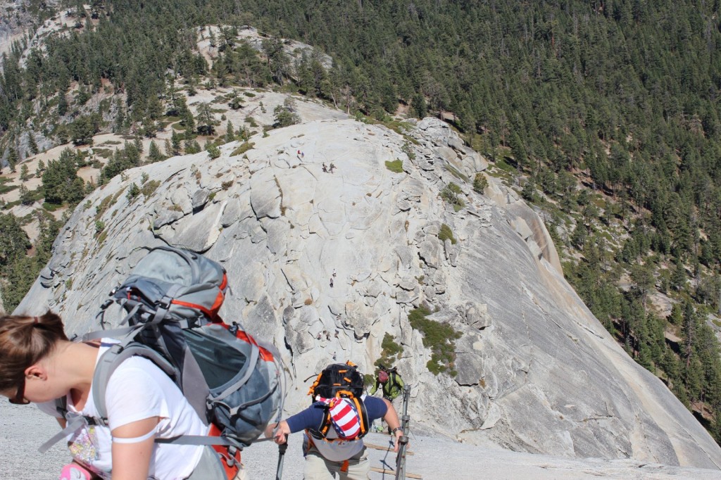
Mount Broderick. Half Dome is not the only halfish-dome-shaped mountain around here.
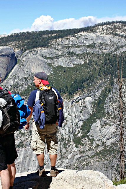
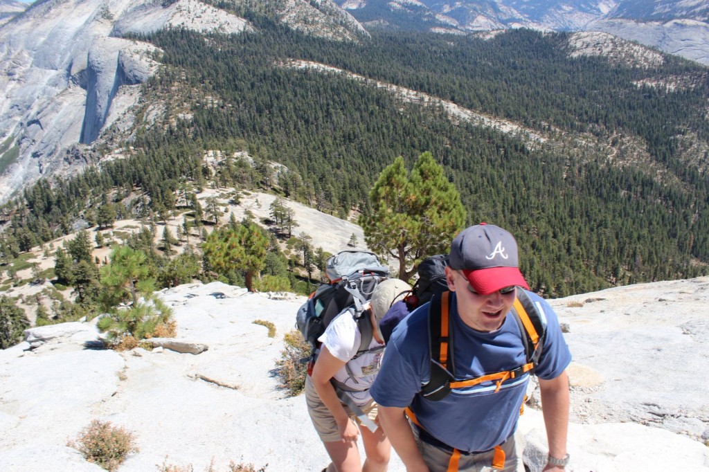
When we finally reached 2300m, the views really opened up. We were a bit worried to see dark clouds in the horizon, because the rule is that you should never climb Half Dome if there’s any sign of thunder on the horizon: the mountain attracts lighting to it like honey attracts bees, and several hikers have died in lightning strikes. This is also why you should reach Half Dome before noon, because afternoon thunderstorms are common in the area. We only reached the check point at half past noon, and I’d say that’s around as late as you should get there without turning back.
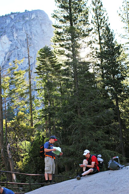
Later we realized that the “clouds” were actually smoke from wildfires in the area.Park Ranger checking permits just below tree line. The ranger had a list of people who’d won the permit, but we had our own print of it with us just to be sure.
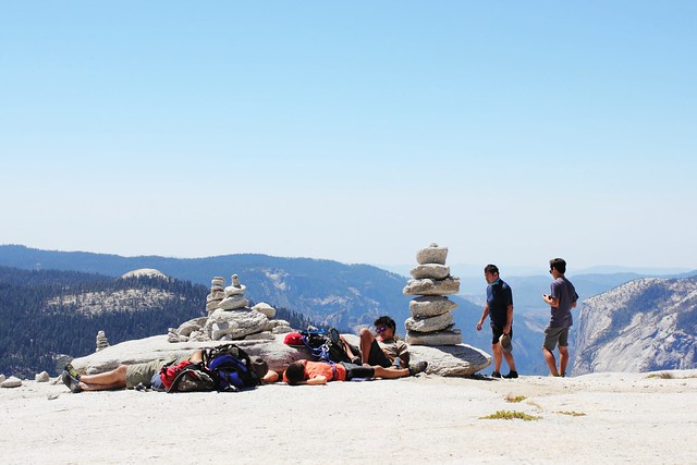
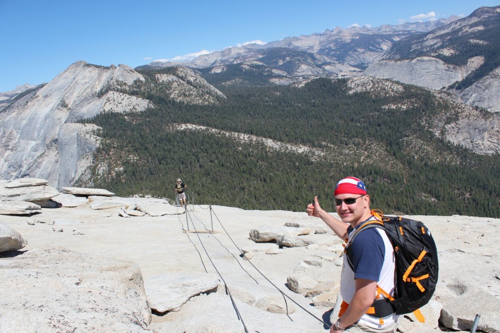
At the ranger check point, we rested for a while and prepared for the final ascent: summiting Half Dome. First 150m (500ft) were a tougher-than-tough climb, the latter 150m were pure crazyness.
On the way up the switchbacksI have a fear of hights that isn’t very strong but started to get the better of me when we got above treeline. This is why all of the photos above treeline have been taken by Aki, because i couldn’t stop anymore to take photos.The other reason was that i was in too bad of a shape to do anything but put one foot ahead another and try to catch my breath.Almost done with the switchbacks, and the 150m-of-pure-craziness is already visible ahead of us.
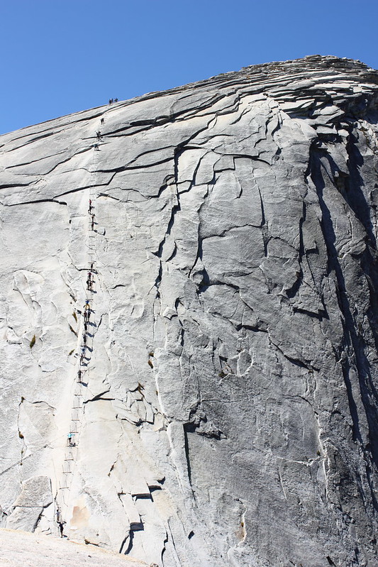
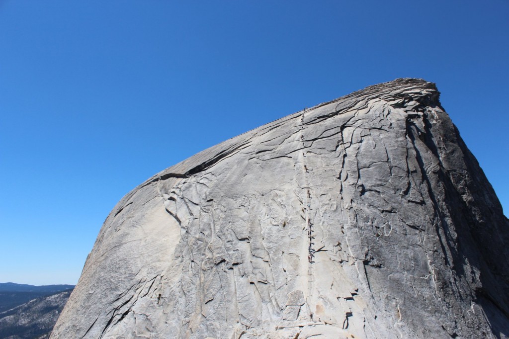
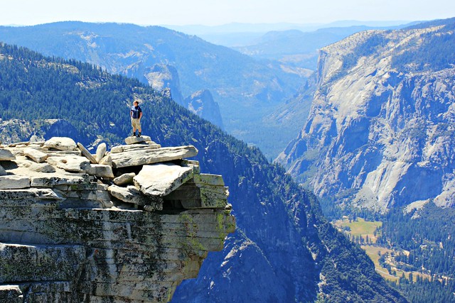
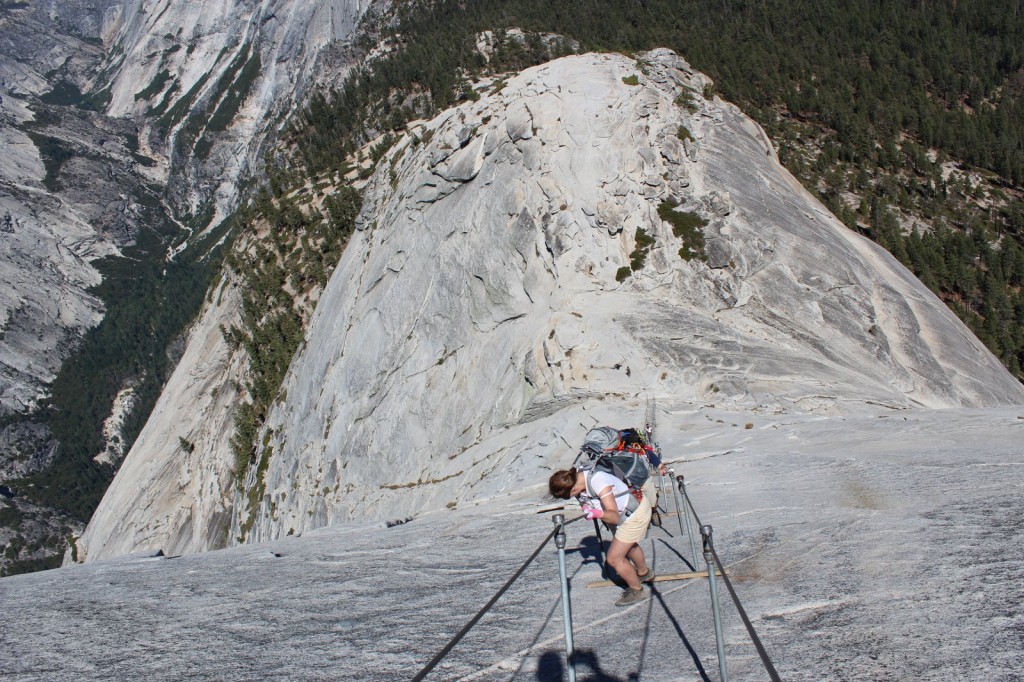
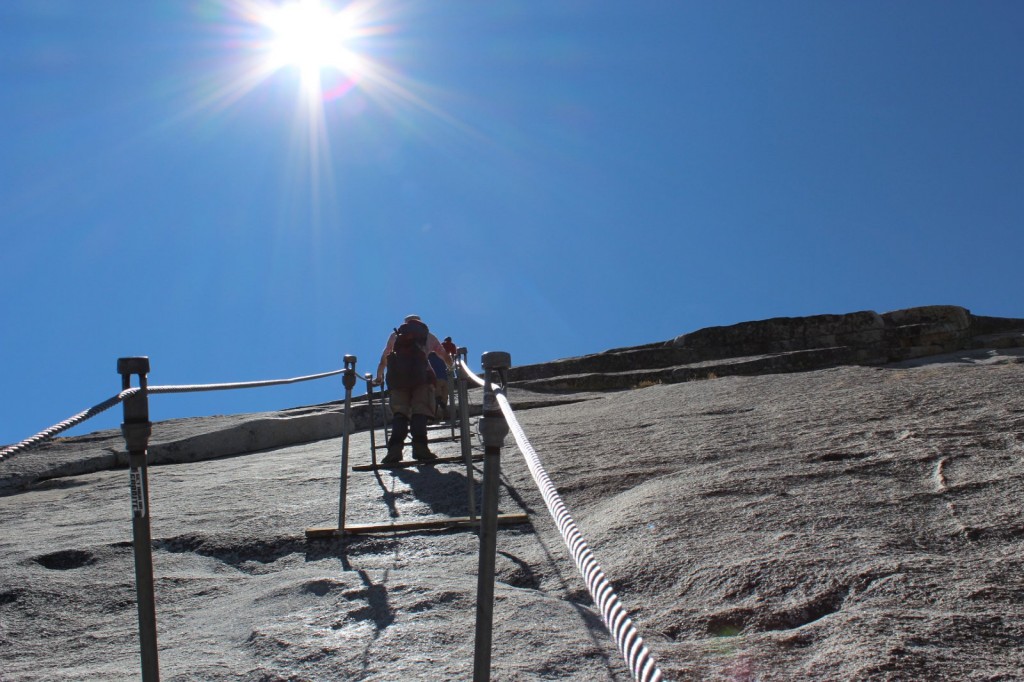
The reason why Half Dome is one of the most dangerous hiking routes in the US is the last 150m meters of it: The Cables. Sure, you could sprain your ankle, fall and hit your knee or suffer from dehydration on other portions of it, but if you fall at the Cables, you fall down. Like really down. Like almost a mile down. Basically, it’s a “make a mistake and die”-portion: you hold on to two cables that ascend up the rock at a 70 degree angle at its best. Every couple meters, there’s a wooden plank where you can stay for a moment and catch your breath, but not for long because there’s people behind you who want to get up – and other people descending the same route.
When we looked at photos of the Cables before the hike, we thought they were taken from an especially dramatic angle or something, and they’re probably not as dramatic in real life. Well, they are. Every bit as dramatic. This is a completely realistic photo of what it’s going to be like.
The wind at the Cables was so strong it was hard to stay upright, and all around me the rock plunged into sure death. From the switchbacks, I crawled on all fours towards the Cables, until I got behind a large boulder and broke down: I can’t! This is horrible! There’s no way I’ll get up there, I’ll just slip and fall and die! This is it, I’m done!
“No you’re not, you can do it,” Iiro told me and after a moment of coaching got me to continue. “Just keep your wits about you, hold on, and if you slip, I’ll catch you.”
So up i went. Maybe one climber out of a hundred had any safety gear with them.
Climbing up was tough but in the end, not as nerve-wrecking as I had thought. I had bought some garden gloves from the internet which had perfect grip and slowly but surely a foot at a time I ascended. At the Cables, you really don’t have time to fear, because all your concentration will go into the climb itself: always one hand at the cables, passing by people coming the other way, going from plank to plank. I tried at first to hold on to both cables, but soon I let go of the other one and just hung on to one with both hands, holding it under my arm and pulling myself up.
You can do it, almost there, coming down is easier, the hikers descending kept telling me, and before I knew it, the rock started leveling out, and the planks and the cables ended. A couple more meters of crawling on all fours, and then I was there.
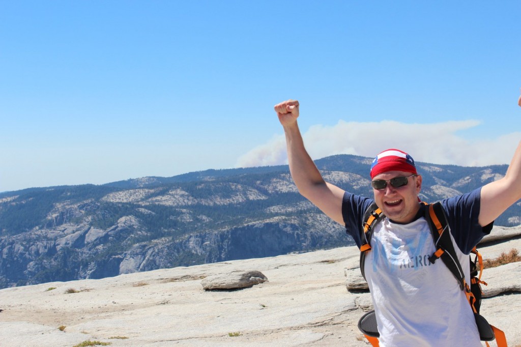
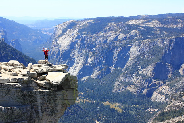
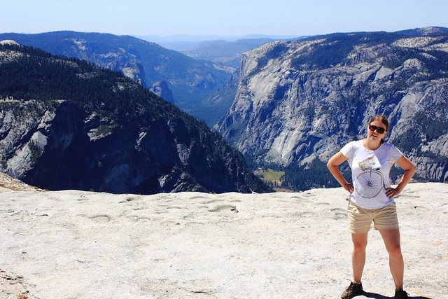
Woooohooo!Half Dome summit!Our packs and a breathtaking view.Chillin’ at Half Dome
All of the celebrational photos here feature just Aki and Iiro, running around the summit, taking photos and eating a relaxed lunch with the best feeling ever: we did it! I, on the other hand…
I feel like throwing up don’t talk to me
After all that stress and exhaustion, I was feeling dizzy and felt like throwing up. My head hurt, stomach hurt, I could eat less than half of my lunch and most of the time at the summit I spent laying down as still as possible and trying to calm my raising heart. Every once in a while I peeked under the scarf on my head to take a look at the views, and yeah, despite my feeling, this was still worth it.
Finally i got up and posed. “Safely” on top of the summit and not on the ledge.
The descent really was easier than the ascent. Aki even got some photos of it, which was nice, because I would never have taken my hand off the cables.
Don’t look down.Don’t let go.The cables were actually pretty wobbly, which didn’t ease my mind at all.
When we finally got down, it was like a weight coming off my shoulders. That was the hard part, now it was just a 7 mile hike to the bus stop.
When we got down the cables, we met the ranger on his way up to check nobody had been left behind.
There’s not much to tell from the way down. Climax of the trip was over, and now we just wanted to get to camp as soon as possible to rest our feet and enjoy a couple victory beers. I think I was the most energetic of us, having gotten over my fit of nausea. Aki had a blister on his foot and Iiro had spent his last drops of energy getting down the cables.
We had all felt the day in our knees, so instead of taking the stairs down, we took the longer John Muir Trail that wasn’t as steep. Now I wouldn’t make the same choice again, because those two extra kilometers with the setting sun and running out of drinking water (yes, we all did – take more than 6 liters on a hot day) felt reeeeaally loooong, and to top it off, we got a bit lost. We finally made it back to camp around 7.30pm, exactly 12 hours after we’d left. Pizza had never tasted as good.
Nevada Fallsffrom John Muir TrailNevada Falls a bit further off
25 kilometers back and forth, 1500 meters of ascent, and 12 hours on the trail. This is probably the craziest and most dangerous thing I’ve ever done, and I’ve also jumped from an airplane. It’s also one of the most beautiful hikes I’ve done
Would I go again? I doubt it. I think this will be a once-in-a-lifetime experience for me, and that was really what it was. But you should go! Start planning your next summer’s adventure and, come March, take part in the lottery. And then train, prepare, train, and hike. You won’t regret it. Good luck!