Hands up who loves US national parks! So do I. Having toured them for a couple of years now, I can agree that they are really America’s best idea.
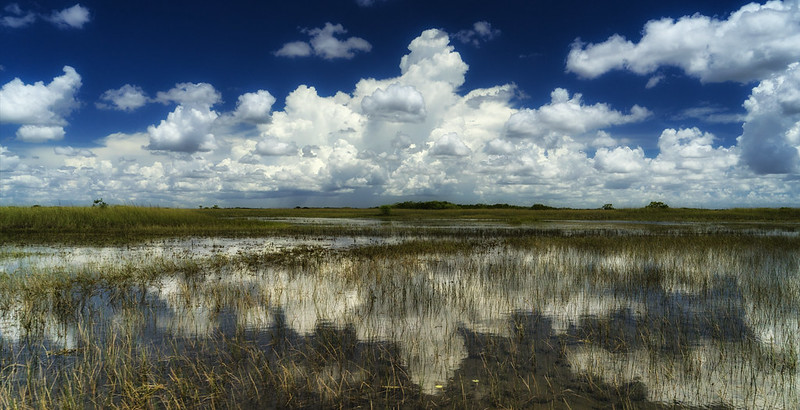
The beauty of national parks is as unbelievable as is their variety. From hot springs to swamps and mountains to volcanoes, every park is special in its own way and no two are really alike.
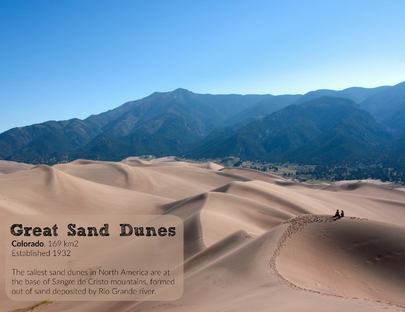
For the last couple of years I’ve made wall calendars for the upcoming year for friends and family, but this year, I’m making them for the public who loves national parks as much as I do. I’m making them for you: 12 months worth of my best photos combined with facts and stats on the parks for you to enjoy all year long.
The calendar is all ready to be hanged on your wall and is of a quality I’m happy with, as I’ve been using the same publisher in previous years. It’s got the most common holidays in it and has space for you to write your own notes.
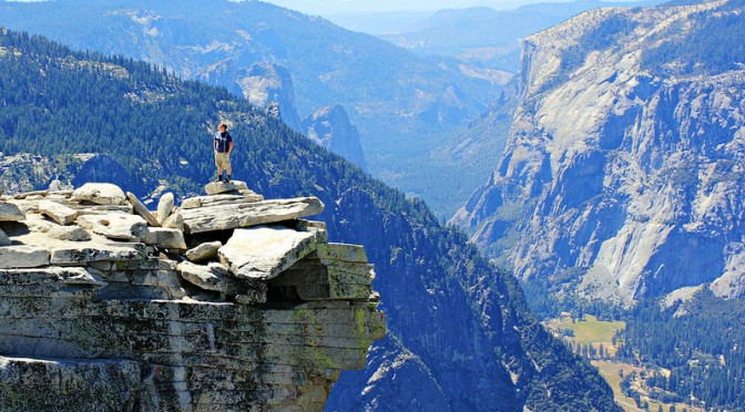
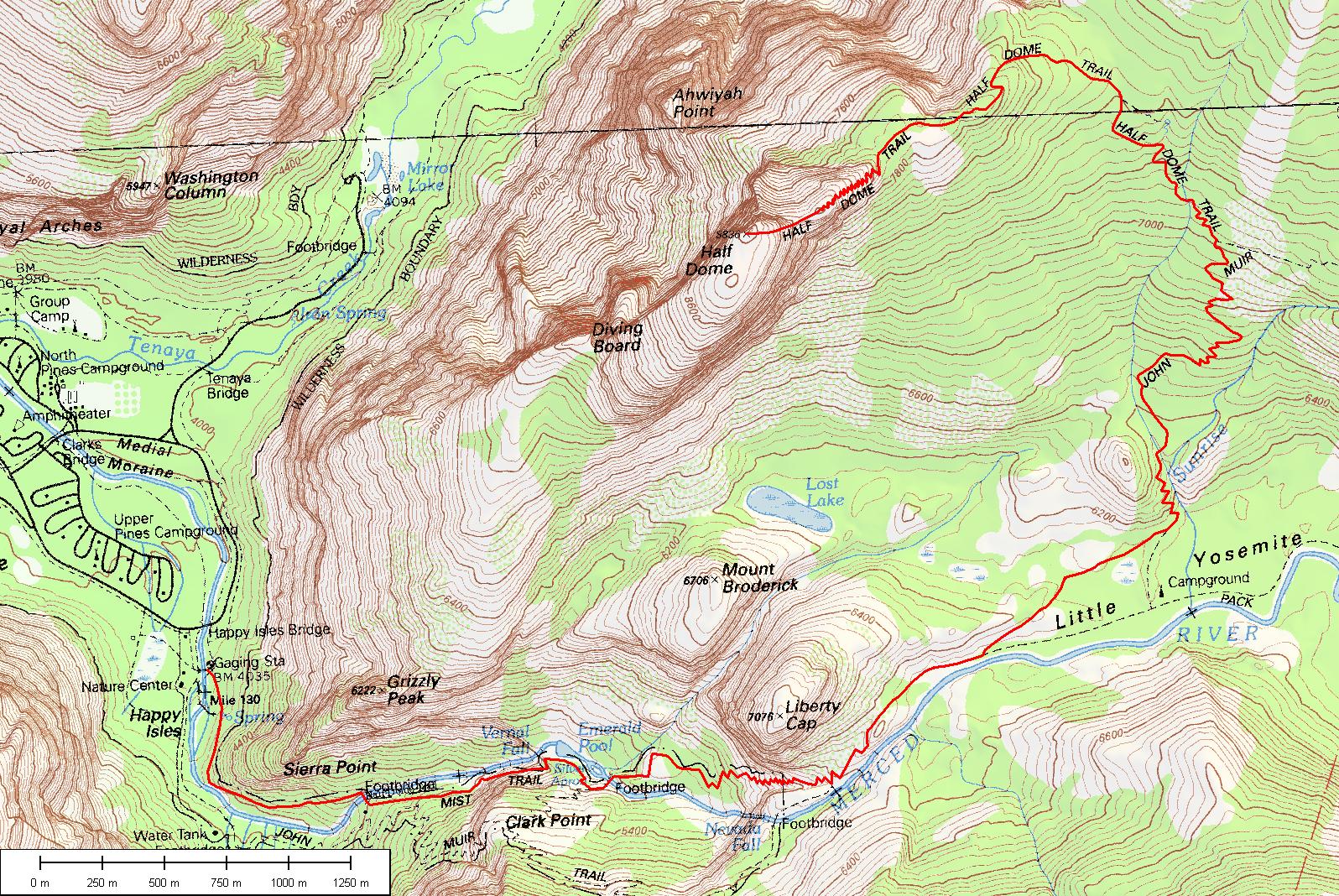
I don’t remember exactly how we got the idea to hike Yosemite’s Half Dome. I think I spotted the hike in some magazine, and although I’d never heard of it before – hey, I’m from Europe! – we were already planning an adventure to California and it sounded like it would fit right in. While researching, I ran across an article in Backpacker, calling it one of the most dangerous hiking routes in the US, and that sounds kinda cool, doesn’t it?
In order to do the hike, you need to take part in the Half Dome Permit Lottery, arranged around March each year, and if you’re lucky, you’ll win a permit to hike up those cables. There’s a limit of one ticket per person, so we put in two, and one of our tickets won a permit that covers a maximum 6 hikers. I recommend putting in more than one ticket if you really want to do this!
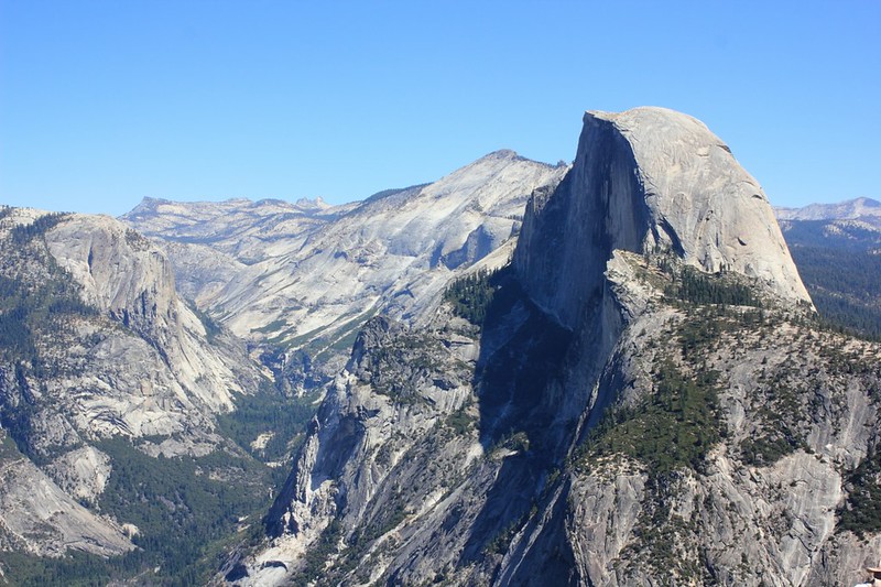
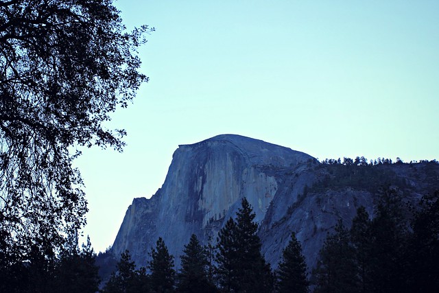
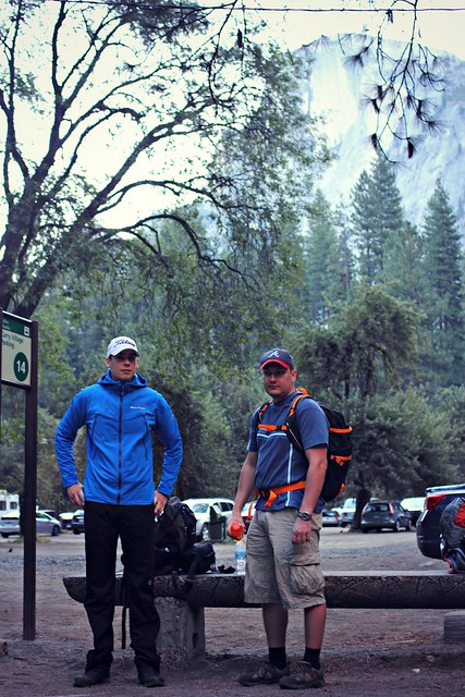
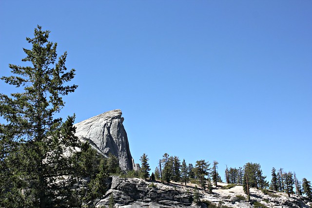
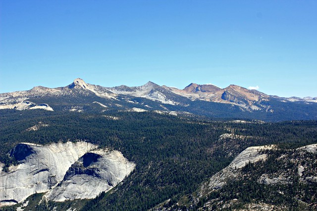
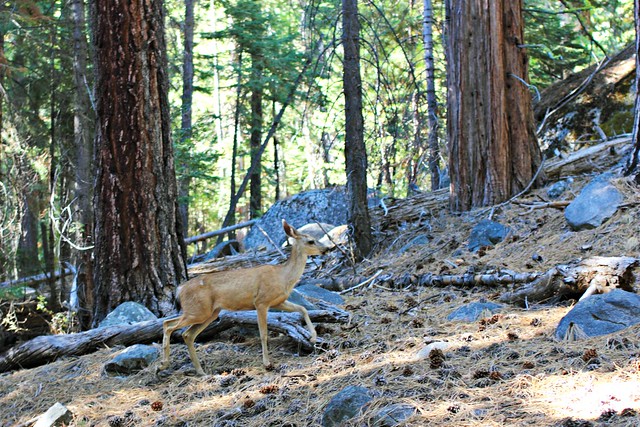
Half Dome (2695 m / 8844 ft) as seen from our campground
We stayed the night before our climb at Curry Village tent cabins, a very short way from beginning of the trail. We were aiming to start off before sunrise, but we made the mistake of not preparing with our own breakfast and had to wait until 7am to get some from Curry Village’s Coffee Corner. (They have pretty good lunch bagels you can pack as take-away on your hike!) If you’re coming from sea level, sleeping in Yosemite Valley is a good idea to get yourself at least a bit accommodated to the thinner air.
Waiting for the shuttle bus from Curry Village to the trailhead at 7.30am
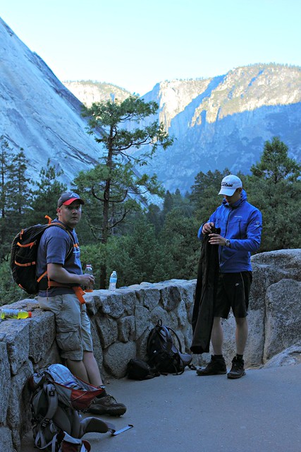
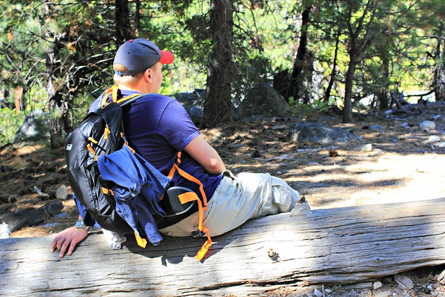
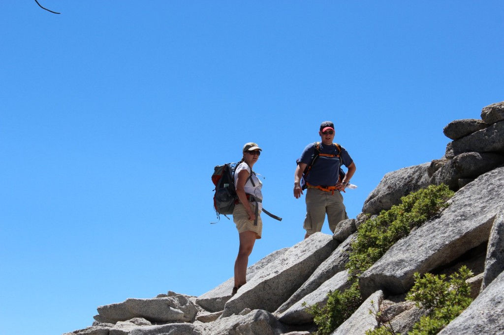
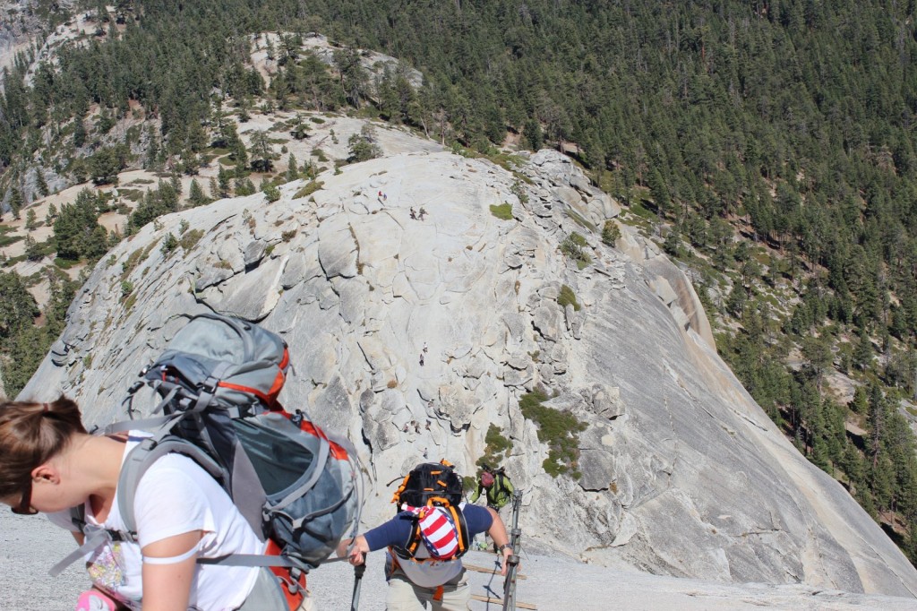
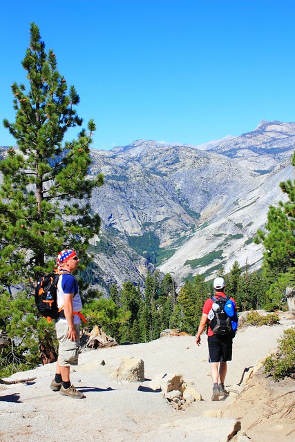
We were three of us on the trail: Iiro, Aki and I. Only Iiro had the courage to leave in shorts, but he made the right choice. In less than an hour, Aki and I were changing our long pants into shorts and packing away our sleeves. It was a great mid-August day with sunshine and warm temperatures predicted for the day, so we were really in luck.
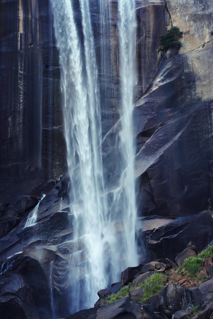
The very beginning of the trail was fairly easy, but it quickly turned into stairs and our calves and quads were feeling it. Unless you’re in really good shape (like Aki was), this is a hike you should train for. I had been a regular at Step classes, hiked along the Ardennes and followed a 6-week program that I can fully recommend. Iiro, living in Georgia at the time, had climbed up Kennesaw Mountain at least once a week. Maybe thanks to our efforts, we passed a group of Asian girls at Vernal Falls – but at the same time, one woman passed us running up the stairs, so we definitely could have been more in shape, too.
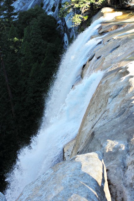
Stairs at Vernal FallsIf you don’t want to hike all the way to Half Dome, hike to Vernal Falls. The trail up there is beautiful!
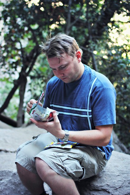
I had trained for the hike with a backpack full of water, and my backpack on the hike ended being around 9kg (20lb). We’d taken with us 6 liters of water per person, and all of us had around two thousand calories worth of nuts, energy bars and trail snack that we stopped to eat around every 45 minutes. This was a pretty good pace for us, because it kept our energy levels high despite the intensive climb, and it also gave us a chance to catch our breath at regular intervals.
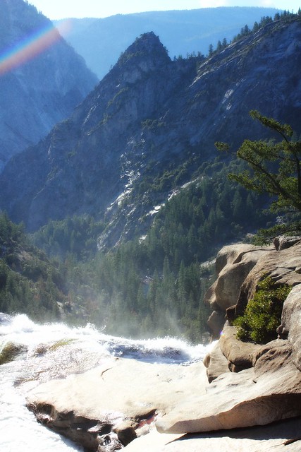
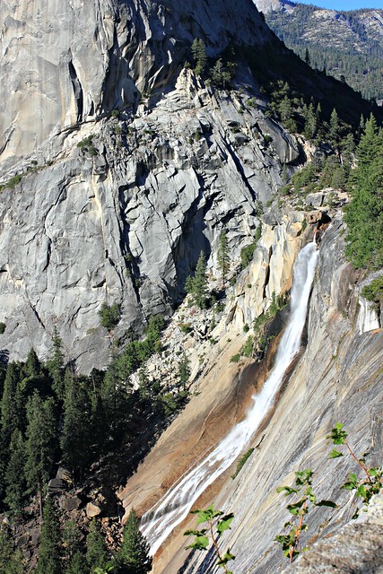
We got all our snacks from Costco, which had a great variety of stuff at bulk.Vernal Falls from above. 1524 m.You don’t especially need a topo map on the trail, but it was great to be able to check how long we still had left to the top.
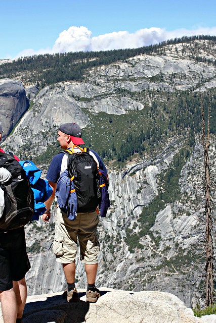
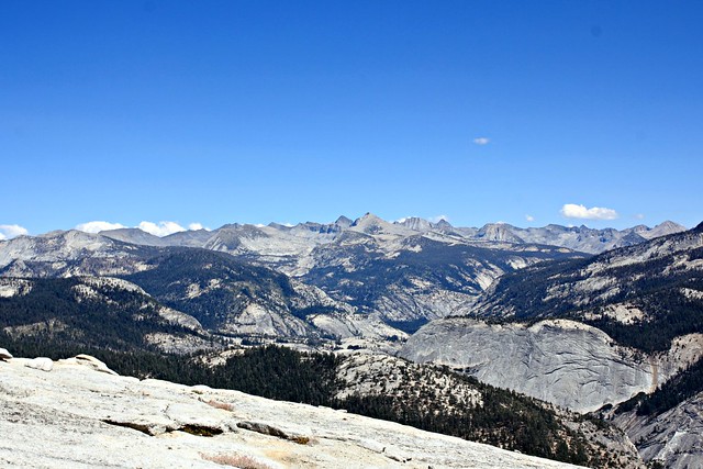
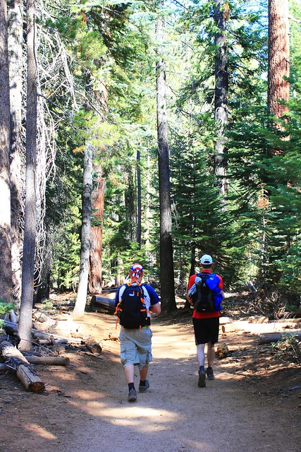
After Vernal Falls, it was a similar effort to make it up to Nevada Falls along some tight switchbacks, but then it got easier. At an altitude of around 1800m, after climbing up 600 meters (around 2000ft) and hiking for 4,2km (around 2.5 miles), all of which took us several hours, we reached Little Yosemite Valley, a flat portion of the trail in a forest which felt like dancing on clouds compared to the climb we had just done. At this point, we finally saw Half Dome for the first time after leaving the trailhead.
There it is!
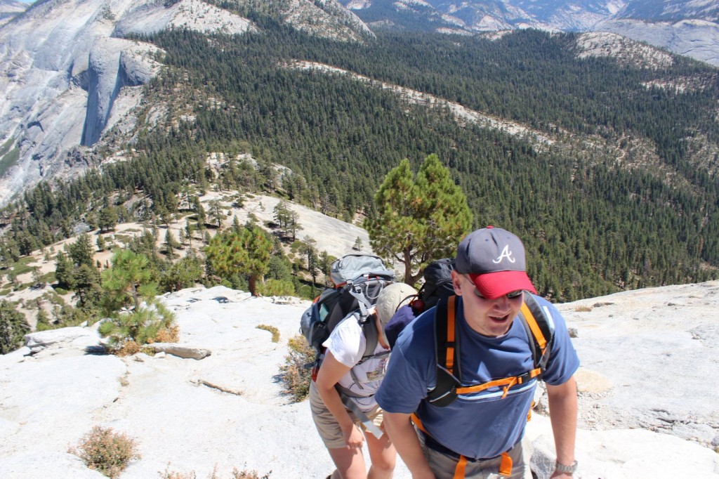
After a couple kilometers in the valley, the trail continued climbing up. All the while we’d seen other hikers on the trail, but now we really started reaching slower hikers who had left already before dawn. Considering how tough the trail was, it was surprising that the hikers ranged from kids to retirees and everyone in between. All the better to them!
The last official toilets we’d seen were at Nevada Falls, so potty breaks in the bushes were a thing at this point (and if you don’t need them, you haven’t drunk enough water). And here’s a word of warning to you: while I was doing my business in the woods, I heard a buzzing noise, and then a horrible pain in my bicep. I didn’t stay to figure out what kind of insect had bit me, but instead I got back to the trail as fast as I could and for a while could just lay in the ground trying to wish the pain away. We had some ibuprofen with us, which took a while to settle in, but antihistamine would have been an even better addition to our first aid kit.
Mount Broderick. Half Dome is not the only halfish-dome-shaped mountain around here.
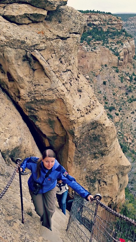
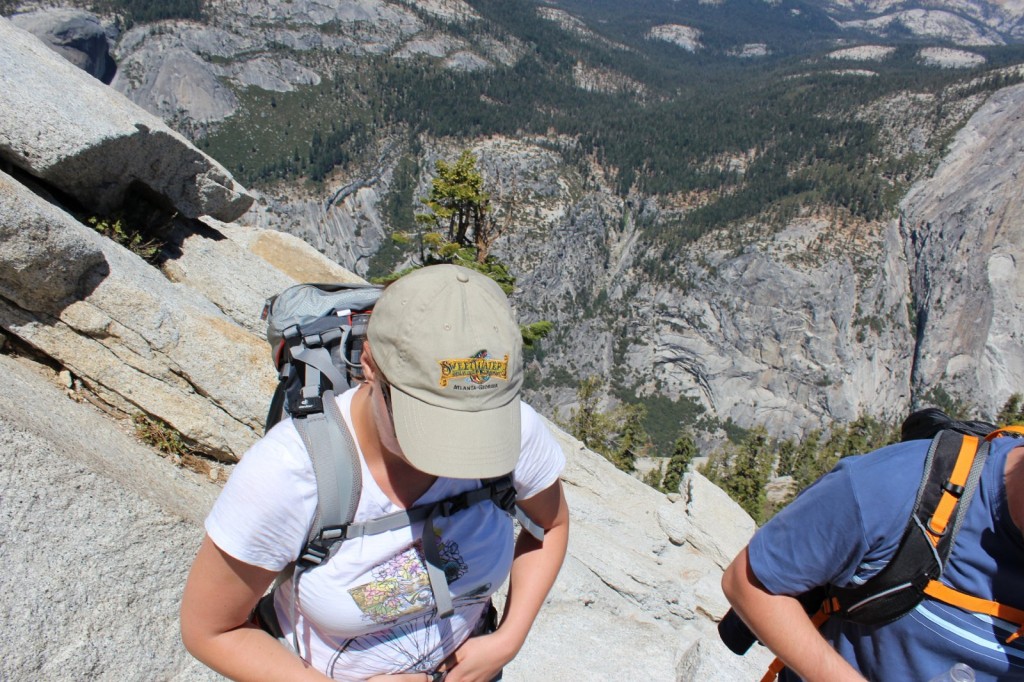
When we finally reached 2300m, the views really opened up. We were a bit worried to see dark clouds in the horizon, because the rule is that you should never climb Half Dome if there’s any sign of thunder on the horizon: the mountain attracts lighting to it like honey attracts bees, and several hikers have died in lightning strikes. This is also why you should reach Half Dome before noon, because afternoon thunderstorms are common in the area. We only reached the check point at half past noon, and I’d say that’s around as late as you should get there without turning back.
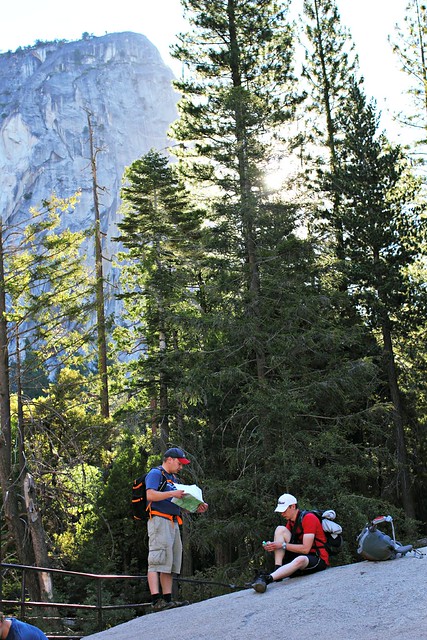
Later we realized that the “clouds” were actually smoke from wildfires in the area.Park Ranger checking permits just below tree line. The ranger had a list of people who’d won the permit, but we had our own print of it with us just to be sure.
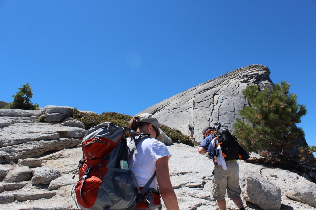
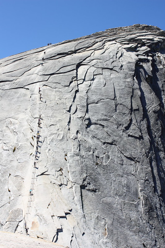
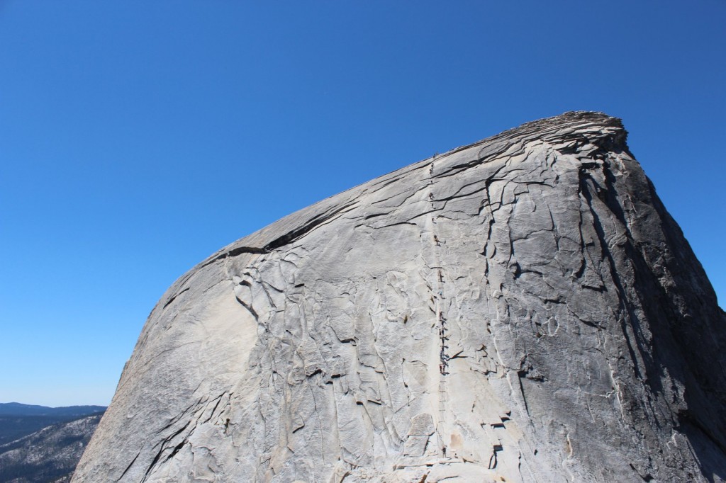
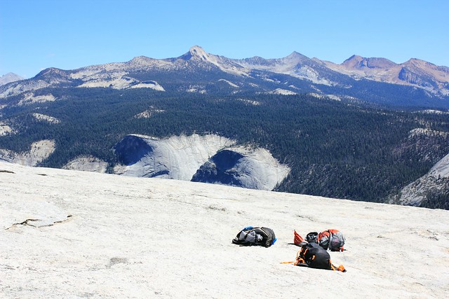
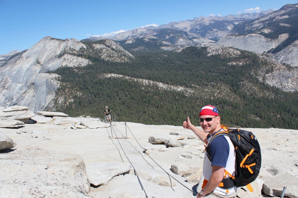
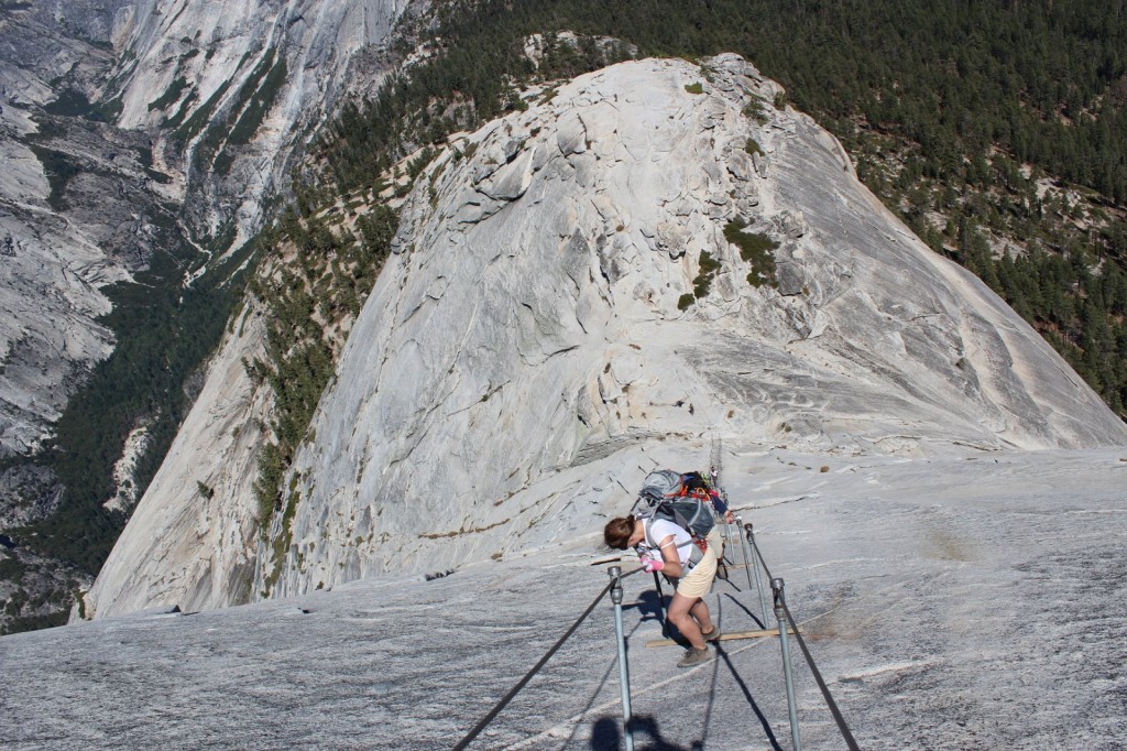
At the ranger check point, we rested for a while and prepared for the final ascent: summiting Half Dome. First 150m (500ft) were a tougher-than-tough climb, the latter 150m were pure crazyness.
On the way up the switchbacksI have a fear of hights that isn’t very strong but started to get the better of me when we got above treeline. This is why all of the photos above treeline have been taken by Aki, because i couldn’t stop anymore to take photos.The other reason was that i was in too bad of a shape to do anything but put one foot ahead another and try to catch my breath.Almost done with the switchbacks, and the 150m-of-pure-craziness is already visible ahead of us.
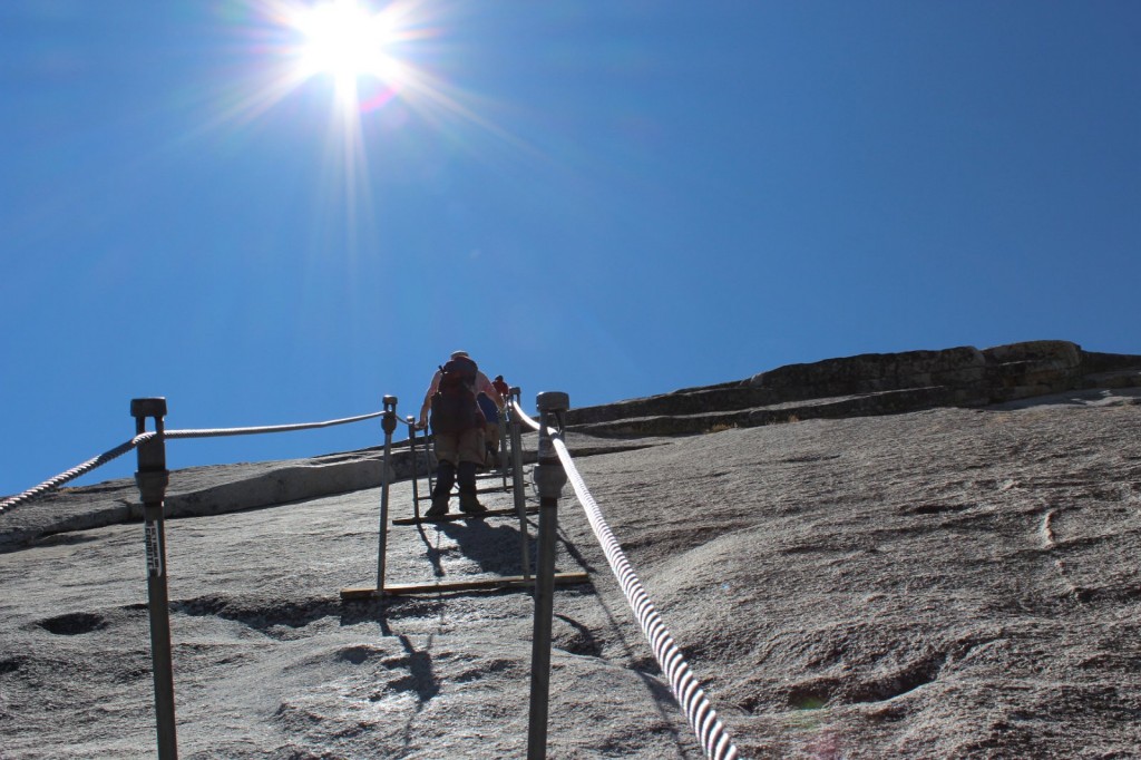
The reason why Half Dome is one of the most dangerous hiking routes in the US is the last 150m meters of it: The Cables. Sure, you could sprain your ankle, fall and hit your knee or suffer from dehydration on other portions of it, but if you fall at the Cables, you fall down. Like really down. Like almost a mile down. Basically, it’s a “make a mistake and die”-portion: you hold on to two cables that ascend up the rock at a 70 degree angle at its best. Every couple meters, there’s a wooden plank where you can stay for a moment and catch your breath, but not for long because there’s people behind you who want to get up – and other people descending the same route.
When we looked at photos of the Cables before the hike, we thought they were taken from an especially dramatic angle or something, and they’re probably not as dramatic in real life. Well, they are. Every bit as dramatic. This is a completely realistic photo of what it’s going to be like.
The wind at the Cables was so strong it was hard to stay upright, and all around me the rock plunged into sure death. From the switchbacks, I crawled on all fours towards the Cables, until I got behind a large boulder and broke down: I can’t! This is horrible! There’s no way I’ll get up there, I’ll just slip and fall and die! This is it, I’m done!
“No you’re not, you can do it,” Iiro told me and after a moment of coaching got me to continue. “Just keep your wits about you, hold on, and if you slip, I’ll catch you.”
So up i went. Maybe one climber out of a hundred had any safety gear with them.
Climbing up was tough but in the end, not as nerve-wrecking as I had thought. I had bought some garden gloves from the internet which had perfect grip and slowly but surely a foot at a time I ascended. At the Cables, you really don’t have time to fear, because all your concentration will go into the climb itself: always one hand at the cables, passing by people coming the other way, going from plank to plank. I tried at first to hold on to both cables, but soon I let go of the other one and just hung on to one with both hands, holding it under my arm and pulling myself up.
You can do it, almost there, coming down is easier, the hikers descending kept telling me, and before I knew it, the rock started leveling out, and the planks and the cables ended. A couple more meters of crawling on all fours, and then I was there.
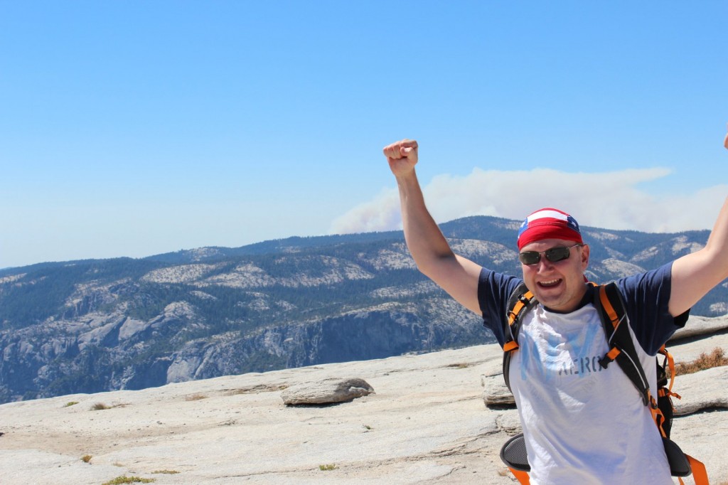
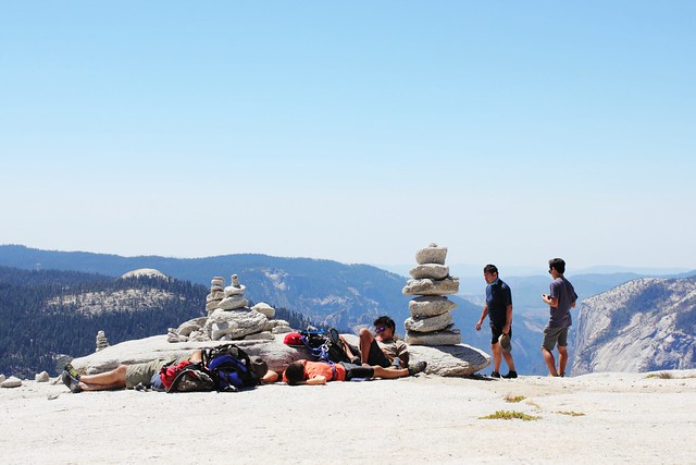
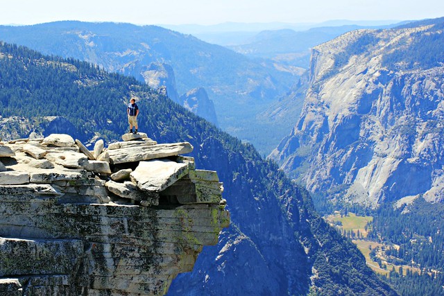
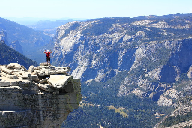
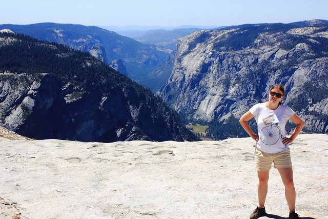
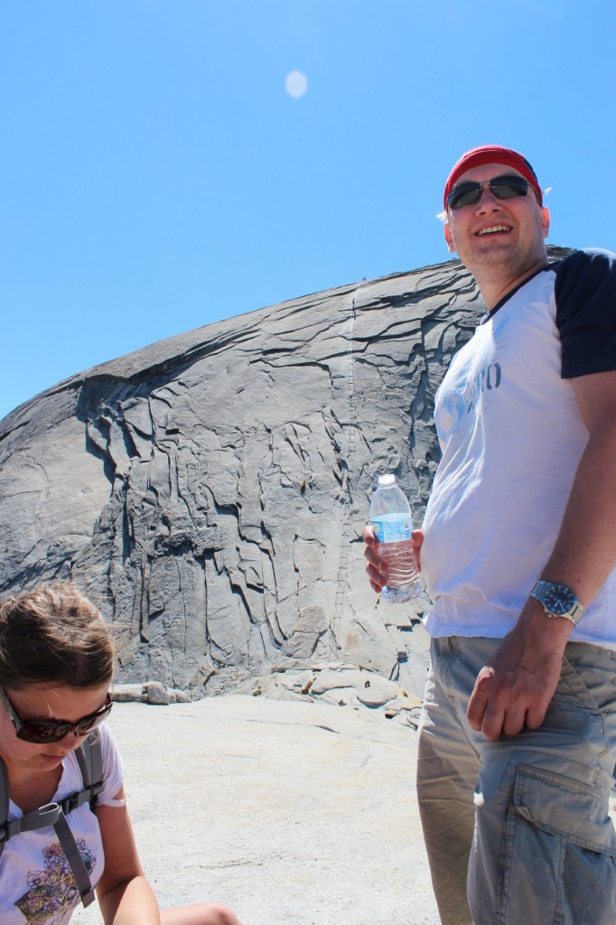
Woooohooo!Half Dome summit!Our packs and a breathtaking view.Chillin’ at Half Dome
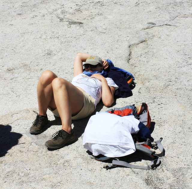
All of the celebrational photos here feature just Aki and Iiro, running around the summit, taking photos and eating a relaxed lunch with the best feeling ever: we did it! I, on the other hand…
I feel like throwing up don’t talk to me
After all that stress and exhaustion, I was feeling dizzy and felt like throwing up. My head hurt, stomach hurt, I could eat less than half of my lunch and most of the time at the summit I spent laying down as still as possible and trying to calm my raising heart. Every once in a while I peeked under the scarf on my head to take a look at the views, and yeah, despite my feeling, this was still worth it.
Finally i got up and posed. “Safely” on top of the summit and not on the ledge.
The descent really was easier than the ascent. Aki even got some photos of it, which was nice, because I would never have taken my hand off the cables.
Don’t look down.Don’t let go.The cables were actually pretty wobbly, which didn’t ease my mind at all.
When we finally got down, it was like a weight coming off my shoulders. That was the hard part, now it was just a 7 mile hike to the bus stop.
When we got down the cables, we met the ranger on his way up to check nobody had been left behind.
There’s not much to tell from the way down. Climax of the trip was over, and now we just wanted to get to camp as soon as possible to rest our feet and enjoy a couple victory beers. I think I was the most energetic of us, having gotten over my fit of nausea. Aki had a blister on his foot and Iiro had spent his last drops of energy getting down the cables.
We had all felt the day in our knees, so instead of taking the stairs down, we took the longer John Muir Trail that wasn’t as steep. Now I wouldn’t make the same choice again, because those two extra kilometers with the setting sun and running out of drinking water (yes, we all did – take more than 6 liters on a hot day) felt reeeeaally loooong, and to top it off, we got a bit lost. We finally made it back to camp around 7.30pm, exactly 12 hours after we’d left. Pizza had never tasted as good.
Nevada Fallsffrom John Muir TrailNevada Falls a bit further off
25 kilometers back and forth, 1500 meters of ascent, and 12 hours on the trail. This is probably the craziest and most dangerous thing I’ve ever done, and I’ve also jumped from an airplane. It’s also one of the most beautiful hikes I’ve done
Would I go again? I doubt it. I think this will be a once-in-a-lifetime experience for me, and that was really what it was. But you should go! Start planning your next summer’s adventure and, come March, take part in the lottery. And then train, prepare, train, and hike. You won’t regret it. Good luck!
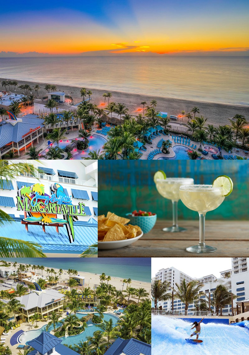
Coming up next week is something I wasn’t really expecting much from in the beginning, but that I’m completely utterly head-over-heels excited about right now. I’m heading off to my first travel blogger conference ever, and on Sunday morning, I’ll jump on a plane towards South Florida and TBEX North America. It’s going to be two days worth of talks on blogging, content creation and traveling, and of course enjoying the beautiful South Florida. The latter is thanks to an invitation that I got for a hosted pre-conference trip with an adventure theme – and when someone says adventure, I’m always in!
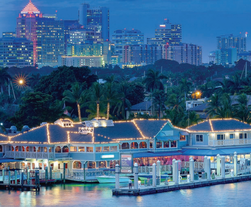
During the trip I’ll enjoy life at the Margaritaville Resort at Hollywood Beach. Did you think the only Hollywood in the US was in California? Well think again, because Florida’s also got its own Hollywod, and unlike its Californian namesake, this one’s also got a beach! Hollywood Beach is situated midway between Fort Lauderdale and Miami, and it’s one long beach boardwalk lined with restaurants, shops, and of course the beach. Next week it’s going to be around +30C, so I’ll make full use of the resort’s pool as well as the Atlantic’s waves. But this trip won’t be just beach life…
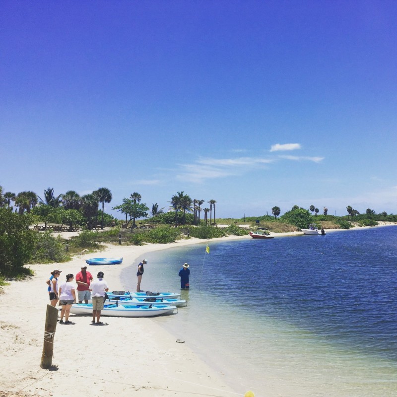
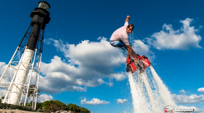
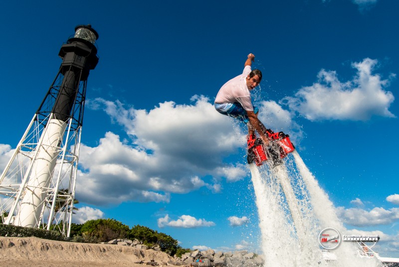
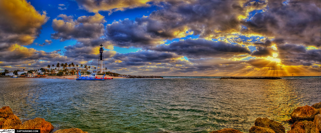
Flyboarding looks absolutely crazy. [photo: Flyboard South Florida]On Monday, I’ll get to try flyboarding at Pompano Beach, a bit north of Fort Lauderdale. According to the info I got, I’m supposed to “soar like a bird and swim like a dolphin”, but let’s see what kind of a flying fish my performance will resemble the most. If it turns out to be harder than you’d think, I’ll switch over to doing a little stand-up paddling in the lagoon. As a hard-core lighthouse fan, I’ll also get my dose with a tour of Hillsboro Lighthouse.
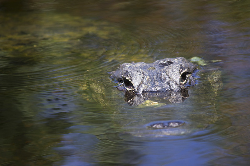
Hillsboro lighthouse and Pompano Beach [photo: Kimo]Everglades is a region of tropical wetlands that extends to a much wider area in South Florida than you’d think just looking at Everglades National Park. The plan is to spot some gators just a rock’s throw from Fort Lauderdale at Sawgrass Park. The best way to get around the marshes is by an air boat, which I’ve only seen before in movies. The next day, I’ll get to tour John U Lloyd Beach State Park‘s mangrove mazes and reefs with a kayak!
Air boat ready to go. [photo: Sawgrass Recreation Park]Kayaks setting off from John U Lloyd Beach State Park. [photo: Whiskey Creek Hideout]John U. Lloyd State Park is a national park with everything from beaches to reefs to mangroves, right next to Fort Lauderdale. [photo: Alysha Khan]All this adventuring is going to make me hungry, and luckily the program’s got some great sounding restaurants on it. The part I’m mostly looking forward to is fresh seafood, as that’s kind of hard to come around to in my present land-locked home.
In the conference, I’ll meet up with a couple Finnish travel bloggers – Sanna from Siveltimellä and Ulla from 50 State Puzzle – and together with Iiro and a couple of other Finnish guys we’ll head off to the always-fabulous Key West. October 31st, also known as Halloween, is on Saturday, and Key West is going to have a parade with floats and everything that we just can’t miss. It would be a long drive to Key West by car, so we’re saving some time by hopping on a private airplane – which I’m looking forward to just as much as Key West!
American Halloween costumes aren’t just limited to those with a horror theme. In fact, it doesn’t seem like the costumes have to fit any theme, just as long as they’re fun! [photo: Brian Lin]We’re still planning on heading deep into the Everglades National Park before we head home. The park’s a UNESCO world heritage site, and it spans more than 6000 square kilometers – more than twice the size of the country of Luxembourg! We’d better not get lost there…
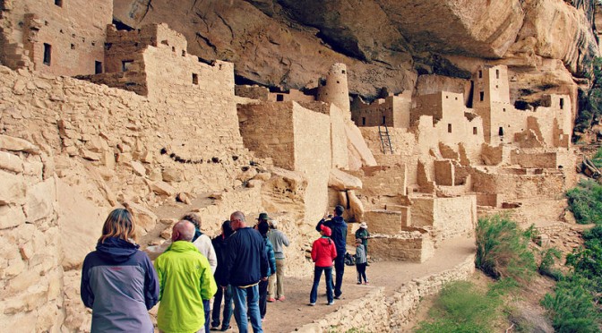
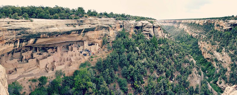
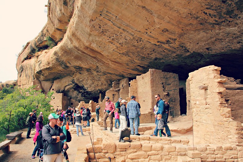
Mesa Verden National Park is located in South-West Colorado near the border of New Mexico. It’s the only national park in the United States designated to protect works of humans instead of Mother Nature, and it’s also an UNESCO world heritage site. If you’re roadtripping in the area, there’s no excuse to pass by these magnificent American Indian ruins that the Ancestral Pueblo people inhabited centuries ago. You could easily spend a couple of days exploring the park – we spent a full 24 hours there – but even a short visit is worth it, as long as you take a little time to plan it.
First: Visitor Center & which tour to take?
It’s always a good idea to start off a national park visit by stopping at the Visitor Center – and especially so at Mesa Verde. This is because Mesa Verde Visitor Center sells tickets to the ranger-led cliff house tours, and this should be the highlight of your trip. You can purchase tickets for the tours up to two days in advance, so if you’re arriving to the area already the night before, it makes sense to drop by the Visitor Center to get tickets fo the next day’s tour. Alternatively, you can purchase tour tickets from Colorado Welcome Center in the town of Cortez.
By the time we arrived at around noon, the two most popular tours had already almost sold out for the day. We managed to snatch tickets for the Balcony House Tour at 4.30 pm (first available slot) and left Cliff Palace Tour for the next morning. These basic tours are $4 per person and can be only bought in person. Specialty tours are sold also at recreation.gov, which I recommend to check out well in advance. I would have personally wanted to visit Cliff Palace at sunset for a special photography tour, but it had already sold out a month before!
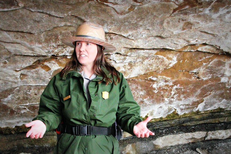
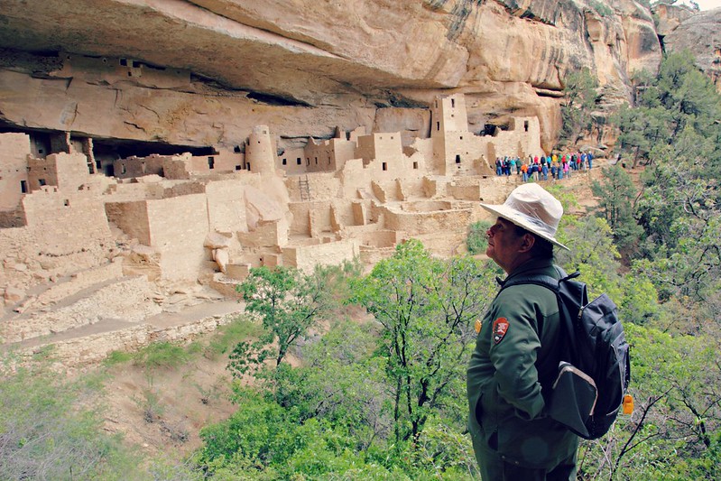
Tours are led by national park rangers, whose uniforms include a rain cover for their hat. Nice!
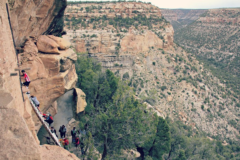
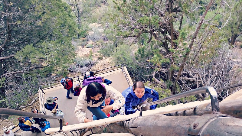
Balcony House Tour
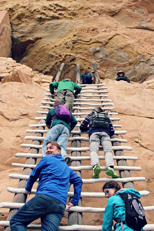
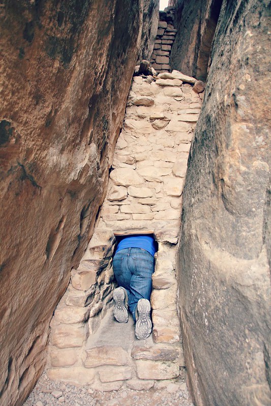
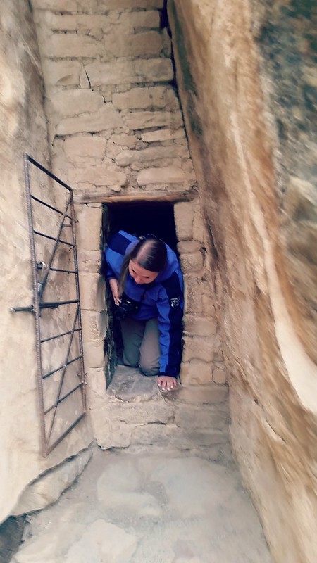
Balcony House is the more challenging of the two basic tours: you’ll have to climb several ladders as well as crawl through a narrow corridor that gave me the jitters beforehand. In the end, though, it was my favorite of the two thanks to its active hands-on nature – or rather, hands-off, touching the ruins is not allowed! There are replicas of the ladders and corridor at the Visitor Center, so you can decide for yourself whether the tour’s the right fit for you. The ladders were exactly the same as on the tour, but the corridor was far more accommodating on the tour, which was VERY nice.
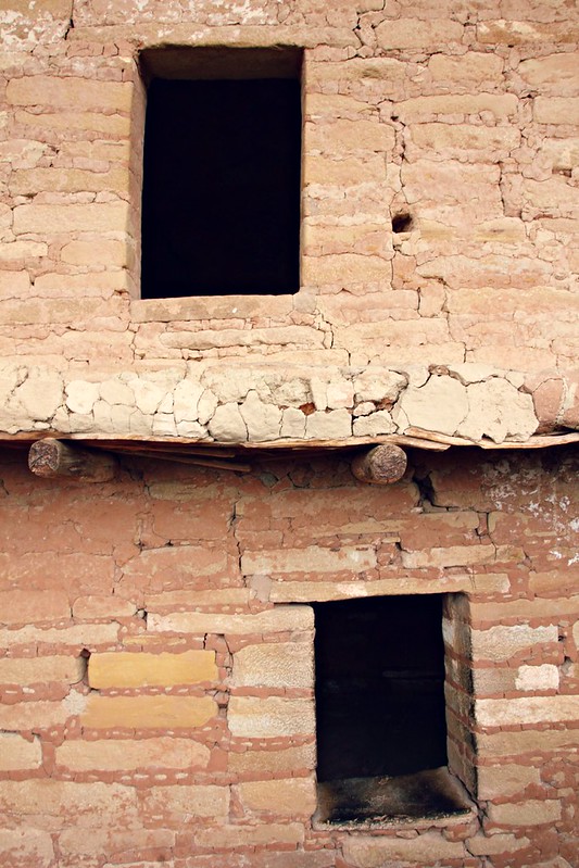
The ladders were so wide they could be climbed in pairs.The views are excellent, if you can spare to look aroundIt didn’t even cross my mind that climbing ladders could be hard, but some of the visitors really had trouble coordinating their limbs. I guess they haven’t been jumping from ladders as kids!Hundreds of years old walls are not made for leaning, so Iiro kept his hands up in the air.Ancestral pueblo apartment building: two doors, and the upstairs unit has a nice balcony.The tour requires you to crawl through a tiny house, no way around this. In the end, it was much easier than I had thought, because there’s a wider space in the middle that eliminated my claustrophobia.A little narrow at the shoulders. Guessing the Ancestral Pueblo weren’t too sturdy.
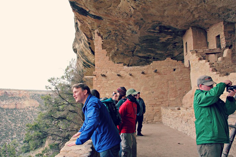
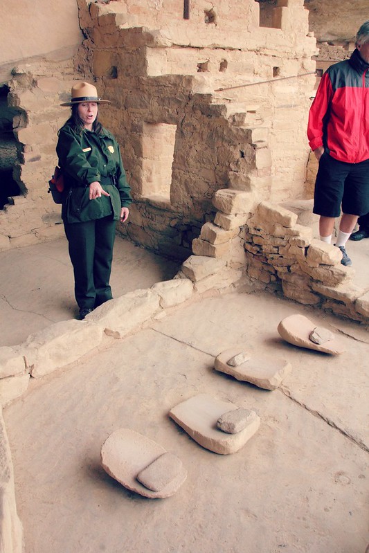
Balcony House has around forty rooms, which makes it average in terms of size for Mesa Verde cliff houses. The ranger on the tour told us tales of Mesa Verde history, pointed out details in Balcony House (murals, kivas), and explained in detail the art of dendrochronology, also known as tree-ring dating, which helped the scientists place the cliff houses on a timeline. With the lack of written history from the Ancestral Pueblo people, anthropologists have resorted to studying their descendants, the Pueblo and the Hopi people, to make educated guesses on centuries-old traditions, and the ranger went on to explain a bit about the rites of passage of the Pueblo.
Dried corn kernels are ground with a round stone called mano on top of a stone slab called metate.
Corn was and still is a staple in the Pueblo diet. It’s a hard day’s work grinding dried corn, and this work is traditionally done by the women. The Hopi Indians’ female rite of passage centered on this practice: girls are locked in small groups in a dark room to grind corn four days in a row. Talking, sleeping and food breaks are allowed, but light is not, and no outsider can lay their eyes on the girls. After four days, the older women wash the girls’ hairs ceremoniously and style them on two buns above their ears, after which the girls can enter the society as women of marrying age. To me, the buns hold an odd resemblance…
Two peas in a pod: princess Leia and a Hopi girlTowards the end of the tour there was a spot where I felt it was better not to look down. Overall, however, can’t say my claustro- and acrophobias did not bother me.
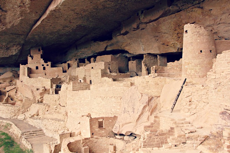
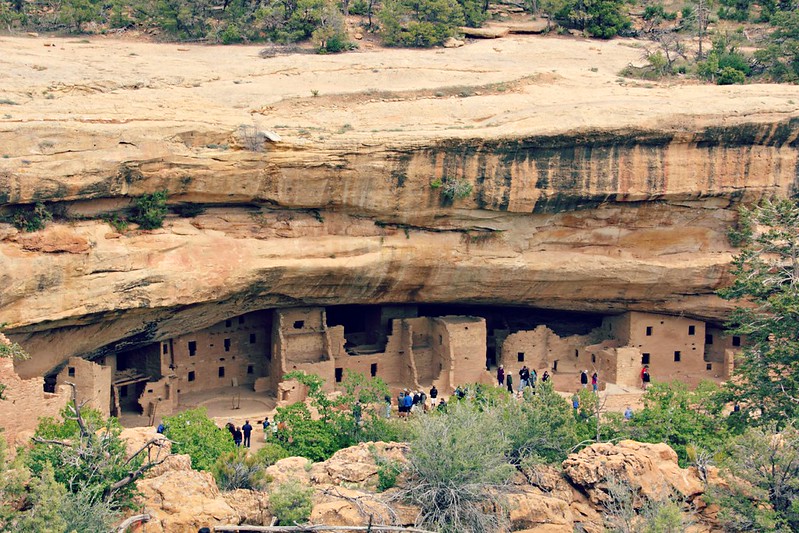
Cliff Palace Tour
Cliff Palace was the administrative center of Mesa Verde: 150 rooms, 23 ceremonial kivas, but only around a hundred residents. Not that administrative centers tend to have that many residents… In any case, it’s the largest cliff dwelling in Mesa Verde, and the route is easier than the one to Balcony House with only a couple short ladders and no standing on high cliffs.
Ranger, leading a moment of silence
Our Cliff Palace Tour really brought out the differences between rangers. The ranger at Balcony House was informative, shooting out facts one after another with so many details you had to keep focused constantly on the talk. The Cliff Palace ranger, on the other hand, let the sights speak for themselves, kept moments of silence to “enjoy the views” and philosophically pondered the Ancestral Pueblo way of life. I’m guessing this was due to the fact that the Balcony House ranger was working her 10th summer at Mesa Verde, wheres the Cliff Palace ranger had just started.
Cliff Palace is impressive already from the lookout point, but if you’ve got the time, I sincerely recommend taking a closer look.
Spruce Tree House
If you don’t have time to attend the tours, go see Spruce Tree House. In fact, even if you do have time to attend the tours, go see Spruce Tree House anyway: Mesa Verde isn’t Mesa Verde with a Spruce Tree House visit. It’s the only cliff dwelling in the area, where you don’t have to take a tour to get up close, and you even have a chance to climb down a restored kiva.
Spruce Tree House from above. The route down isn’t long.
We also thought about hiking Petroglyph Point Trail (4km) that leaves from close to Spruce Tree House, but the rainy weather made us think again. Instead, we popped by Chapin Mesa Archelogical Museum, which I don’t recommend if you’re short on time: you’re here to look at the buildings, not at stuff in vitrines.
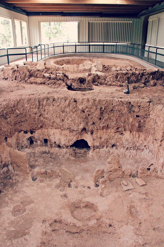
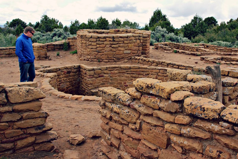
Mesa Top Loop
This one-way road can take anywhere from half an hour to two, depending on how much you stop to take a look around. As wannabe-archaeologists, we stopped everywhere we could to marvel at the more-than-millennia-old dwellings, the oldest in the area, which would have looked like holes in the ground without the interpretive signs. This is a good tour to do on a rainy day, since most of the sights are indoors or at least under cover. If you go here, pick up a guide leaflet from the Visitor Center for $0.50.
If you’re too busy to stop everywhere, at least stop at the lookout at Sun Point View, where you have a great view of several cliff dwellings at once.
A couple thousand years old pit house. How did they not die of carbon monoxide poisoning?
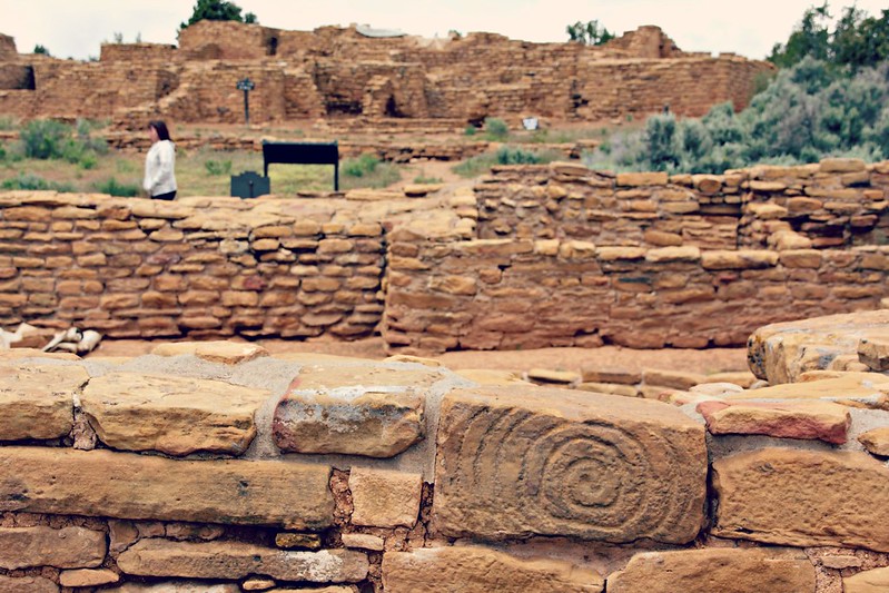
Far View Village Pueblos
Just when we thought we had already seen everything, here comes Far View. This is the place for Mesa Verde’s largest mesa top ruins, whole village pueblos right next to each other, and many of them were only abandoned at the same time as the cliff dwellings. At this point, we were already a little tired of all the ruins and in a hurry to make it to the next stop on our trip, but we stopped briefly enough to figure out that if we ever come here again, the short walking trail here is a must-do. Highly recommended you leave some time for this.
Even a thousand years ago they knew how to decorate their walls
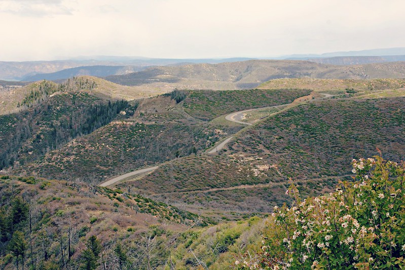
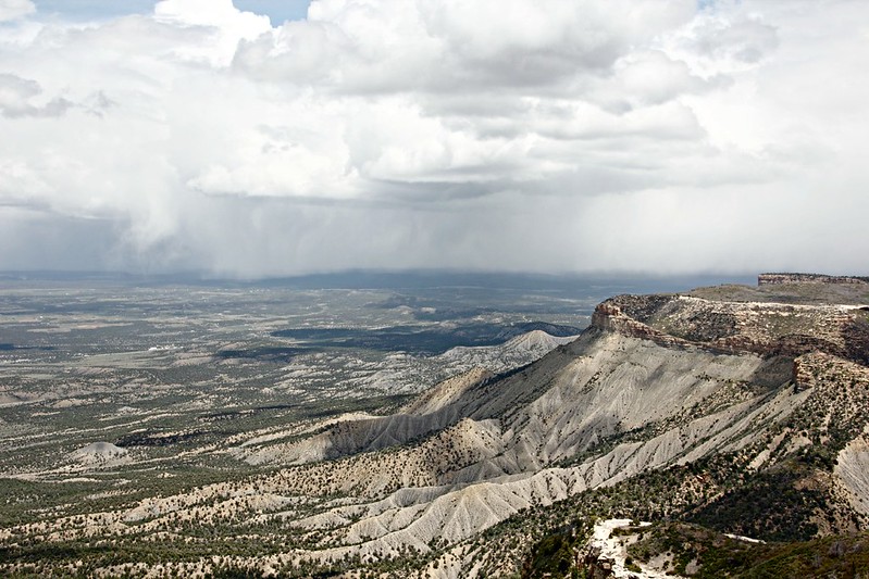
Best Views: Park Point Overlook
Although Mesa Verde is known for its historical significance, you can’t ignore the nature and the strikingly beautiful mesas. The best place to take these in is Park Point Overlook, the highest point in the park, with 360-degree views to every direction. Because of this, the park’s fire ranger station is situated here, and during dry season there’s a 24/7 guard here to watch out for wildfires. Several large wildfires have scorched the area in the past couple of decades, and long-ago burned trees line the roads.
View to the South toward the mesa topsView to the East, where rain was approaching
Eat: Far View Terrace in the park is a good cafeteria-style lunch restaurant with a selection of burgers, hot dogs, and… navajo tacos! Try these out if you haven’t. Spruce Tree Terrace probably has the same selection, but the views aren’t as good.
Sleep: We slept at the Morefield Campground inside the park, where we had reserved a spot – a good choice, because thanks to Memorial Day weekend, the “almost never full” campground was indeed full. Even with the reservation, you’ll need to pick out the spot by yourself in a first-come-first-serve style, so go early if you have a strong preference for it. The campground has decent free showers, and the General Store stocks firewood, food, and other essentials.
The night before we stayed an hour’s drive away at Purgatory Ski Resort’s Village Condos, a real steal outside the high winter season: an excellent studio with a fireplace and a kitchenette cost only $70 a night. Highly recommended if you’re passing by.


![ilmatyynyalus valmiina lähtöön. [kuva: Sawgrass Recreation Park]](http://globecalledhome.fi/wp-content/uploads/2015/10/12038677_764655650310911_3466657757045180341_o-800x533.jpg)